
Boston & Maine Railroad and Connections
$150.00
An early 20th century overview of one of northern New England’s most successful railroad companies.
1 in stock
Description
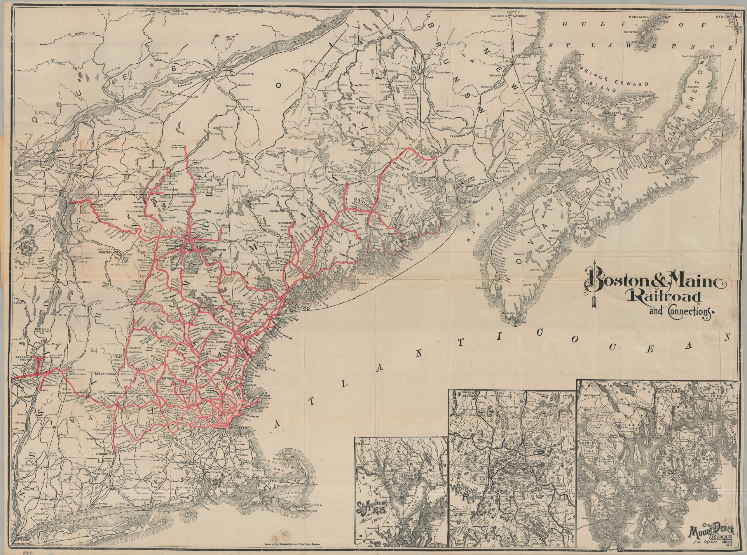
This uncommon pocket map of New England and eastern Canada was created by the Rand Avery Supply Company of Boston and published in 1904 to highlight the routes of the Boston & Maine Railroad. Operational lines (steamships included) are brightly colored in red, stretching from Boston across a vast region filled with potential vacation destinations: the Hudson Valley, Lake Champlain, White Mountains, Green Mountains, the Maine Coast, and more. Scores of toponyms reflect upscale resort towns, small fishing villages, popular hunting retreats, and more. Topography is depicted in hachure, and prominent geographic features are also labeled. Insets in the lower right outline three of the most fashionable retreats – St. Andrews (New Brunswick), the White Mountain Region, and Mount Desert Island.
The Passenger Department of the Boston & Maine Railroad issued several editions of this map, starting in the late 19th century and continuing through the early 20th. According to the front cover, this version is corrected to January, 1904 – a period of significant consolidation for the railroad, which operated about 2,300 miles of track across northern New England.
Source: University of Illinois
Map Details
Publication Date: 1904
Author: Rand Avery Supply Company
Sheet Width (in): 31.00
Sheet Height (in): 23.50
Condition: B+
Condition Description: Single-sided map printed on thin paper, folded, and affixed to original stiff paper wraps. Heavy wear along original folds, including creasing, small holes at fold joints, a few repaired splits, and small edge tears. Lightly wrinkled in several areas, but remains legible and in good condition overall.
$150.00
1 in stock