Atlantic Ocean
Maps of the Atlantic Ocean, including portions of the eastern United States and west Africa/Europe.
Showing 1–18 of 115 resultsSorted by latest
-

De Zee Custen Van Ruslant, Laplant, Finmarcken, Spitsbergen en Nova Zembla
$1,000.00 Quick View -
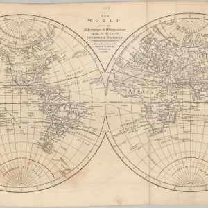
The World from the Discoveries & Observations made in the Latest Voyages & Travels
$145.00 Quick View -

Andrees Allgemeiner Handatlas
$275.00 Quick View -
![[Early Mapping of Greenland]](https://curtiswrightmaps.com/wp-content/uploads/map_15.00x10.69_02-17-26_inv008283c-300x300.jpg)
[Early Mapping of Greenland]
$70.00 Quick View -
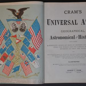
Cram’s Universal Atlas
Quick View -

Places of the World
$95.00 Quick View -

Atlante Geografico Metodico
$200.00 Quick View -
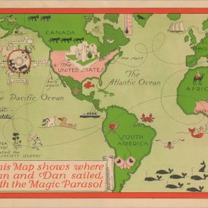
This Map shows where Ann and Dan sailed with the Magic Parasol
Quick View -
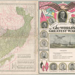
The World’s Greatest War
$85.00 Quick View -
Chocolate and Cocoa Nourishing Foods
$500.00 Quick View -
A Souvenir of the Southern Railway Co’s Southampton Docks
$95.00 Quick View -
Atlas of the World
$110.00 Quick View -
French Line Tourist Map of France
$85.00 Quick View -
Rand McNally Cosmopolitan World Atlas Centennial Edition
Quick View -
Tropical Cyclones of the North Atlantic Ocean Tracks and Frequencies of Hurricanes and Tropical Storms, 1871-1963
$75.00 Quick View -
Maps Illustrating Ancient History
$95.00 Quick View -
Isles Acores
Quick View -
Atlas der Geologie [Berghaus’ Physikalischer Atlas]
$150.00 Quick View


![Atlas der Geologie [Berghaus' Physikalischer Atlas]](https://curtiswrightmaps.com/wp-content/uploads/DSC_1650-1-300x300.jpg)