Battle Fields of Today
Keeping the American public informed of action on the Western Front.
Out of stock
Description
This fascinating atlas was published in Chicago by Rand McNally during the early summer of 1918, according to the table of events printed on the back cover (last entry is May 20th). Issued for distribution by the National Bank of Ogdensburg, presumably to its patrons, the cheaply printed volume was designed to inform the friends and loved ones of the ‘doughboys’ deployed overseas.
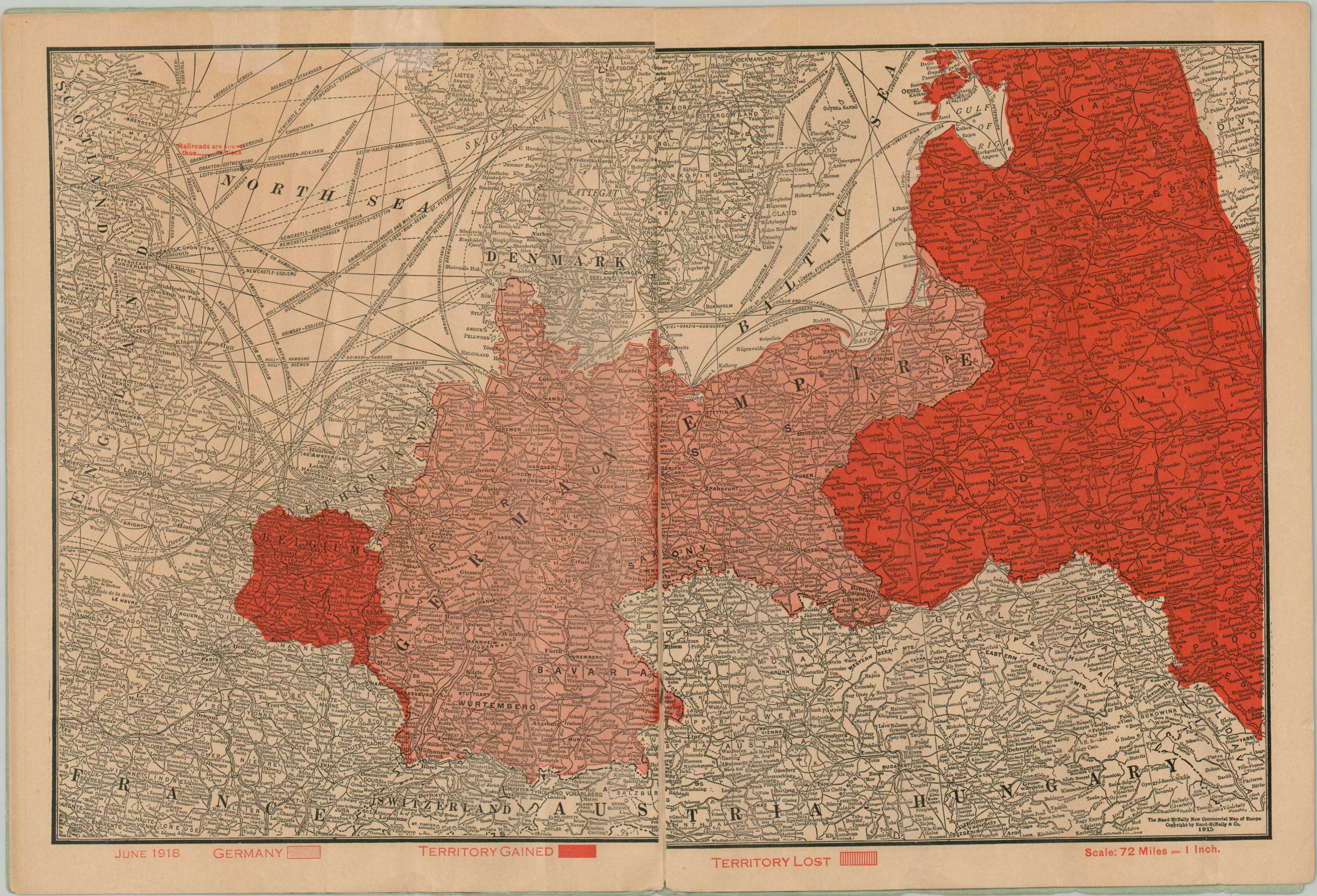
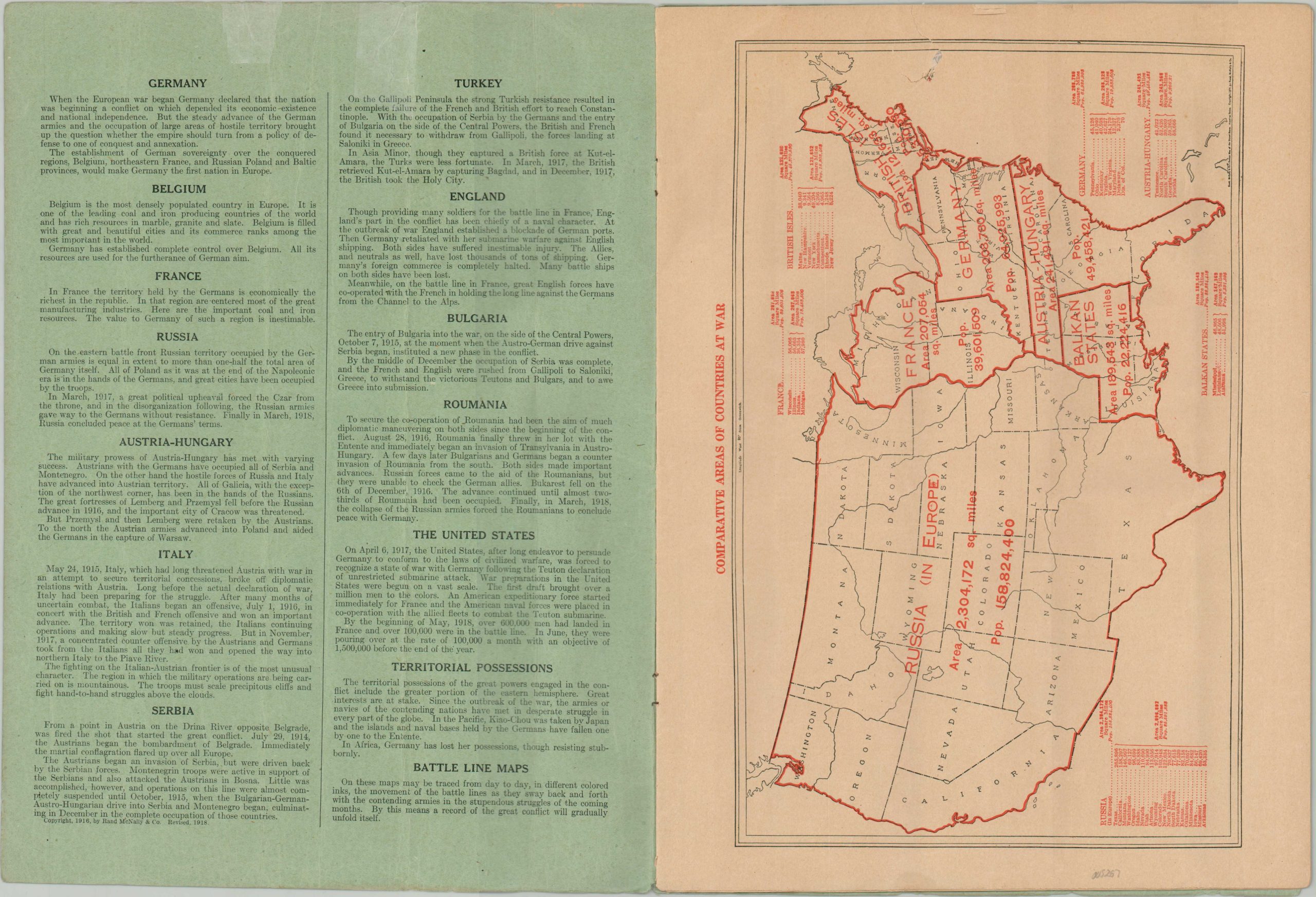
The atlas consists of 16 double-sided pages that are heavily biased in favor of the Allied powers and emphasize the geography of the Western Front. A map of the United States presents the Comparative Areas of the Countries at War, alluding that America is the same physical size as all other combatants combined. This is followed by general maps of the world and Europe, two maps of territorial changes as of June 1918, one map of the Turkish Theater, and 9 larger scale maps of the Western Front between Belgium and Austria-Hungary.
Map Details
Publication Date: 1918
Author: Rand McNally
Sheet Width (in): 10.25
Sheet Height (in): 13.75
Condition: B
Condition Description: 16 pp. atlas bound with staples to original blue paper wraps. Two irregular tears, about 2" and .75", visible at the top of each page, apparently where the atlas was previously punctured. Each has been flattened and repaired on one side with archival tape. Sheets are lightly, but evenly toned, and show some wrinkling where previously rolled. Minor to moderate edge wear, including minor small tears and wrinkling. About good condition overall.
Out of stock


