Air & Space
Items related to aerial transportation and navigation.
Showing 1–18 of 169 resultsSorted by latest
-

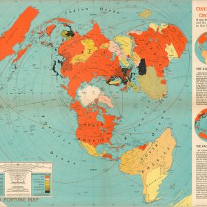
One World One War
$95.00 Quick View -
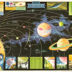
Universal Map of Outer Space
$125.00 Quick View -
Plan Your Vacation on this Flagship Map [American Airlines]
$50.00 Quick View -
The World…Their Battleskies
$80.00 Quick View -
Star Wars Planetary Maps [Tatooine, Endor, Death Star]
$325.00 Quick View -
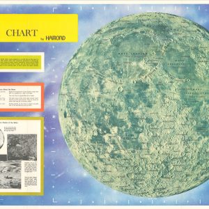
Moon Chart by Hammond
$100.00 Quick View -
[21 Issues of Rakkasan, official newsletter of the 187th Airborne]
$450.00 Quick View -
[Scrapbook for the Badger Balladiers 1973 Pacific Tours]
$475.00 Quick View -
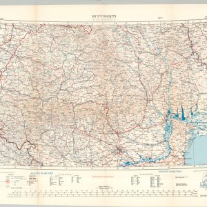
Bucharesti (Bucharest)
$125.00 Quick View -
Phi-Truong Tai Viet-Nam [Map of Vietnamese Airfields]
$950.00 Quick View -
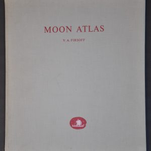
Moon Atlas
Quick View -
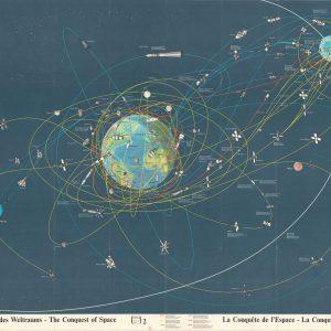
The Conquest of Space
Quick View -
Wampole’s Creo-Terpin for Coughs and Colds [World Map Ink Blotter]
$40.00 Quick View -
The Tenebris System
$65.00 Quick View -
[Spelljammer Game Maps]
$110.00 Quick View -
Star Trek Maps
Quick View -
Star Trek The Original Series Crew Member’s Explorer Pack
$75.00 Quick View -
[Fabric Map of Bucharest and Lublin – Zhitomir]
$150.00 Quick View
![Plan Your Vacation on this Flagship Map [American Airlines]](https://curtiswrightmaps.com/wp-content/uploads/map_12.69x14.23_02-17-26_inv008252jpgc-300x300.jpg)

![Star Wars Planetary Maps [Tatooine, Endor, Death Star]](https://curtiswrightmaps.com/wp-content/uploads/Inv008165-300x300.jpg)
![[21 Issues of Rakkasan, official newsletter of the 187th Airborne]](https://curtiswrightmaps.com/wp-content/uploads/DSC_2245-300x300.jpg)
![[Scrapbook for the Badger Balladiers 1973 Pacific Tours]](https://curtiswrightmaps.com/wp-content/uploads/DSC_2239-300x300.jpg)
![Phi-Truong Tai Viet-Nam [Map of Vietnamese Airfields]](https://curtiswrightmaps.com/wp-content/uploads/map_10.77x19.98_01-05-26_inv007971c-300x300.jpg)
![Wampole's Creo-Terpin for Coughs and Colds [World Map Ink Blotter]](https://curtiswrightmaps.com/wp-content/uploads/DSC_2156-300x300.jpg)

![[Spelljammer Game Maps]](https://curtiswrightmaps.com/wp-content/uploads/Inv7672-scaled-300x300.jpg)


![[Fabric Map of Bucharest and Lublin - Zhitomir]](https://curtiswrightmaps.com/wp-content/uploads/map_24.71x36.82_08-20-25_inv007428c-300x300.jpg)