
One World One War
$95.00
Re-orienting the world to accommodate the Aviation Age during World War II.
1 in stock
Description
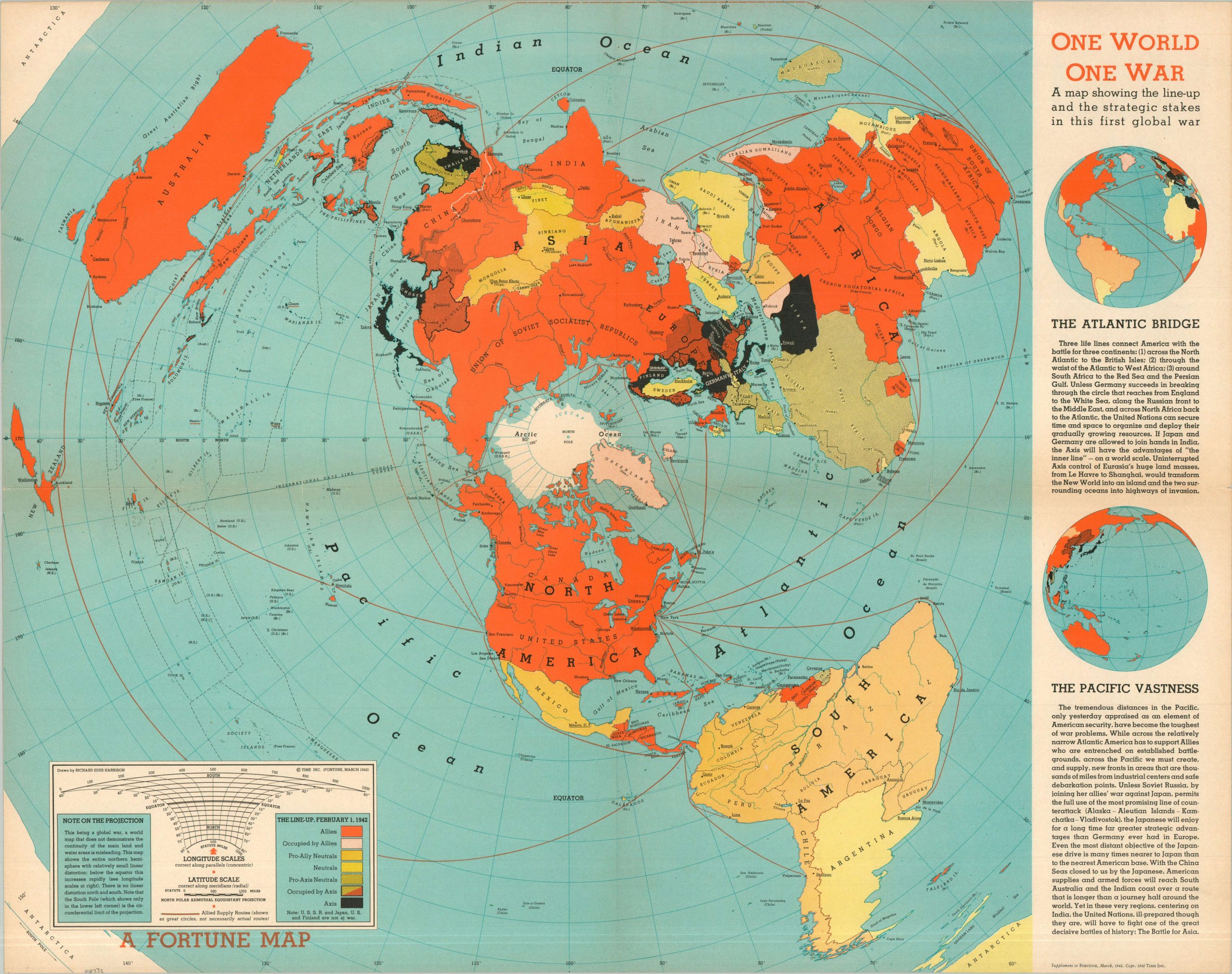
This iconic 1942 fold-out map, titled One World, One War, was designed by the master of perspective cartography, Richard Edes Harrison, as a supplement to the March 1942 issue of Fortune Magazine. Eschewing the traditional Mercator projection, Harrison utilizes a North Polar Azimuthal Equidistant projection (described, lower left), centering the world on the North Pole.
This airman’s view was a radical departure for the American public, vividly illustrating how the great powers of the Axis and Allies were actually positioned across the “top” of the world (if traveling through the air), rather than separated by flat oceans and sea lanes. Sharp distinctions in color highlight the wartime affiliation of territory – Allied (orange), Neutrals (yellow), and Axis (black). The Atlantic Bridge and the Pacific Vastness, two unique geographic problems in each theater, are explored with accompanying insets.
Further Reading: Cornell University
Map Details
Publication Date: 1942
Author: Richard Edes Harrison
Sheet Width (in): 26.60
Sheet Height (in): 21.10
Condition: A-
Condition Description: Color printed map on a single-sided sheet of somewhat toned paper. Light wear and faint discoloration along original folds. Very good condition overall.
$95.00
1 in stock