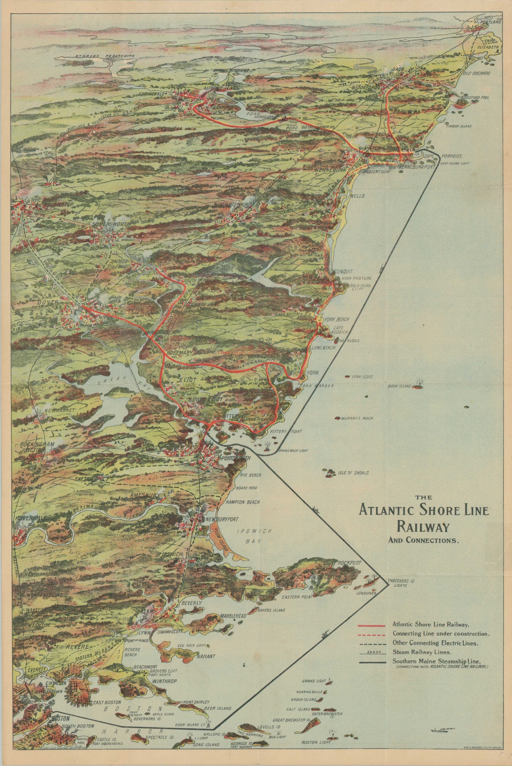
The Atlantic Shore Line Railway and Connections
Scarce early 20th century transportation map of the New England coast.
Out of stock
Description
This interesting and colorful aerial perspective shows various means of traveling the Atlantic Coast between Boston, MA and Portland, ME, during the early 20th century. The electric railway lines of the Atlantic Shore Line Railway are highlighted in bright red, with hash marks identifying tracks under construction. The Southern Maine Steamship lines are noted in thick black, while other various connections to inland locations are also shown according to the legend in the lower right.
Several lighthouses dot the coastline. Towns and geographic features are illustrated and labeled throughout the image, offering an attractive view of the New England countryside. Many of the locations were popular summer vacation destinations for residents of Boston, New York, and Philadelphia.
Copywritten and published by George H. Walker & Co. of Boston in 1906 (dated in the lower left corner). Scarce, with no examples from this year found in OCLC and only one sales record (from a 1908 edition) identified at Carol Spack Antique Maps.
Map Details
Publication Date: 1906
Author: George H. Walker & Co.
Sheet Width (in): 13.75
Sheet Height (in): 20.9
Condition: A-
Condition Description: Pocket map disbound from original covers (now lost). A 2" spot of separation in the upper right has been repaired on the verso with archival tape. A similar closed tear, lower right, shows some discoloration from old repairs. Good to very good overall. Blank on verso.
Out of stock