Map of the Eastern Railroad and Principal Connections
The last breath of the Eastern Railroad.
Out of stock
Description
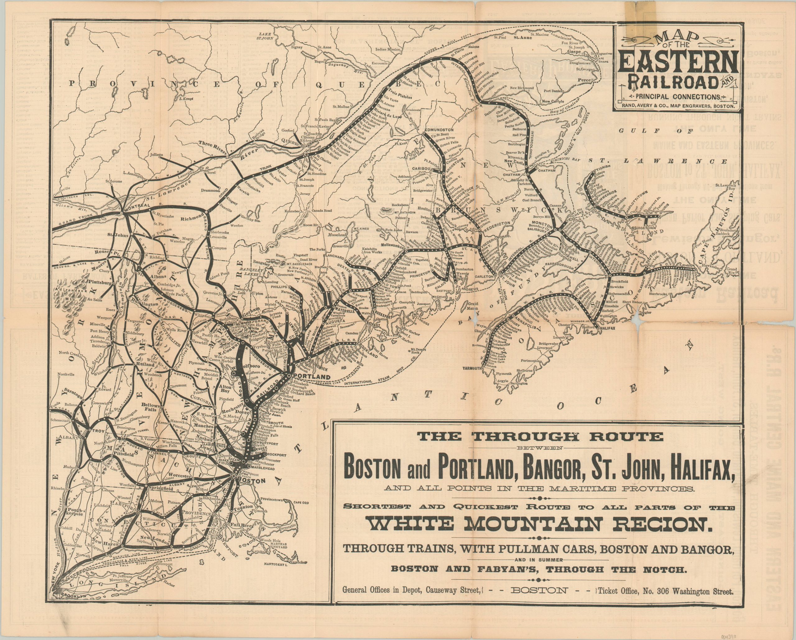
“The Through Route Between Boston and Portland, Bangor, St. John, Halifax and All Points in the Maritime Provinces. Shortest and Quickest Route to all parts of the White Mountain Region. Through Trains, with Pullman Cars, Boston and Bangor, and in Summer Boston and Fabyan’s Through the Notch.”
Chartered in 1836, the Eastern Railroad of Massachusetts was organized to compete with the Boston and Maine Railroad for passenger and freight service between Boston, MA and Portland, ME. This ephemeral map and timetable highlight the routes in operation across New England as of January, 1882. Heavy black lines show the Eastern Railroad tracks, while connections are shown in a more diminutive fashion. Each stop is labeled, making for a somewhat cluttered and illegible appearance. Topographic details are limited, with the Adirondack and White Mountains depicted with simple hachure.
The year following publication, the competition between the Eastern Railroad and the Boston & Maine ended when the Boston & Maine leased the Eastern for 54 years. On May 9, 1890, the Boston & Maine purchased the Eastern outright, dissolving the company.
Map Details
Publication Date: 1882
Author: Rand Avery & Co.
Sheet Width (in): 18.8
Sheet Height (in): 15.1
Condition: B-
Condition Description: Heavy separation along former fold lines has been repaired on the verso with archival tape. Some minor image loss on the right side at the two fold intersections and along the central fold. Old cellophane tape repair in the upper right that discolors the title block.
Out of stock