
The Old Northwest Territory
$75.00
A historical look at the lands acquired by America after the Revolutionary War, published for the Northwest Territory Celebration Commission.
1 in stock
Description
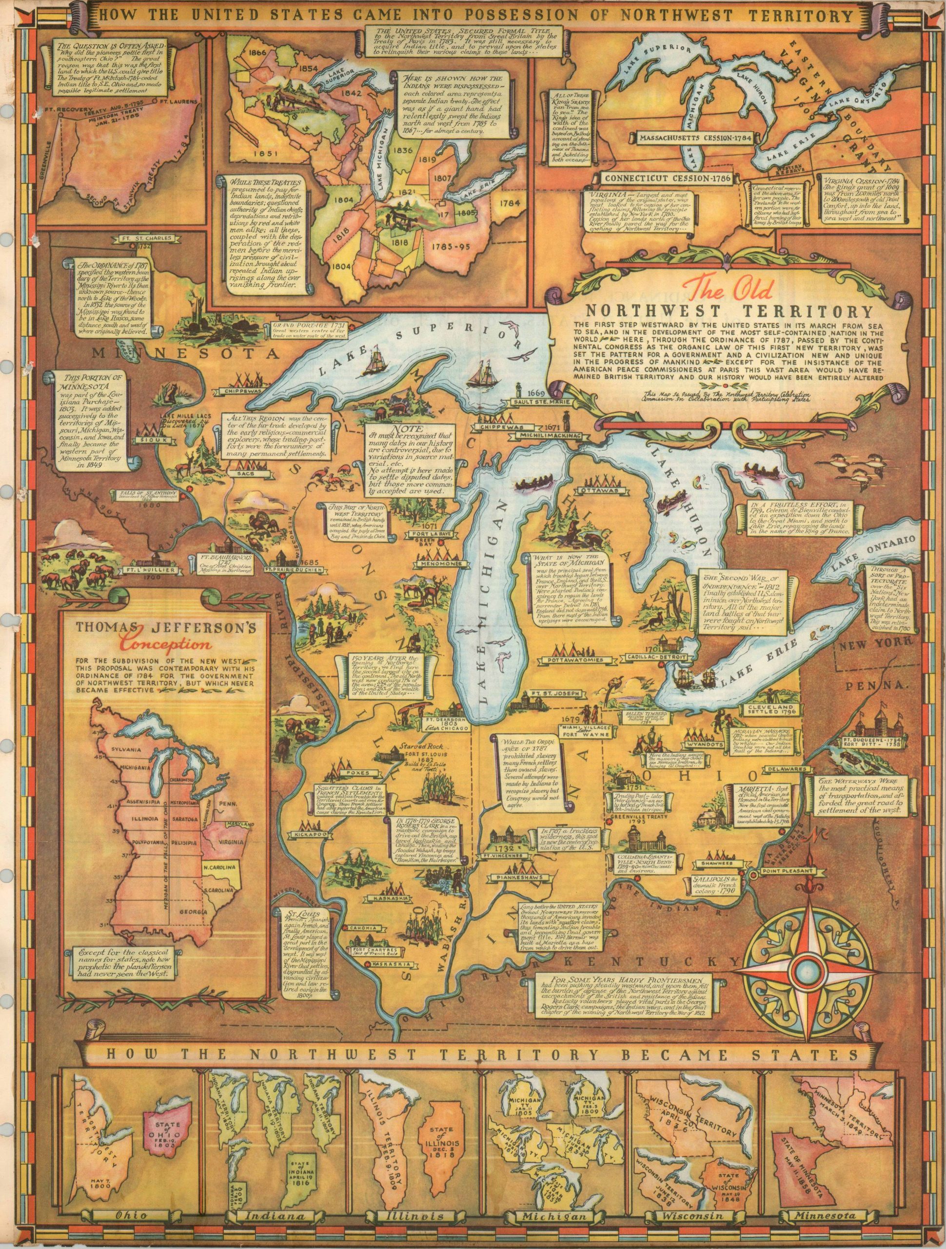
This map is full of wonderful detail related to the history and development of the region known as the Northwest Territory, which would ultimately contain the area of six states: Ohio, Indiana, Illinois, Michigan, Minnesota, and Wisconsin. Inset diagrams detail the progression of statehood for these six, as well as Thomas Jefferson’s separate model for creating 15 states along the Meridian of the Falls of Ohio (including the names of 9 proposed states, Sylvania, Michigania, Assenisipia, Illinois, Polypotania, Cheronessus, Metropotamia, Saratoga and Peilsipia). Further insets show the land cessions of states and Indian tribes that comprised the territory. Scattered throughout the map are illustrated vignettes and text boxes detailing notable events, locations and Indian tribes.
The map was created by Fred Rentschler, one of thousands of works produced by artists that were supported by the Works Progress Administration. Published in 1937 by the Northwest Territory Celebration Commission.
Source: David Rumsey Map Collection;
Map Details
Publication Date: 1937
Author: Fred Rentschler
Sheet Width (in): 16.5
Sheet Height (in): 22
Condition: B-
Condition Description: The map has been flattened and mounted to an old scrapbook page, complete with three hole binding on the left side (partially affecting the image). The sheet is trimmed to the neatline and shows some waviness and light edge wear, but retains the vibrant printed color and the entirety of the image. Fair to good condition overall.
$75.00
1 in stock