Michigan
Showing 1–18 of 184 resultsSorted by latest
-

Premier Series Map of Michigan
$245.00 Quick View -
Automobile Road Map of Michigan Showing Condition of State Trunk Line System in the Lower Peninsula and the Improved Connecting County Roads
$315.00 Quick View -
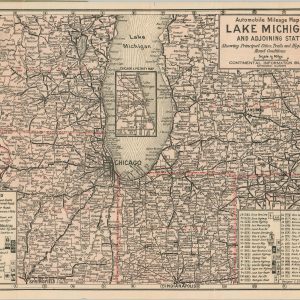
Automobile Mileage Map of Lake Michigan and Adjoining States
$300.00 Quick View -
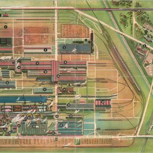
The Ford Rotunda Showplace of the Automotive Industry
$85.00 Quick View -
Section No. 2 Cram’s Highway Map of the Central States Illinois Indiana Michigan Wisconsin And portions of Minnesota, Iowa, Missouri, Kentucky, and Ohio
$110.00 Quick View -
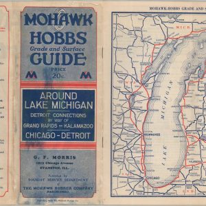
Mohawk-Hobbs Grade and Surface Guide – Around Lake Michigan Detroit Connections by Way of Grand Rapids or Kalamazoo – Chicago-Detroit
$150.00 Quick View -
[Road Map of Ohio and Surrounding Region]
$95.00 Quick View -
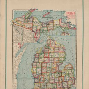
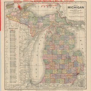
Map of Michigan
$95.00 Quick View -
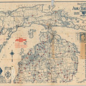
Rand McNally Official 1920 Auto Trails Map District Number 3 Southern Peninsula of Michigan Northern Indiana Northwestern Ohio
$185.00 Quick View -
Rand McNally Official 1923 Auto Trails Map District Number 3 Northern Indiana Michigan North West Ohio
$125.00 Quick View -
Travel the North-South Fast Route from the Great Lakes to Florida
$95.00 Quick View -
Clason’s United States Highway Map Sheet No. 12 [Michigan, Ohio, Indiana]
$95.00 Quick View -
New National Authentic Map of Detroit and Environs [Ford River Rouge Overprinting]
$1,100.00 Quick View -
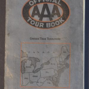
AAA Official Tour Book Northeastern
$125.00 Quick View -
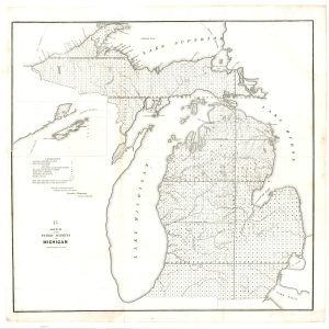
Sketch of the Public Surveys in Michigan
$200.00 Quick View -
Sportsman’s Map of Drummond Island
$50.00 Quick View -
Automobile Blue Book Vol. 3 1926 Middle Western: Mich., Ohio, Ind, Ky, Ill, Wis, Minn, Iowa, Mo.
$95.00 Quick View -
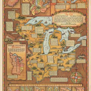
The Old Northwest Territory
$150.00 Quick View


![[Road Map of Ohio and Surrounding Region]](https://curtiswrightmaps.com/wp-content/uploads/map_12.19x12.13_04-14-26_inv008487c-300x300.jpg)

![Clason's United States Highway Map Sheet No. 12 [Michigan, Ohio, Indiana]](https://curtiswrightmaps.com/wp-content/uploads/map_18.55x26.29_04-25-26_inv008368c-300x300.jpg)
![New National Authentic Map of Detroit and Environs [Ford River Rouge Overprinting]](https://curtiswrightmaps.com/wp-content/uploads/map_23.52x28.15_04-26-26_inv008570c-300x300.jpg)