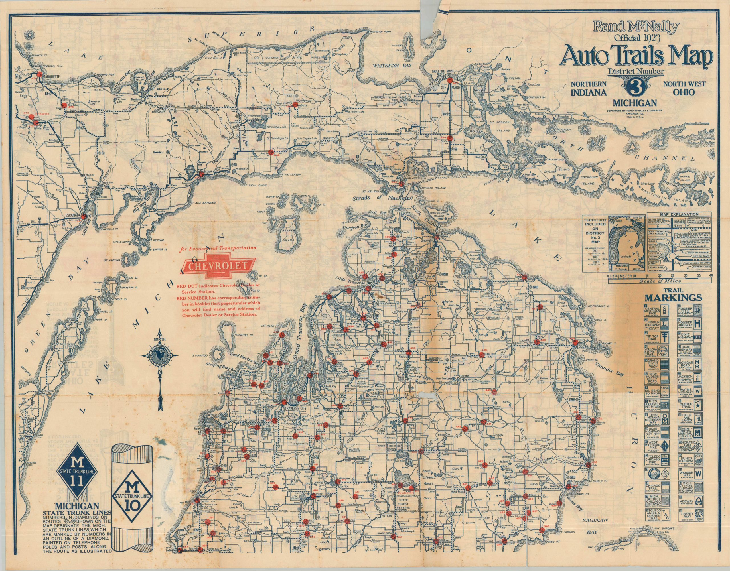
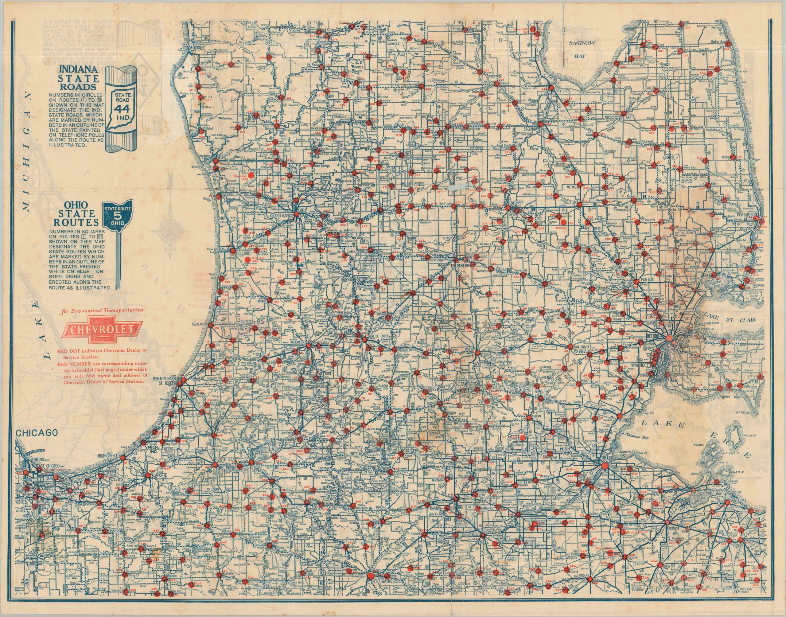
Rand McNally Official 1923 Auto Trails Map District Number 3 Northern Indiana Michigan North West Ohio
$125.00
For Economical Transportation, Trust Chevrolet.
1 in stock
Description
This interesting double-sided map offers an interesting snapshot of the highway system across the Upper Midwest during the early 1920s. One side of the sheet shows the bottom part of the ‘glove’ of Michigan’s Lower Peninsula, plus portions of northern Indiana, Ohio, and Illinois (Chicago, mainly). The verso is the remainder of Michigan, including the Upper Peninsula and parts of Green Bay.
Both images use different styles of lines to showcase the variations in road surfaces. State highway or trunk line markers are noted (the U.S. Numbered Highway System would be introduced in 1926), as well as the signage used to denote auto trails (generally sponsored by private organizations and associations). Red dots pinpoint the location of scores of Chevrolet dealers or service stations.
Map Details
Publication Date: 1923
Author: Rand McNally
Sheet Width (in): 28.00
Sheet Height (in): 22.25
Condition: C
Condition Description: Double-sided map disbound from original covers and showing heavy wear along folds, areas of severe toning and foxing, and closed tears with minor image loss. Fair condition overall.
$125.00
1 in stock