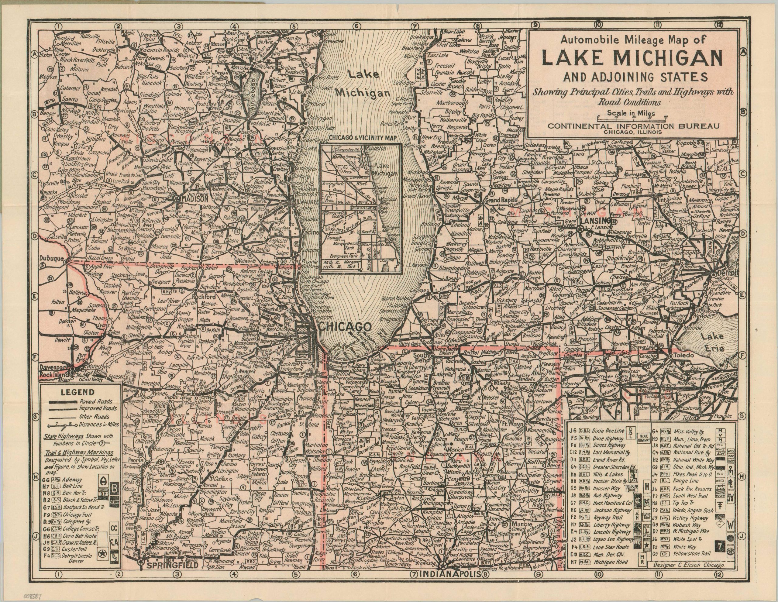
Automobile Mileage Map of Lake Michigan and Adjoining States
$300.00
A scarce pocket map of the roads through the Industrial Midwest.
1 in stock
Description
This densely informative map of the roads around Lake Michigan was designed by C. Elison and published in the early 1920s by the Continental Information Bureau of Chicago. Scant information exists on the firm, one of numerous local companies looking to capitalize on the rapidly increasing popularity of automobile tourism during the Good Roads Era. With no works located in WorldCat or other major online repositories, this ephemeral example is a remarkably scarce survivor of the period.
The image depicts Paved, Improved, and Other Roads across a broad industrial and agricultural corridor stretching from Green Bay to Indianapolis and Springfield, bounded by Detroit in the east and the Quad Cities in the west. Distances between points are noted and state highways are labeled with small ringed numbers. These often overlap (and frequently compete) with the private Auto Trails, which are listed alphabetically and denoted with short abbreviations. This “alphabet soup” of markings illustrates the cartographic chaos of the early 20th century, a landscape of conflicting private signage that would only be resolved by the implementation of the U.S. Numbered Highway System in 1926.
The verso of the sheet provides a detailed directory of sponsoring businesses essential to the early motorist, including garages, restaurants, and auto supply stores. Continental Information Bureaus are noted in several cities, while further companies are listed on the covers. This specific example was distributed “Compliments of M.W. Timm Gas Station” in Michigan City, Indiana, placing it at a primary geographic bottleneck for travelers navigating the southern tip of Lake Michigan. Plus, it had a separate Ladies’ Rest Room!
Map Details
Publication Date: c. 1923
Author: C. Elison
Sheet Width (in): 16.40
Sheet Height (in): 12.70
Condition: A-
Condition Description: Color printed pocket map creased along original folds and showing faint marginal wear, consistent with age. Attached to original green paper wraps, lightly toned and chipped corners. 1" irregular tear in the upper center, repaired on verso with archival tape. Very good condition overall.
$300.00
1 in stock