
Summer Resorts of the Coast, Lake, and Mountain Regions along the Boston & Maine Railroad and Connections
$165.00
An attractive “summer vacation” map of New England.
1 in stock
Description
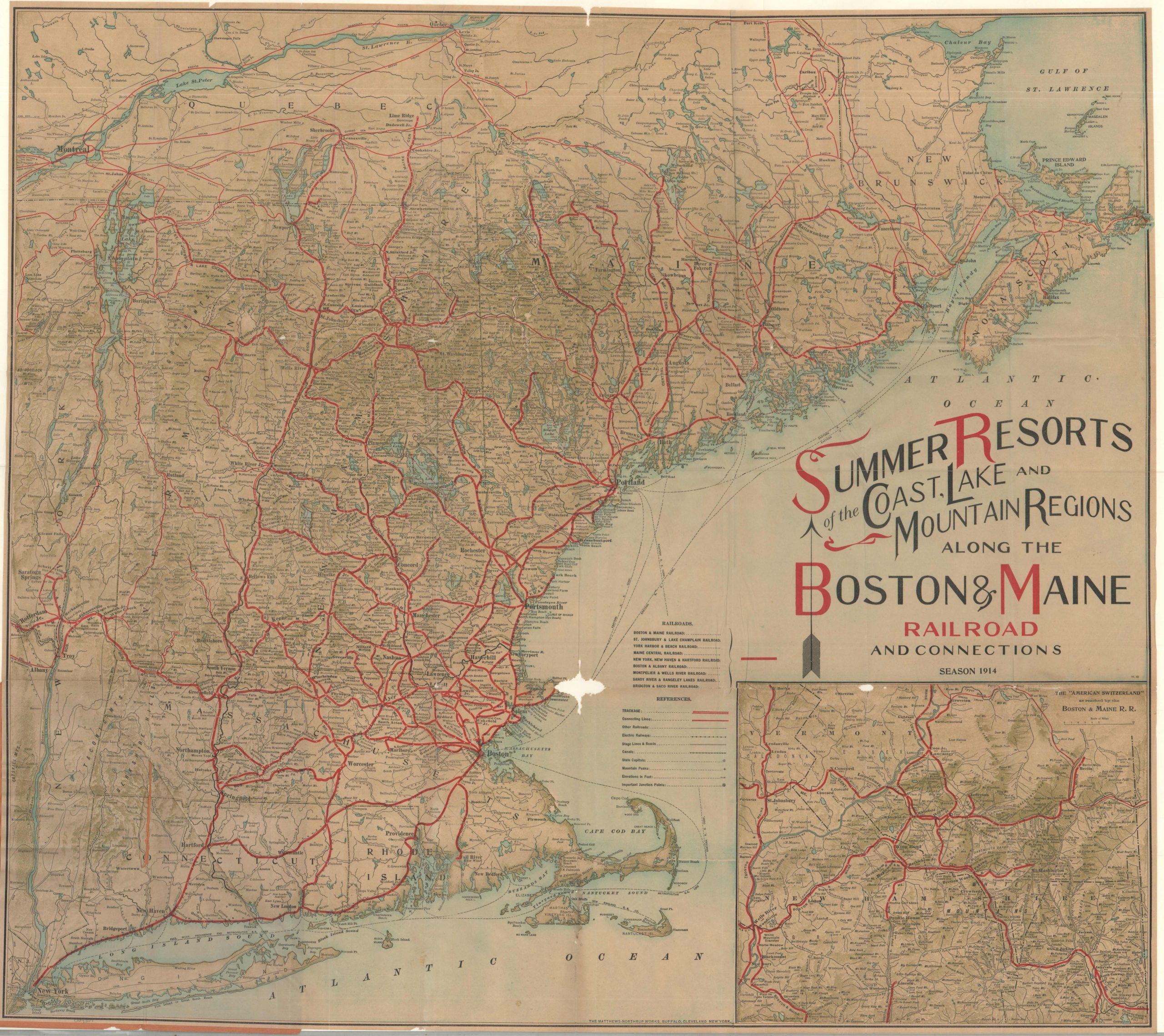
This detailed map of New England and Eastern Canada was lithographed in Buffalo by the Matthews-Northrup Works in 1914 to showcase the network of the Boston & Maine Railroad. Eight distinct lines and connecting companies are represented in bold red, reflecting the railroad’s diversified interests and regional reach.
Tourists were a critical component of the B&M’s business, particularly during the summer months when city dwellers sought relief in the cooler coastal, lake, and mountain regions shown. A robust transport network—encompassing steam and electric railways, steamship lines, stage routes, auto roads, and canals—is clearly detailed in the lower-center legend. Towns, resorts, and geographic landmarks are labeled throughout.
An inset in the lower right highlights New Hampshire’s White Mountains, dubbed “The American Switzerland.” Shaded relief, labeled peaks, and spot elevations offer a fine overview of the region’s rugged terrain.
Map Details
Publication Date: 1914
Author: Matthews-Northrup Works
Sheet Width (in): 28.75
Sheet Height (in): 25.75
Condition: B-
Condition Description: Color printed map on a thin sheet of paper, folded and affixed to original stiff orange paper wraps. Wear and wrinkling along folds, including small repaired splits at the joints along the lower third. An irregular hole, about the size of a quarter, in the lower center, just off Cape Ann. Between fair and good condition overall.
$165.00
1 in stock