
Skeleton Map of Rail-Roads between Cape Canso and St. Louis
$500.00
Connecting the agricultural output of the Midwest with the great Eastern markets in the early 19th century.
1 in stock
Description
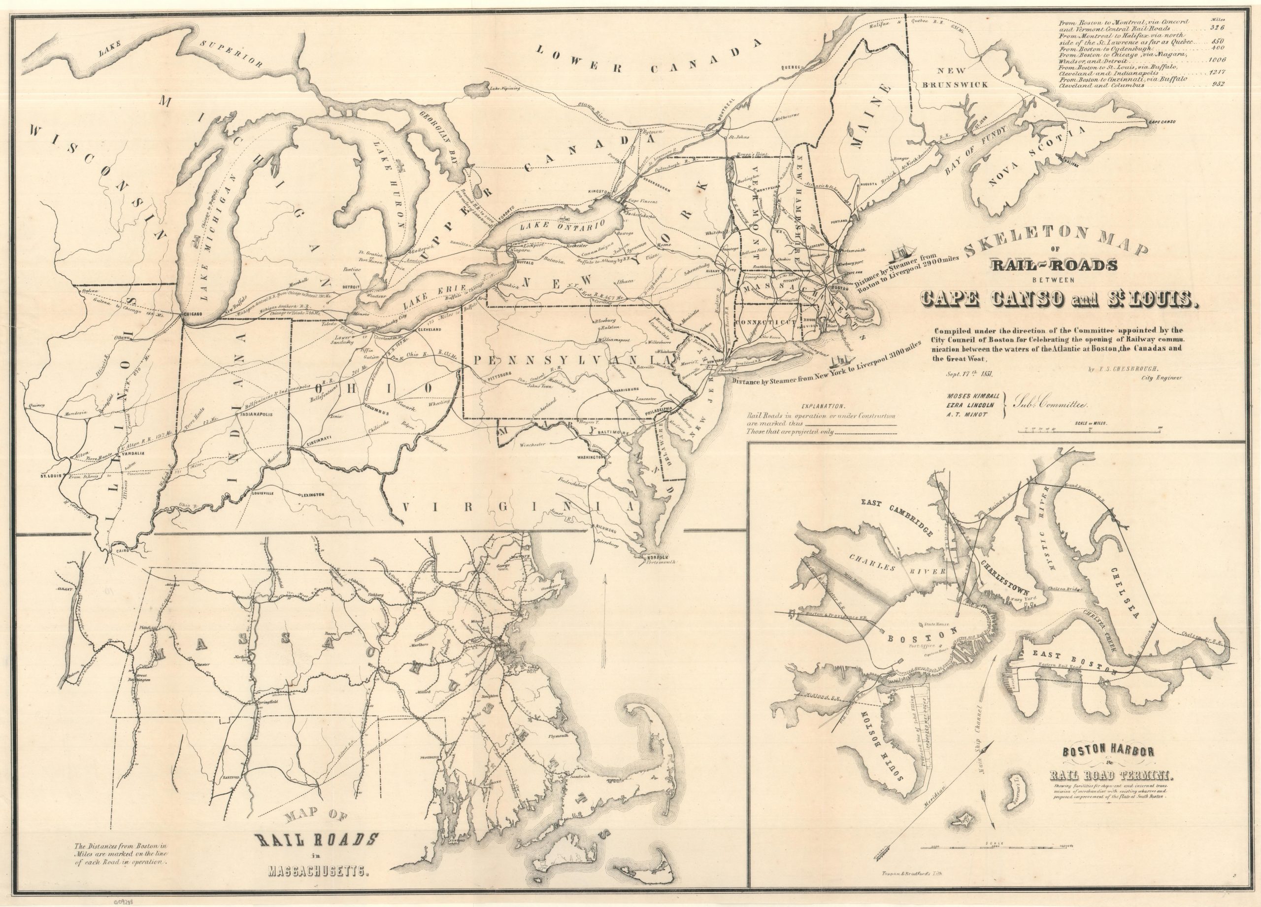
This fascinating and scarce map of the Midwest, Northeast, and parts of Canada was issued in 1851 to illustrate the rapidly developing railroad network between Cape Canso, Nova Scotia, and St. Louis, Missouri. Practicalities be damned in the heyday of railway speculation and massive engineering projects: an enormous 2,000-mile transportation corridor is envisioned between the Atlantic coast and the banks of the Mississippi River, incorporating railroads that were completed, under construction, or merely projected.
Lines “in operation or under construction” are marked with solid lines, while projected routes (those that existed largely on paper) are shown with dotted lines. The resulting network offers a fascinating snapshot of American and Canadian railroad development at a moment when many of the routes that would become major transportation corridors were still being planned or built.
Cape Canso is presented as an important eastern terminus and emerging Atlantic port, while Boston receives considerably more attention as the commercial and transportation center of New England. Two insets along the bottom reinforce this emphasis: the left provides a detailed view of the railroad network across Massachusetts, while the right presents Boston Harbor and its railroad termini.
The map was drawn by Boston City Engineer Ellis Sylvester Chesbrough and compiled under the direction of a committee appointed by the Boston City Council to celebrate the opening of railway communication between Boston, the Canadas, and the Great West. It was lithographed by Toppan & Bradford. The map is less a practical railroad plan than a civic and promotional vision of Boston’s expanding connections to the Canadian provinces and the rapidly developing American interior.
Map Details
Publication Date: 1851
Author: Ellis Sylvester Chesbrough
Sheet Width (in): 32.50
Sheet Height (in): 23.25
Condition: A
Condition Description: Expertly cleaned and flattened sheet with minor edge wear, including narrow margins and a small unobtrusive hole in the lower right. Very good condition overall.
$500.00
1 in stock