Route 66 Travel the Mother Road from Chicago to LA
Fun guide map to Route 66 created by one of its foremost experts.
Out of stock
Description
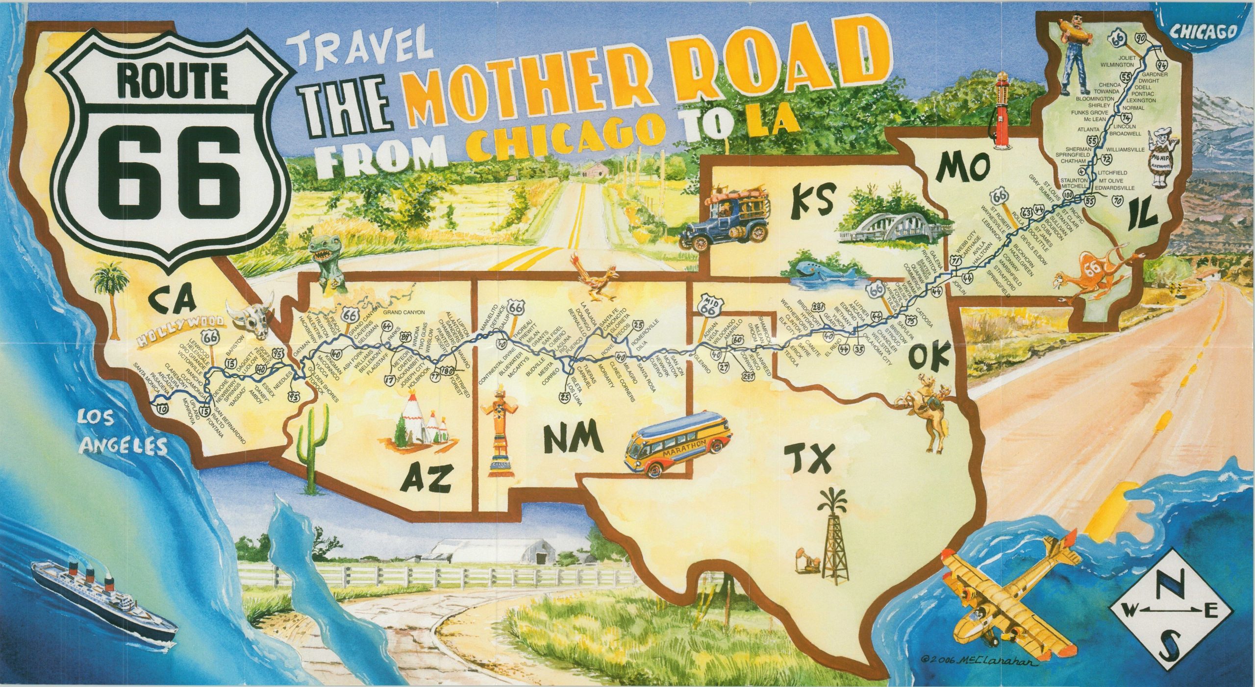
Route 66 is one of the most iconic highways in America, stretching nearly 2,500 miles between downtown Chicago and the Santa Monica Pier in Los Angeles. Though its functionality has been long surpassed by interstate highways and air travel, it remains an important part of the country’s history and culture.
This pictorial celebration of the ‘Mother Road’ (also known as the Main Street of American and the Will Rogers Highway) was designed by artist Jerry McClanahan and self-published in 2006. It shows the highway stretching across eight different states, with stylized vignettes scattered throughout place names identifying the major towns along the way.
Map Details
Publication Date: 2006
Author: Jerry McClanahan
Sheet Width (in): 26.75
Sheet Height (in): 14.50
Condition: A
Condition Description: Creasing along originally issued fold lines, otherwise in fine condition.
Out of stock