Rand McNally Junior Auto Road Map of New England States
$110.00
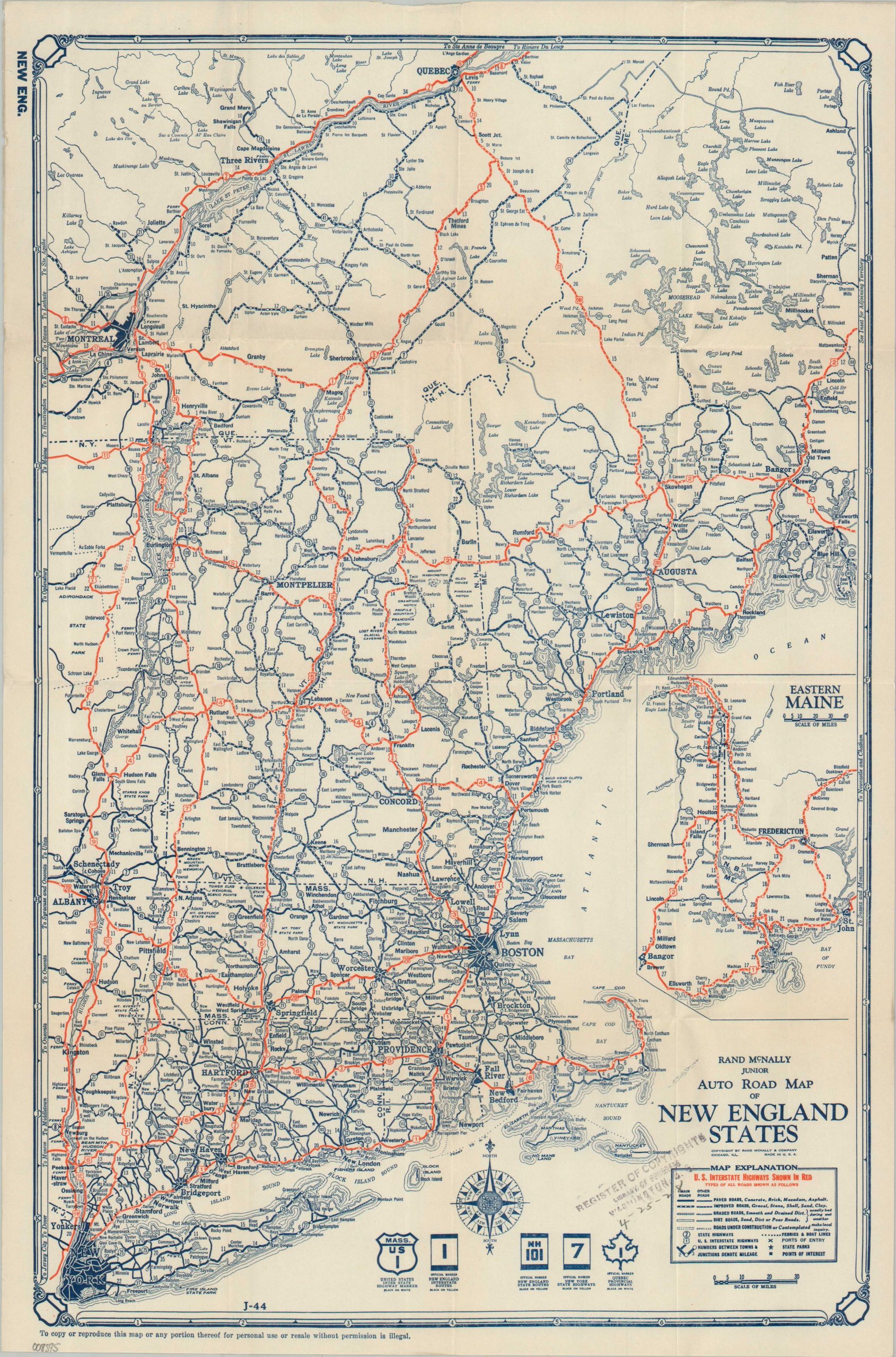
The roads of New England near the end of the Roaring 20s.
1 in stock
Description
This crisp, pocket-sized road map of New England is a classic example of the Junior series produced by Chicago-based Rand McNally during the late 1920s – a pivotal era when American road navigation was transitioning toward federal standardization. A dated 1928 rubberstamp in the center right indicates this example was applied with a Register of Copyright from the Library of Congress.
The map utilizes a sophisticated legend to convey the varied (and often challenging) driving conditions of the time. “U.S. Interstate Highways” are prominently highlighted in red, while five distinct line styles and two weights are used to differentiate road surfaces, ranging from Paved and Improved to Graded, Dirt, and even sections Under Construction (or Contemplated). Regional urban areas – New York, Boston, Montreal, Providence, etc. – are colored in deep blue.
Beyond simple navigation, the map serves as a detailed snapshot of the New England landscape during the early “Golden Age” of motor touring. U.S. and State Highway markers are clearly outlined, and the inclusion of square-marked points of interest and star-labeled state parks highlights the growing importance of leisure travel. The distinctive Highway Shields are incorporated as decorated elements in each corner. Distances between key points are meticulously noted, a reflection of the utility that made Rand McNally a household name in motor travel in the latter half of the 20th century.
Map Details
Publication Date: 1928
Author: Rand McNally
Sheet Width (in): 12.00
Sheet Height (in): 17.75
Condition: A-
Condition Description: Single-sided map creased along old folds. Scattered soiling on the verso and a rubberstamp in the lower right. A few tiny pinholes and light marginal wear. Very good condition overall.
$110.00
1 in stock