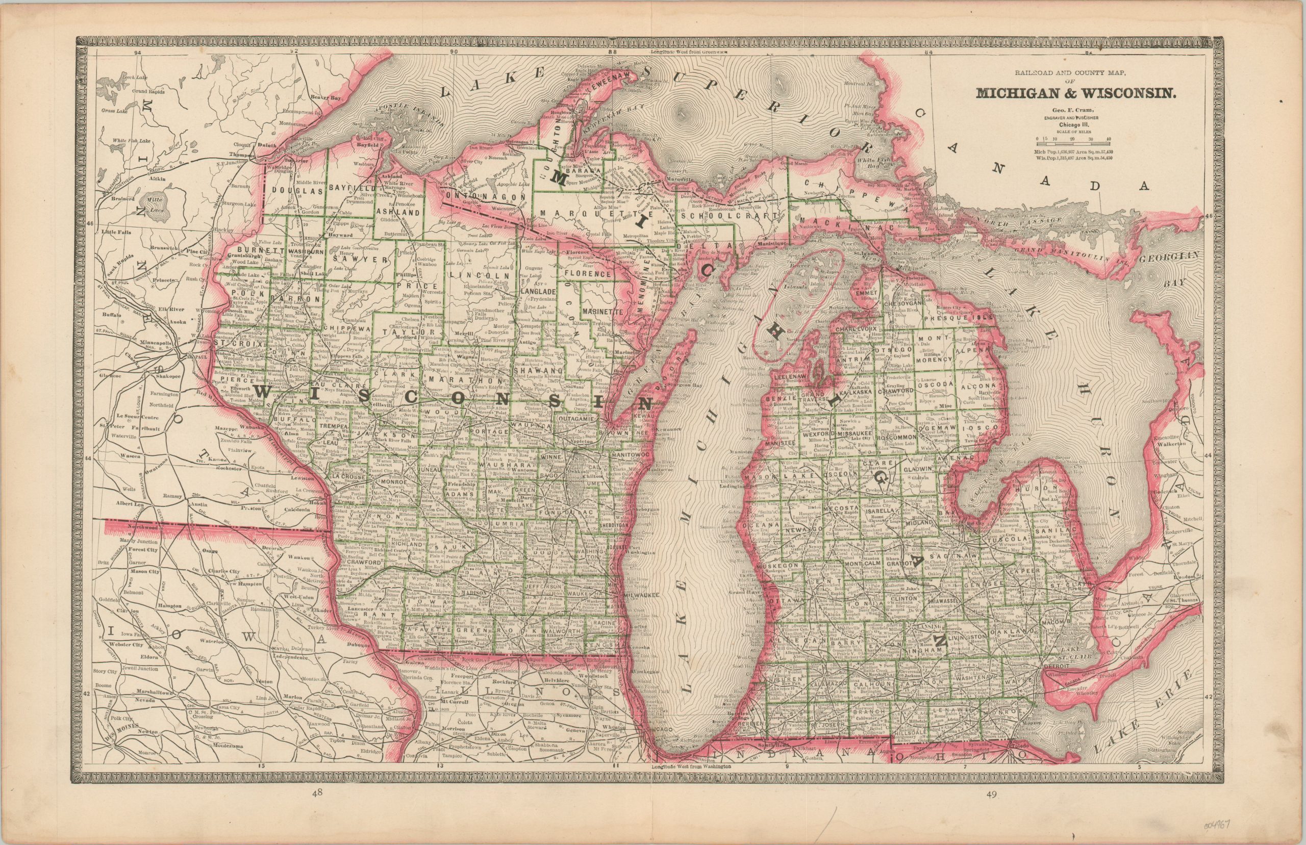
Railroad and County Map of Michigan & Wisconsin
$60.00
Michigan and Wisconsin in the early 1880s.
1 in stock
Description
This detailed map of Wisconsin and Michigan was published by George Cram in Chicago in 1883. It provides a detailed snapshot of the two Great Lakes states in the midst of the Gilded Age. Vibrant red color distinguishes state borders, while a more muted green outlines individual counties (the exception being Manitou County’s island claims in Lake Michigan).
Toponyms identify a fascinating variety of settlements, geographic features, and other locations of interest throughout the image. The network of railroads is strongly emphasized, connecting some of the more remote regions filled with valuable timber and minerals. Distances between points are noted, somewhat cluttering the view but adding a useful data point for users.
Map Details
Publication Date: 1883
Author: George Cram
Sheet Width (in): 21
Sheet Height (in): 13.6
Condition: A-
Condition Description: Scattered soiling visible in the margins, concentrated most heavily in the lower right. A few spots here and there within the image (see above title block), but overall in very good condition.
$60.00
1 in stock