Preliminary Chart of Nantucket Shoals Massachusetts
$95.00
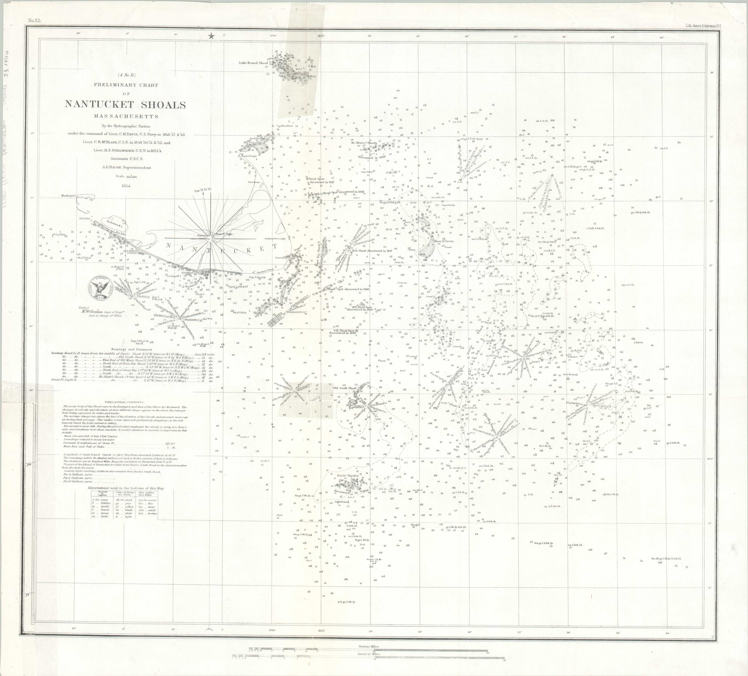
Navigating the hazardous shoals of Nantucket.
1 in stock
Description
This detailed nautical chart was compiled by a team of surveyors from the U.S. Coast Survey and published in 1854 under the authority of superintendent A.G. Bache. Their important work notes major maritime hazards around the Massachusetts island of Nantucket.
Depth soundings are noted and numerous shoals are named, often with their date of discovery. Navigational beacons, buoys, and other geographic features are also labeled. Text in the lower left proffers information about tides and tidal currents.
Map Details
Publication Date: 1854
Author: U.S. Coastal Survey
Sheet Width (in): 20.6
Sheet Height (in): 18.5
Condition: B
Condition Description: Creasing and a few small tears visible in the upper right corner. Discoloration on the sheet (professionally cleaned) from old tape repairs on the verso. A nice impression on a bright white sheet. Good condition overall.
$95.00
1 in stock