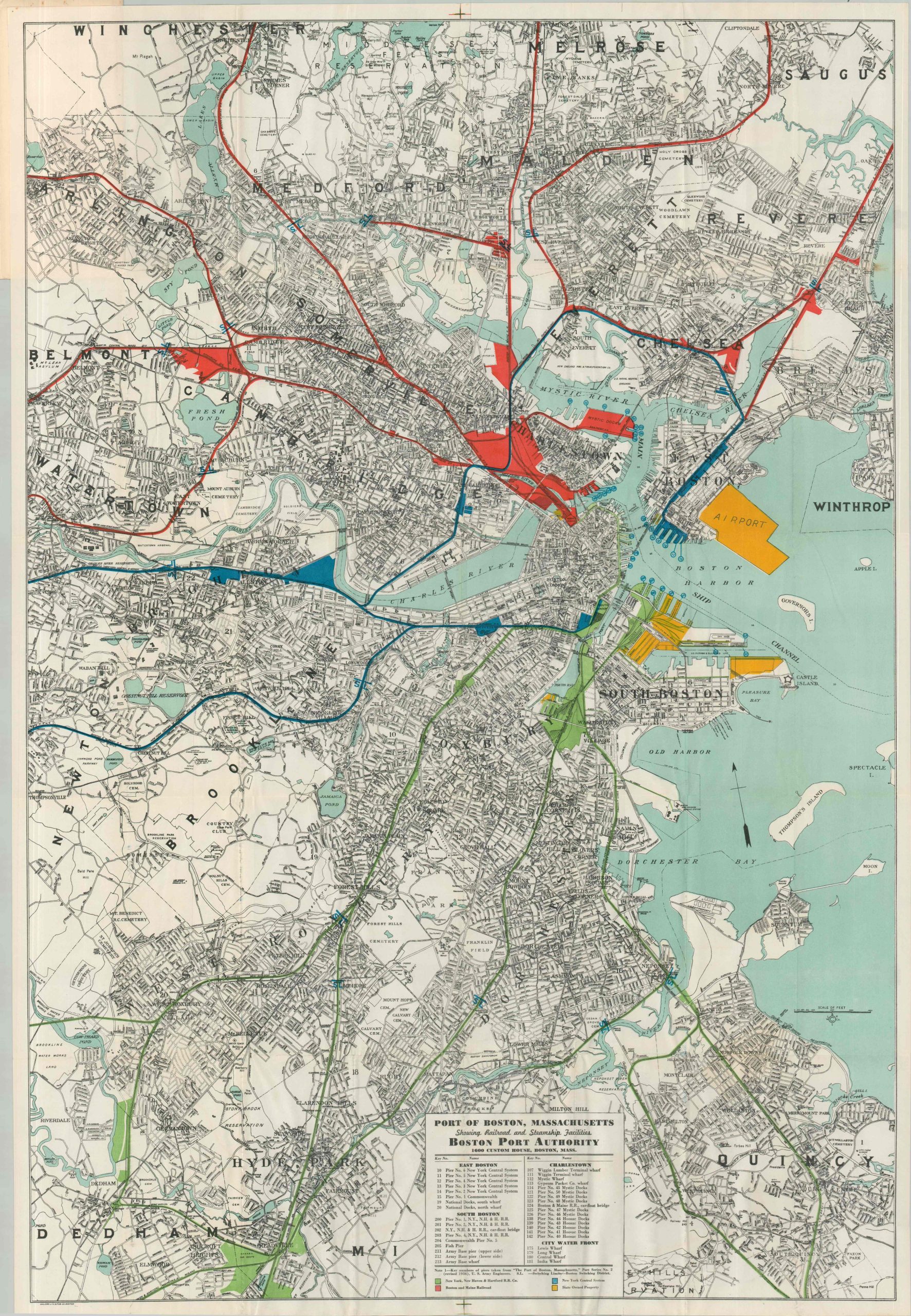
Port of Boston, Massachusetts Showing Railroad and Steamship Facilities
$95.00
Boston Harbor, about 165 years after its famous Tea Party.
1 in stock

Description
This finely detailed street plan of Boston and the surrounding cities highlights in vibrant color the transportation facilities owned by four separate entities: New York, New Haven & Hartford Railroad Company (green), the Boston and Maine Railroad (red), New York Central System (blue), and state-owned property (yellow). This interconnected system includes piers, tracks, railyards, warehouses, and more – all vital elements to the area’s industrial economy. An interesting snapshot of Boston’s commercial infrastructure in the midst of the Great Depression.
The map was created by the Walker Lithograph & Publishing Company. Issued by the New York, New Haven & Hartford Railroad, most likely in 1937 (pier numbers revised the year prior).
Map Details
Publication Date: c. 1937
Author: Walker Lithograph & Publishing Company
Sheet Width (in): 29.00
Sheet Height (in): 42.00
Condition: A
Condition Description: Large color printed map, folded and affixed to original stiff paper wraps. A bit of srinkling and creasing along folds and in the margins, but overall in very good condition.
$95.00
1 in stock