Plan of Boston
$85.00
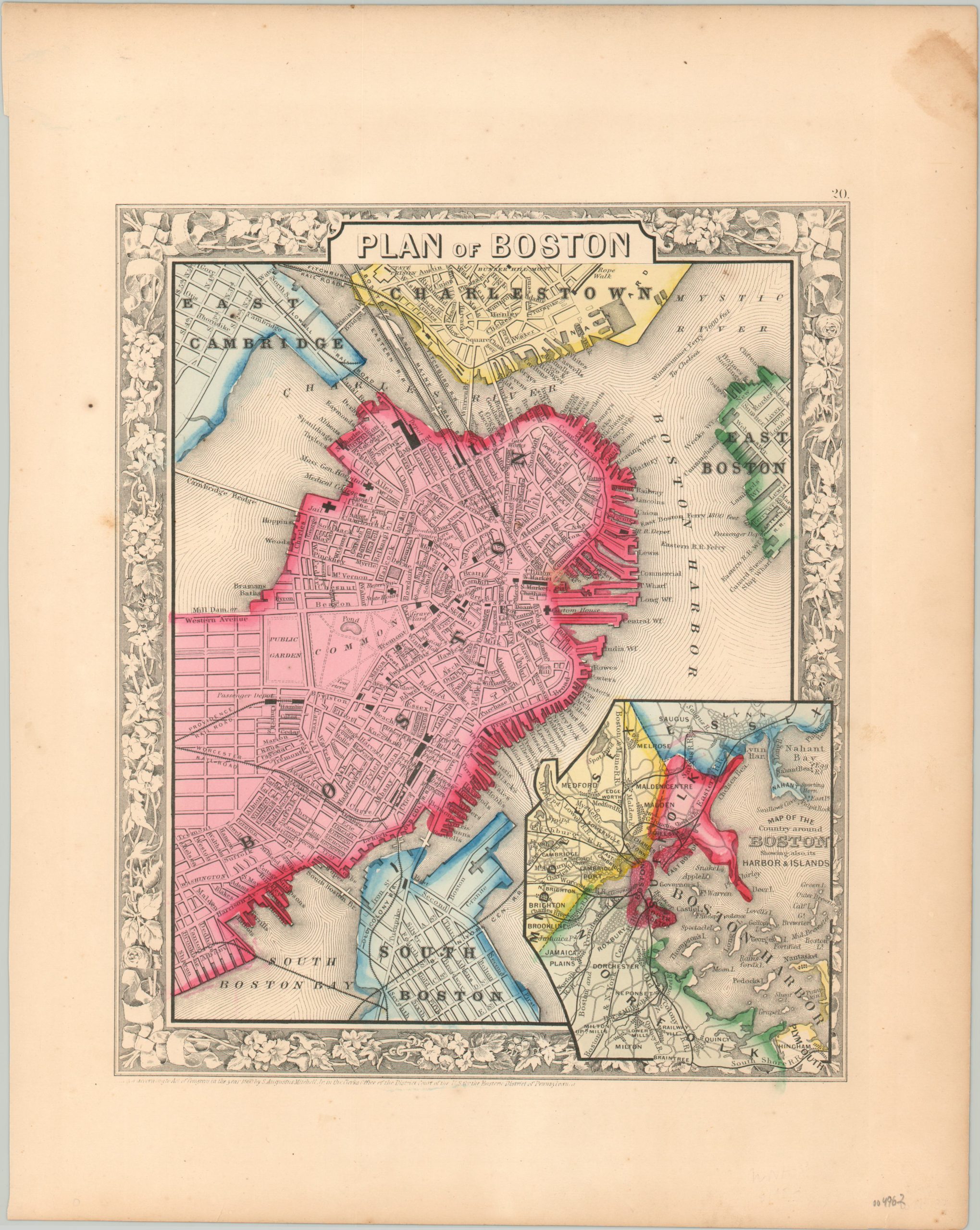
City plan of Boston published shortly before the outbreak of Civil War.
1 in stock
Description
This marvelous plan of Boston, Massachusetts was published in Philadelphia in 1860 by Samuel Augustus Mitchell. Mitchell was one of the most prominent American mapmakers of the 19th century, and initially got involved with cartography as a school teacher who was frustrated with the quality of available maps. He collaborated with skilled engravers and produced high-quality maps and atlases that contained the most up to date information available. Mitchell’s son (of the same name) would take over the business after his death in 1860 and continue the tremendous output.
His attention to detail is evident within the image, which provides an engaging overview of the abolitionist hotspot on the eve of the Civil War. Bright hand color defines the ‘original’ city limits from those of surrounding communities like South Boston, Charlestown, and East Cambridge.
Numerous railroads are depicted and named, with several managing the impressive engineering feat of crossing the Charles River or Boston Harbor. Ferry routes are also noted. A fascinating variety of buildings are outlined and labeled, several of which (Custom House, Quincy Market, Revere House, and State House) can still be visited today.
Map Details
Publication Date: 1860
Author: Samuel Augustus Mitchell
Sheet Width (in): 12.2
Sheet Height (in): 15.25
Condition: A-
Condition Description: Scattered staining visible in the margins, most evident in the upper right. A few spots visible in the image (upper corners), but overall in very good condition. A crisp impression with vibrant hand color.
$85.00
1 in stock