Picture Story of the Historical Rides of Paul Revere William Dawes Dr. Prescott April 18-19, 1775
The British are coming!
Out of stock
Description
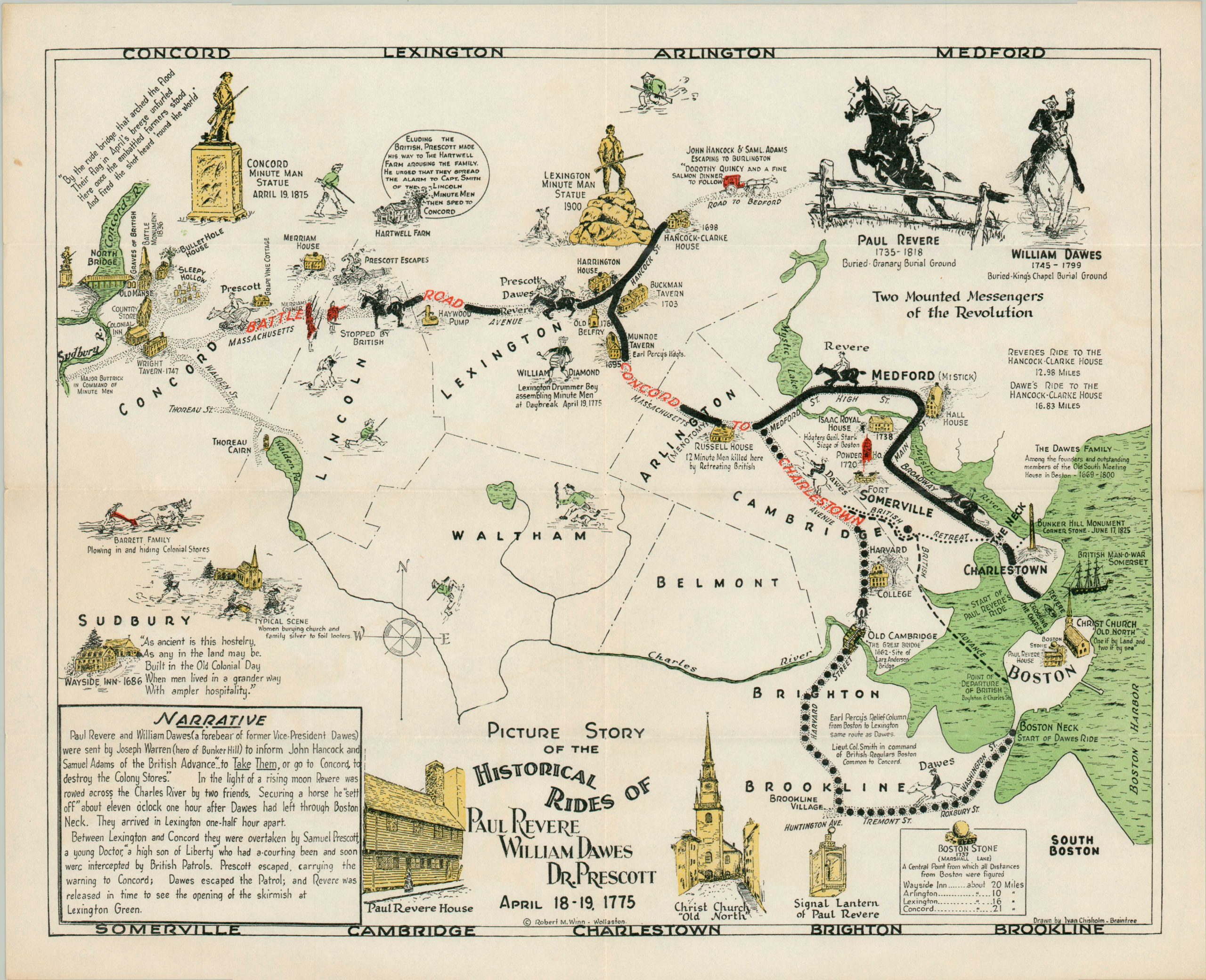
Paul Revere’s name dominates the historical record of the famous ride to warn American troops of an impending British attack, but his colleagues William Dawes and Dr. Samuel Prescott get their dues on this charming pictorial map. Drawn by Ivan Chisholm and copy written by Robert Winn in nearby Quincy, the map details the events of that fateful April night using an appealing variety of vignettes, small figures of the riders, and interesting annotations.
Revolutionary-era quotes, profiles of the riders, and building views at the bottom of the sheet enhance the visual appeal of the map and provide additional historical context. Further narrative is presented in the lower left. A worthy representation of America’s most famous midnight ride.
Map Details
Publication Date: c. 1960
Author: Ivan Chisholm
Sheet Width (in): 17
Sheet Height (in): 13.5
Condition: A-
Condition Description: Rich color printed map on a single sided sheet. Creasing along old fold lines and a bit of spotting in the margins. Near fine condition overall.
Out of stock