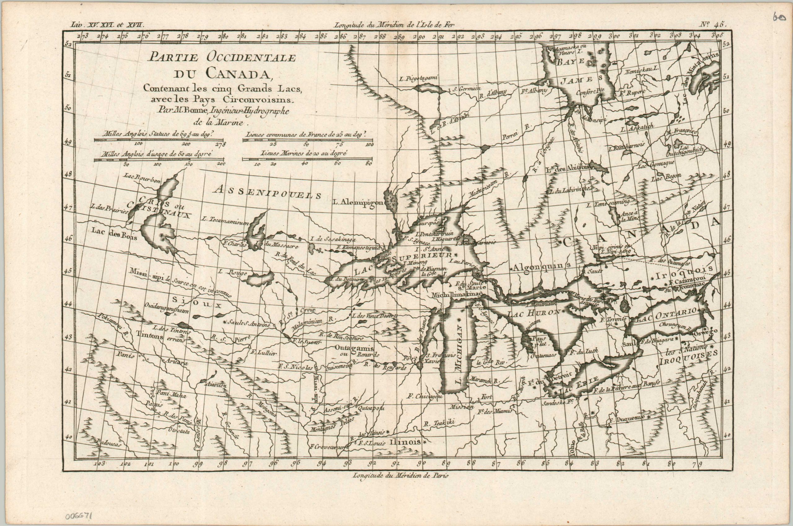
Partie Occidentale du Canada
An important map of the Great Lakes, issued by Rigobert Bonne.
Out of stock
Description
This late 18th-century map of the midwestern United States and southern Canada was originally issued by Rigobert Bonne at a time of significant competition between French and English for the resources of the New World. Forts, missions, Native American tribes, and scattered villages reflect the frontier composition of the depicted territory. Locations such as Fort Chicagou, Fort de Detroit, and Michillimakinac provide toponymy that persists today, along with the largely recognizable outline of the Great Lakes system.
Though Bonne strived for accuracy in his role as the Royal Cartographer to France, there are numerous inaccuracies within the image; including mythical mountain ranges, non-existent rivers, and the apocryphal islands of Lake Superior. Although this particular edition was issued later, around 1790, it remains an important map in the cartography of the Great Lakes and American Midwest.
Map Details
Publication Date: c. 1790
Author: Rigobert Bonne
Sheet Width (in): 14.6
Sheet Height (in): 9.75
Condition: A-
Condition Description: A crisp and dark impression on thick laid paper. Faint discoloration along the vertical centerfold from the binding strip and some very light soiling along the upper edge of the sheet. Very good condition overall.
Out of stock