North America Parts of Wisconsin and Michigan. Sheet V.
$125.00
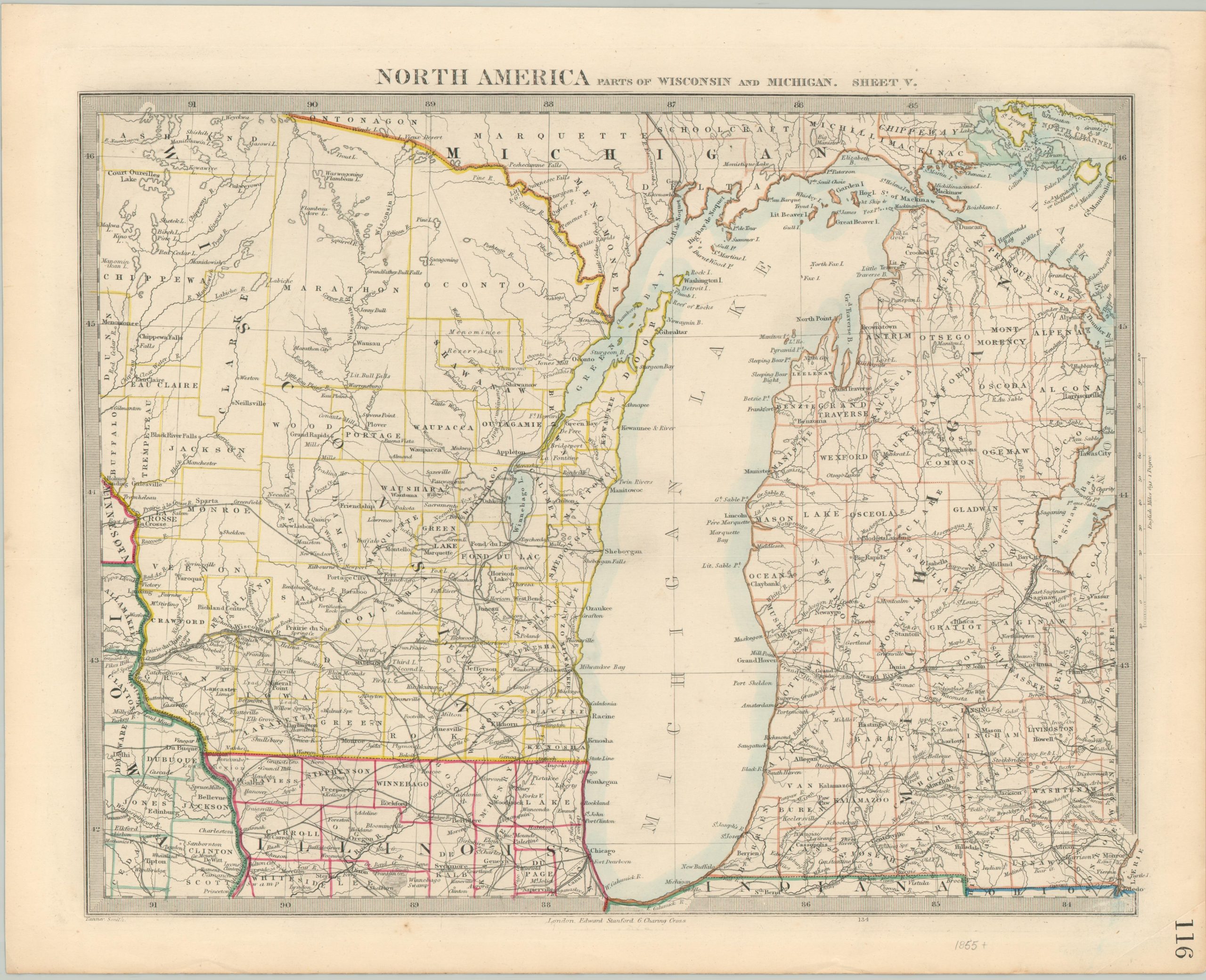
One of the final versions of the S.D.U.K. map of Lake Michigan.
1 in stock
Description
This attractive map of the region around Lake Michigan was published in London by Edward Stanford around 1860, as part of an atlas featuring maps from the Society for the Diffusion of Useful Knowledge (S.D.U.K.). A robust network of railroads is prominently featured, connecting rich agricultural, industrial, and mineral regions to towns and market cities along the coast. Though rails span the east/west breadths of both Wisconsin and Michigan, the northern limits of both states remain relatively inaccessible.
Hand color outlines counties across portions of Michigan, Wisconsin, Missouri, Illinois, Iowa, Indiana, and Ohio, as well as the sole Native American reservation in the image. Settlements, geographic features, and other locations of interest (forts, mines, mills, lighthouses, etc.) are labeled throughout.
Founded in 1827 by Lord Russel and Henry Brougham, the S.D.U.K. was formed to help the working man educate himself. With the concept that ‘Knowledge is Power’ behind it, the organization issued scientific works, an encyclopedia, an atlas, and other educational materials in relatively inexpensive formats. For instance, the atlas was originally published in parts – approximately two maps each month – with prices around a shilling for black and white copies. S.D.U.K. maps were neatly engraved on steel and often updated with the latest available geographic information, allowing for the working class to stay up to date on international affairs.
As such, they also provide some of the most detailed snapshots from areas across the globe during the mid-19th century. Though the maps are sometimes found undated, identifying the publisher helps to narrow the timeframe of publication. Edward Stanford first obtained the S.D.U.K. plates long after the organization shuttered its doors in 1846. He published them independently from between 1856 and 1877, with significant revisions taking place between 1863 and 1865. For more information on S.D.U.K. maps, check out my blog post here.
Map Details
Publication Date: c. 1860
Author: Edward Stanford
Sheet Width (in): 17.1
Sheet Height (in): 13.9
Condition: A-
Condition Description: Light scattered spotting visible in the margins and some darkening from the plate impression in the upper right corner. Very good overall, with original color.
$125.00
1 in stock