New England Tours for 1915
$125.00
Three recommended auto trips across New England for the 1915 motoring season.
1 in stock
Description
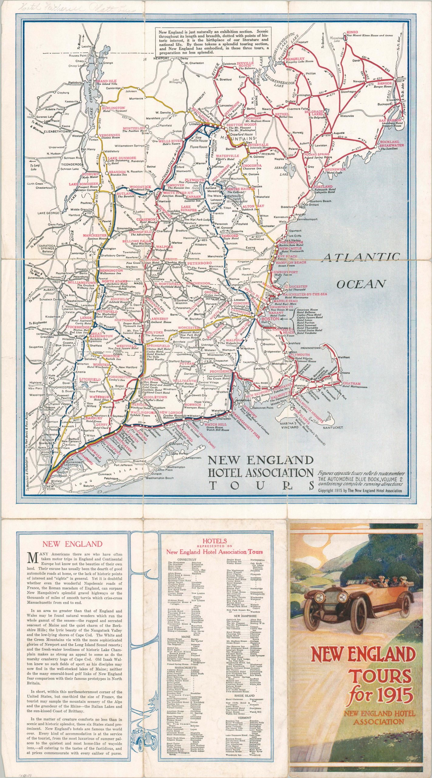
“In short, within this northeasternmost corner of the United States, but one-third the size of France, the tourist may sample the mountain scenery of the Alps and the grandeur of the Rhine – the Italian Lakes and the sun-kissed Coast of Brittany.” – Text, upper lower left.
This ephemeral tourist map of New England was copyrighted in 1915 by The New England Hotel Association. The trade organization sought to transplant the Grand Tour of Europe in a more accessible, localized form, available to the affluent residents of New York and Boston.
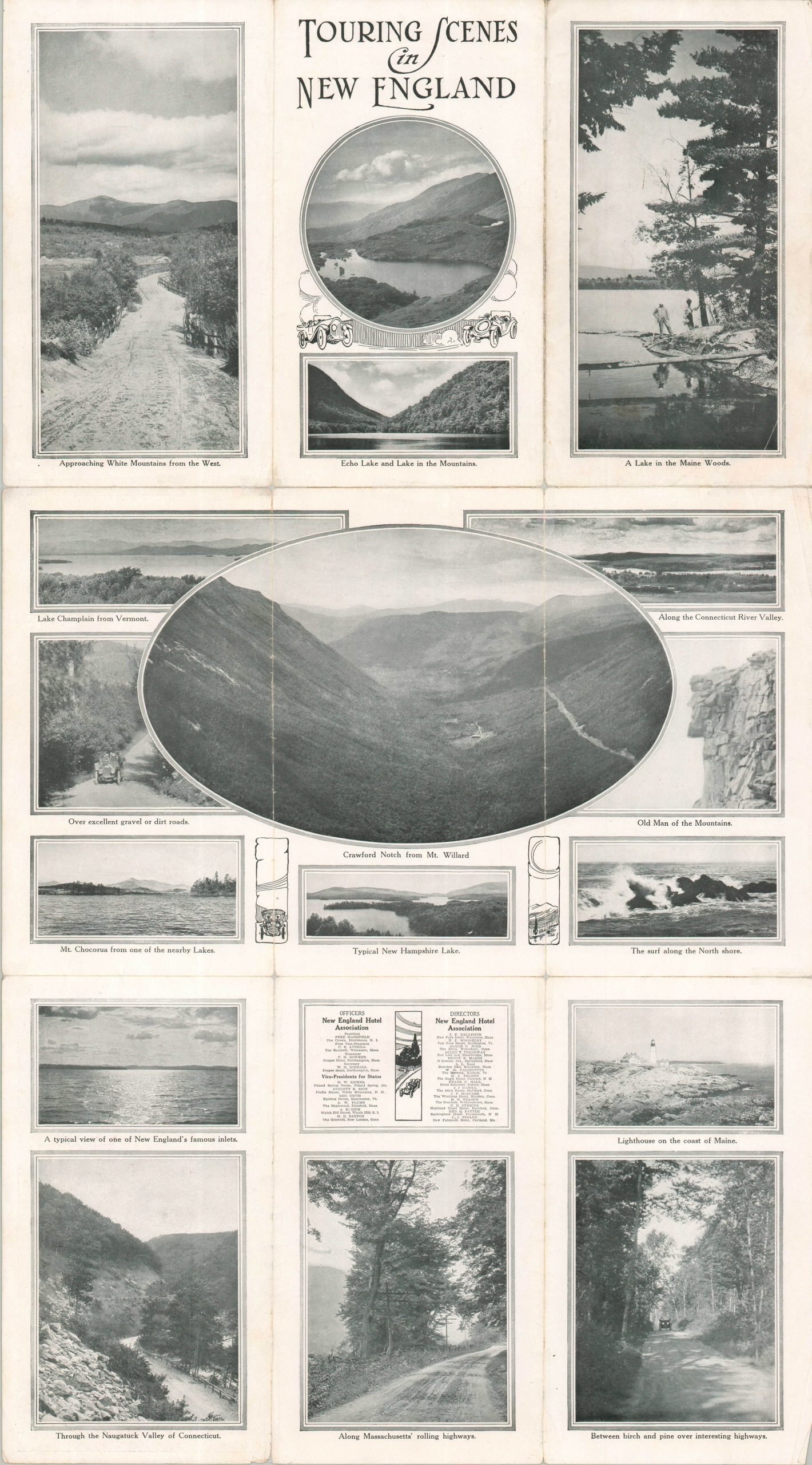
Bright blue, yellow, and red lines trace the route of three suggested motor tours that explore the rich history, natural beauty, and diverse outdoor leisure of the Northeast. Major stopovers are printed in red, each accompanied by at least one recommended accommodation (and likely association member). Issued before the standardization of numbered highways, the route numbers reflect those assigned by the popular Automobile Blue Book. The verso of the sheet presents several black and white images of ‘Touring Scenes in New England.’
Map Details
Publication Date: 1915
Author: New England Hotel Association
Sheet Width (in): 14.75
Sheet Height (in): 27.00
Condition: B
Condition Description: Double-sided map brochure with numerous splits along folds, with significant archival tape repairs on the verso. Very minimal loss and small visible separations in a few areas. Good condition overall. Includes original cloth case.
$125.00
1 in stock