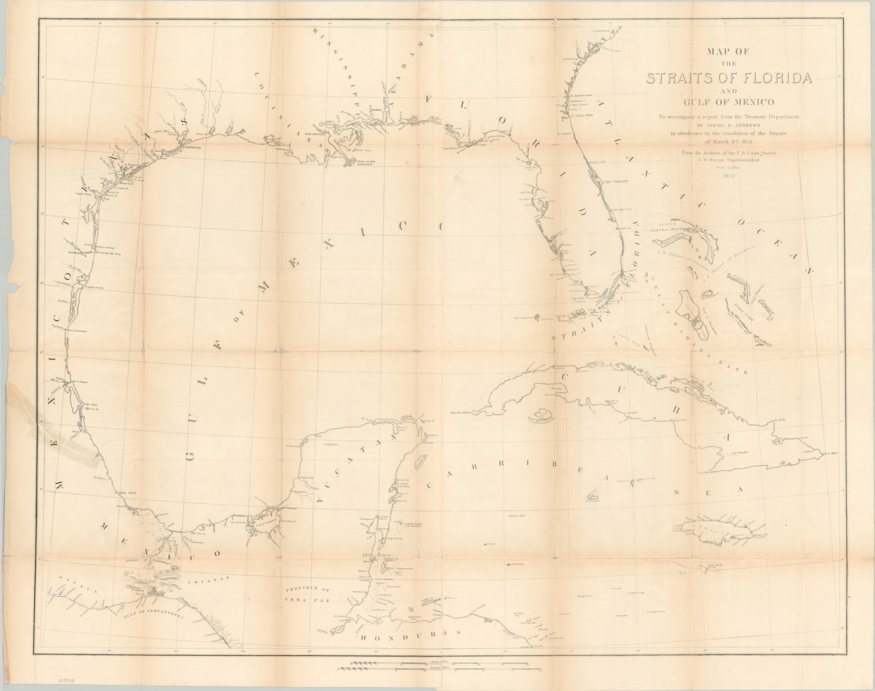
Map of the Straits of Florida and Gulf of Mexico
$175.00
The Gulf of Mexico, now dominated by the United States.
1 in stock
Description
This mid-19th century chart shows the coastline of the southeastern United States, portions of Mexico, the Bahamas, Cuba, and Jamaica. Rivers, settlements, coastal islands, maritime hazards, and lighthouses are all labeled, in addition to the various geographic regions.
The border of Texas is noted as the Rio Grande, reflecting the Treaty of Guadeloupe Hidalgo signed just a few years prior to publication. Interior details are sparse, with the exception of topography and a few paths present in the Isthmus of Tehuantepec.
This overland route represented the shortest distance between the Pacific Ocean and the Gulf of Mexico and was a primary trans-oceanic transportation point prior to the opening of the Panama Canal. Its economic value was clearly recognized by the United States, who included provisions for its use in the Gadsden Purchase treaty of 1854.
The map was issued by the United States Coastal Survey in 1852 as part of a Treasury Department report by Israel D. Andrews.
Map Details
Publication Date: 1852
Author: United States Coast Survey
Sheet Width (in): 35.75
Sheet Height (in): 28.4
Condition: B
Condition Description: Two sheets, joined along a vertical seam in the center of the sheet. Moderate to heavy wear along former fold lines, including holes and minor paper loss at fold intersections. Large separations along the seams have been repaired on the verso using archival tape, with one 4" diagonal tear in the lower left showing old cellophane tape residue. Old library stamps on verso.
$175.00
1 in stock