Louisiana
Showing 1–18 of 76 resultsSorted by latest
-
![Canada Louisiane et Terres Angloises [Southeastern U.S.]](data:image/svg+xml,%3Csvg%20xmlns='http://www.w3.org/2000/svg'%20viewBox='0%200%20300%20300'%3E%3C/svg%3E)
Canada Louisiane et Terres Angloises [Southeastern U.S.]
$500.00 Quick View -
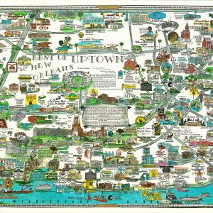
Best of Uptown New Orleans
$175.00 Quick View -
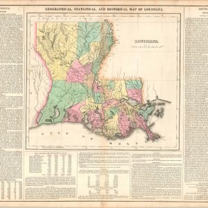
Geographical, Statistical, and Historical Map of Louisiana
$145.00 Quick View -
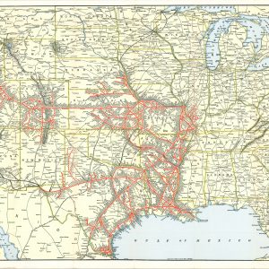
Map of the Missouri Pacific Lines and Connections
$225.00 Quick View -
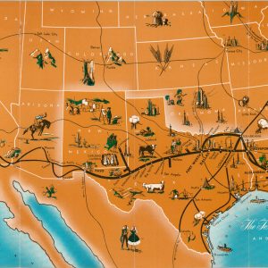
The Texas and Pacific Railway and Connections
$80.00 Quick View -
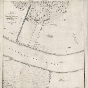
Plan of an Attack Made by the British Forces on the American Lines in Advance of New Orleans on the 8th January 1815
$125.00 Quick View -
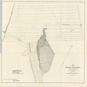
Inspection of the Improvement of the South Pass of the Mississippi River
Quick View -
Alluvial Valley of the Mississippi River Southern Sheet – New Orleans District
$295.00 Quick View -
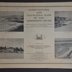
Flood Control and Navigation Maps of the Mississippi River Cairo, Illinois to the Gulf of Mexico
Quick View -
New Orleans
$150.00 Quick View -
Top of the Mart
$65.00 Quick View -
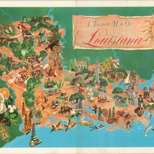
A Tourist Map of Louisiana
$110.00 Quick View -
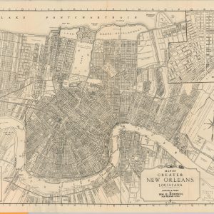
Map of Greater New Orleans Louisiana
$145.00 Quick View -
[Parts of Texas, Louisiana, and Arkansas during the American Civil War]
$75.00 Quick View -
[Parts of Texas and Louisiana during the American Civil War]
$75.00 Quick View -
[Parts of Louisiana and Mississippi during the American Civil War]
Quick View -
[Parts of Louisiana and Mississippi during the American Civil War]
$75.00 Quick View -
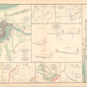
Approaches To New Orleans; Map of Spanish Fort, Ala.; Diagrams Illustrating the Different Positions Occupied by the 4th Division, 17th Army Corps during the Battle of Atlanta; Map of the Vicinity of Mechanicsville, Va.
$75.00 Quick View
![Canada Louisiane et Terres Angloises [Southeastern U.S.]](https://curtiswrightmaps.com/wp-content/uploads/map_22.95x33.37_04-14-26_inv008527c-300x300.jpg)


![[Parts of Texas, Louisiana, and Arkansas during the American Civil War]](https://curtiswrightmaps.com/wp-content/uploads/map_28.94x18.11_07-19-24_plate_clviii-300x300.jpg)
![[Parts of Texas and Louisiana during the American Civil War]](https://curtiswrightmaps.com/wp-content/uploads/map_29.04x18.13_07-19-24_plate_clvii-300x300.jpg)
![[Parts of Louisiana and Mississippi during the American Civil War]](https://curtiswrightmaps.com/wp-content/uploads/map_28.96x18.15_07-19-24_plate_clvi-300x300.jpg)
![[Parts of Louisiana and Mississippi during the American Civil War]](https://curtiswrightmaps.com/wp-content/uploads/map_28.99x18.17_07-19-24_plate_clv-300x300.jpg)