
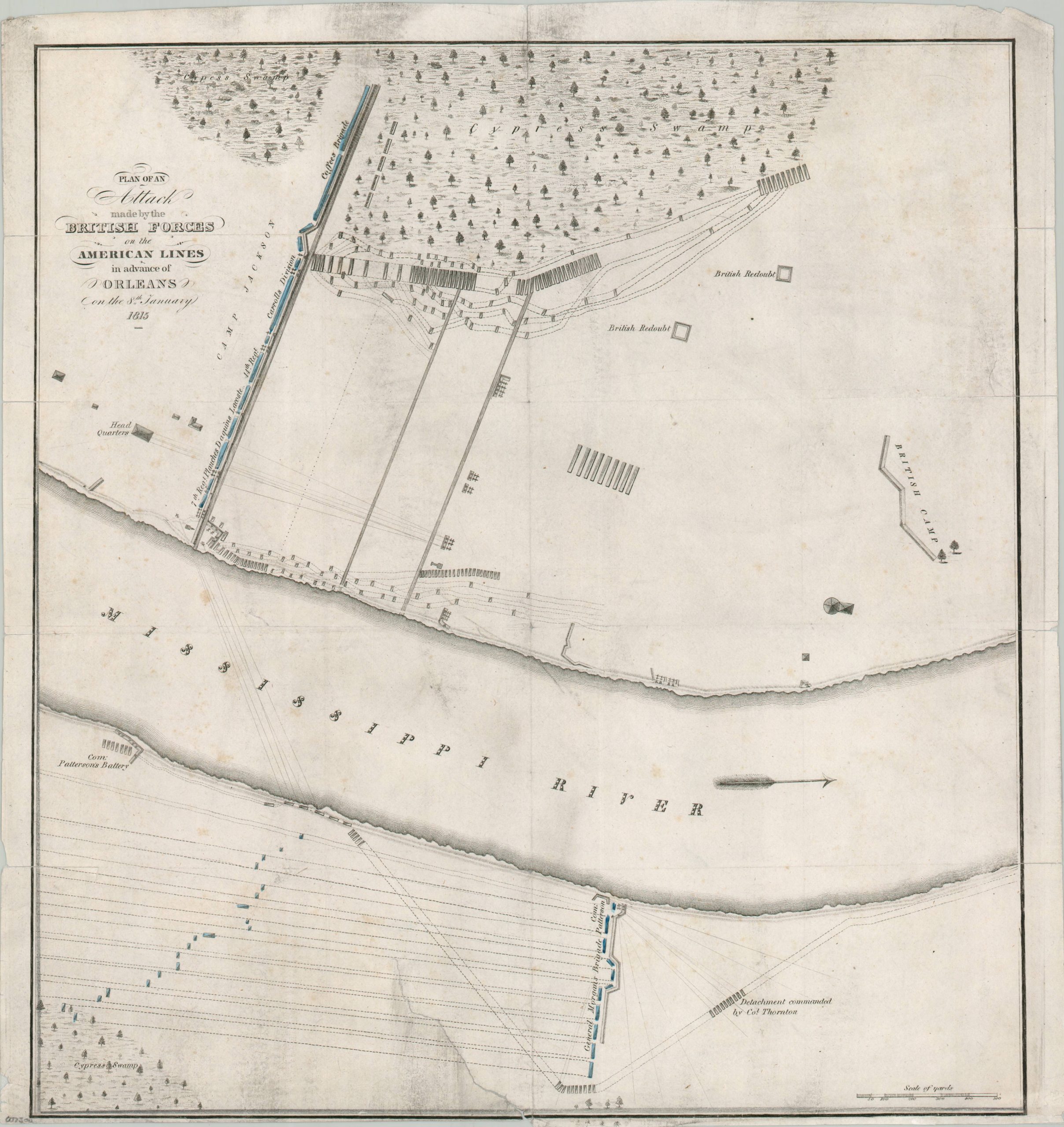
Plan of an Attack Made by the British Forces on the American Lines in Advance of New Orleans on the 8th January 1815
$125.00
Mapping the (surprising) results of the Battle of New Orleans.
1 in stock
Description
The Battle of New Orleans was a decisive American victory against a larger, veteran British force on January 8, 1815. Led by Major General Andrew Jackson, the American defenders inflicted over 2,000 casualties on the British while suffering minimal losses themselves (despite the battle technically taking place after the Treaty of Ghent, ending the War of 1812, was signed).
This battle plan provides an easily understood overview of the American defenders and the British defenders on both banks of the Mississippi River. Redoubts, artillery emplacements, trenches, and other military features are shown throughout. Two large cypress swamps near the top and bottom of the page would have made for nearly impassable terrain.
Originally printed shortly after the battle, in 1816, but this is an undated later example (possibly printed in the 1850s-1860s?). It shares the same image dimensions as an example at the Louisiana State Museum Collections, which is described thus;
“This is a later adaptation of Plate VII, “Plan of the Attack and Defence of the American Lines below New Orleans, on the 8th January, 1815,” published in A. Lacarrière Latour’s 1816, “Atlas to the Historical Memoir of the War in West Florida and Louisiana.”
Map Details
Publication Date: c. 1850?
Author: A. Lacarriere Latour
Sheet Width (in): 15.4
Sheet Height (in): 16.1
Condition: B-
Condition Description: Printed on thin paper with numerous tears and splits repaired on the verso with archival material. The largest is an irregular tear about 4" long in the lower center (see scan). Narrow lower margin, several spots of heavy surface soiling, and faded old color. Between fair and good condition overall.
$125.00
1 in stock