Map of Greater New Orleans Louisiana
$145.00
New Orleans in the mid-1930s – a battleground between Huey Long and local political interests.
1 in stock

Description
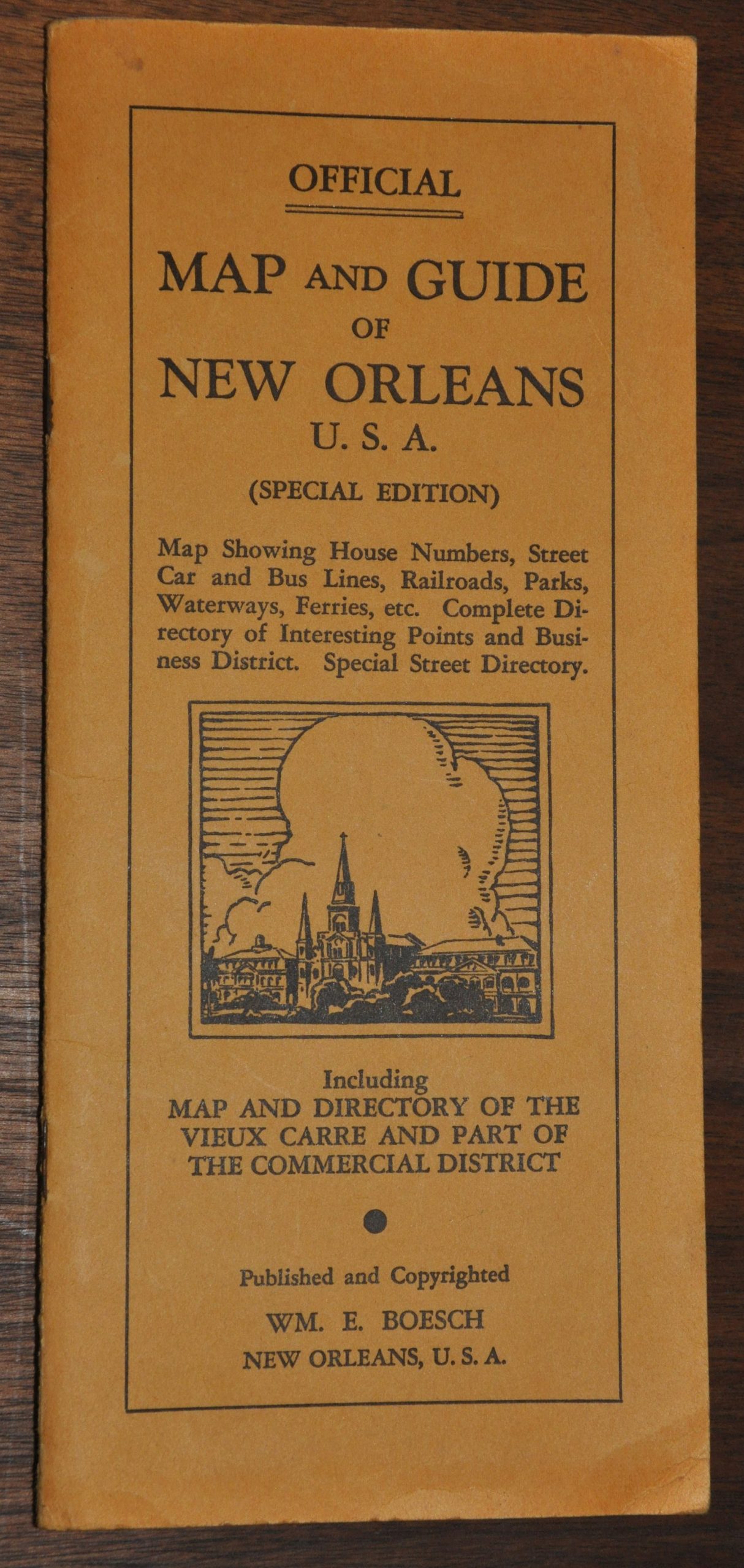
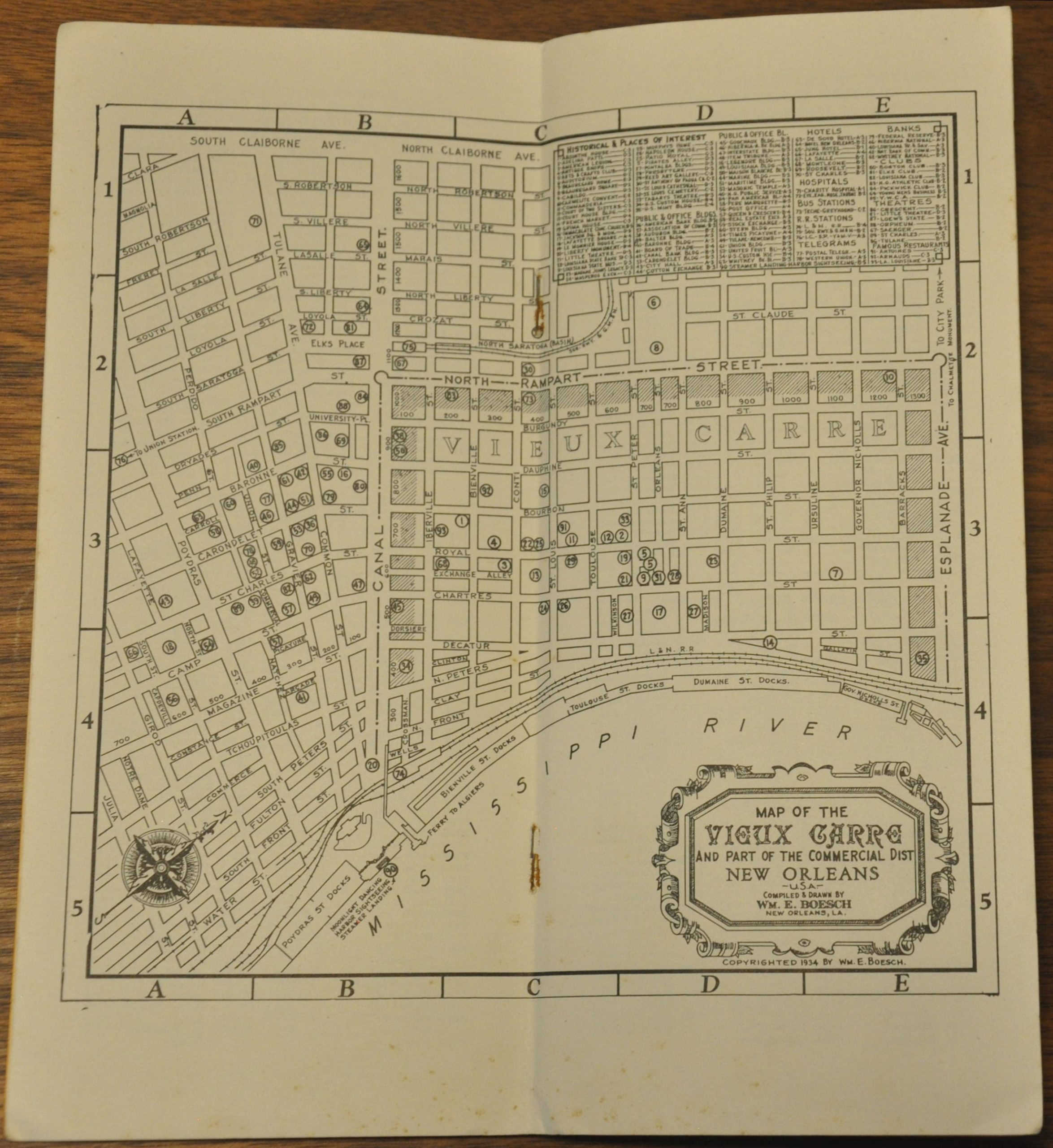
This spectacularly detailed city plan of New Orleans, Louisiana was created and published locally by William E. Boesch around 1935. Delicate labels identify a wealth of information about ‘La Vieux Carre’ in the midst of the Great Depression – noting transportation options, major landowners, prominent businesses, schools, recreational opportunities, military installations, and much more. Numerous industries are shown along the banks of the Mississippi River, reflecting the city’s primary avenue for economic development.
The folding map is affixed to a guidebook of the city that provides a street index, a map of the commercial district, and lists of places of interest. The centerfold ‘Map of The Vieux Carre’ was copywritten by Boesch in 1934, but the presence of the Huey P. Long Bridge on the fold-out indicates a date of at least 1935.
Map Details
Publication Date: 1935
Author: William E. Boesch
Sheet Width (in): 34
Sheet Height (in): 21.75
Condition: A-
Condition Description: Pocket map folded into 24 segments and affixed to original orange paper wraps. Covers show light wear and some rust along the staples, which bind an 18 pp. guide to the city. The map shows some wrinkling and creasing along fold lines, and one or two small holes at fold intersections. Very good overall.
$145.00
1 in stock