Map of the Southern Railway System
$90.00
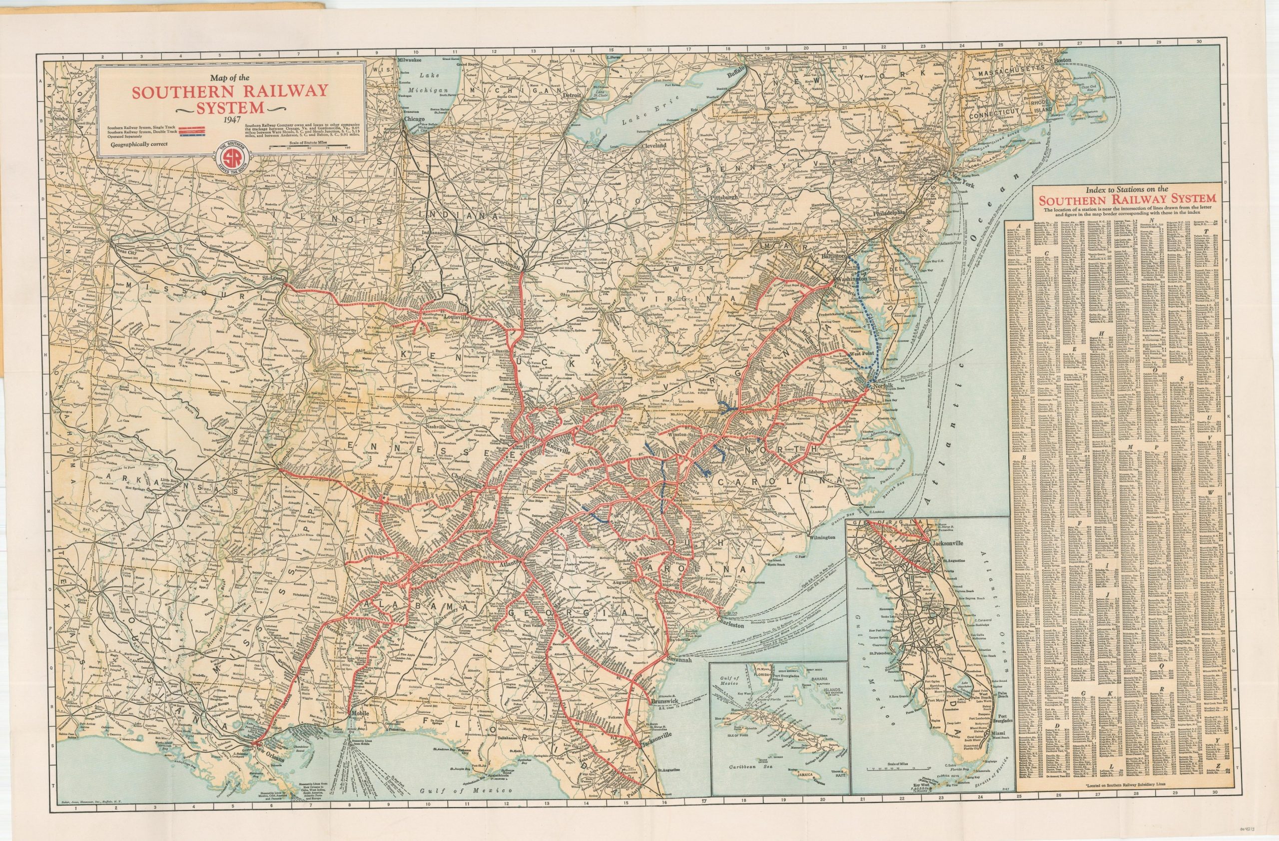
Postwar map showing the vast network of the Southern Railway System.
1 in stock
Description
This vibrant map of the eastern United States highlights the lines of the Southern Railway System, organized in 1894 as a combination of several smaller companies with routes throughout the South. Striking red strokes identify single and double tracks running from Cincinnati and St. Louis to Washington, D.C., Norfolk, Memphis, and numerous port cities along the Atlantic and Gulf coasts.
Independent operators are shown in blue, while other competing railroad companies are represented with simple black lines. Steamship routes are also noted. Insets in the lower right show connections to Jacksonville, Florida and steamship routes to Cuba, while the right side of the sheet presents a comprehensive index to all the stations situated along the Southern Railway System.
Also of interest is the ‘Geographically Correct’ note in the title block – many railroad maps distort state outlines to best present relevant route information, and this may be an effort to ensure the audience that no such duplicitous efforts were made here.
Published in Buffalo in February 1947 by Baker, Jones, Haushauer, Inc. on behalf of the Southern Railway System. Blank on verso.
Map Details
Publication Date: 1947
Author: Baker, Jones, Haushauer, Inc.
Sheet Width (in): 31.75
Sheet Height (in): 21
Condition: A
Condition Description: Pocket map folded into 24 panels and affixed to original yellow stiff paper wraps. Light creasing and wear along fold lines, the outer edge of the sheet, and in the corners, but remains in near fine condition overall.
$90.00
1 in stock

