
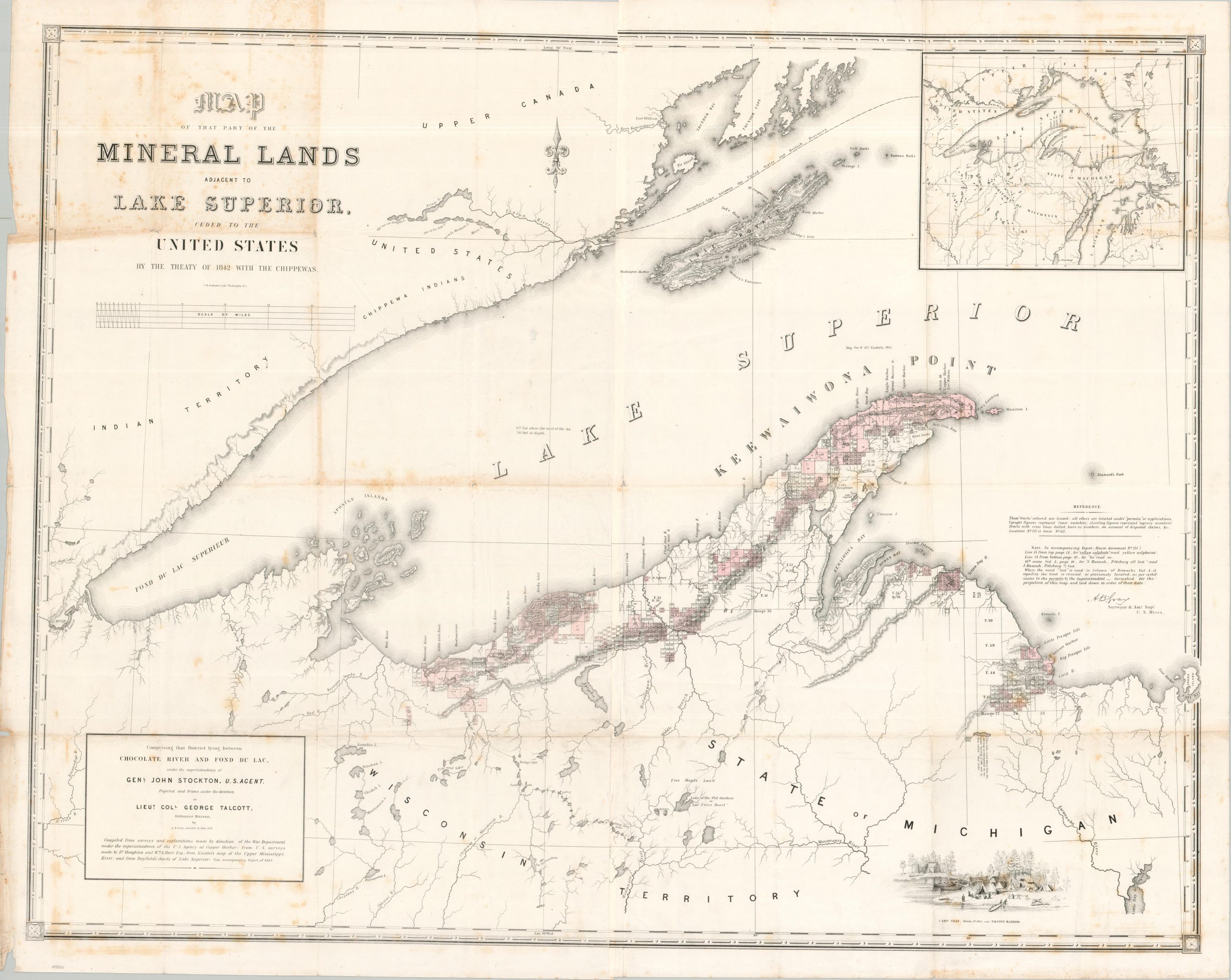
Map of that Part of the Mineral Lands Adjacent to Lake Superior, Ceded to the United States by the Treaty of 1842 with the Chippewas
Confirming the terms of the 1842 Treaty of La Pointe.
Out of stock
Description
This impressive map of western Lake Superior and the adjacent lands shows the remote region during a transitional period in American history. The local indigenous populations had signed away most of their land, either through coercion, force, or a combination of the two, ‘validating’ U.S. expansion and white settlement. An 1842 Treaty with the Chippewa (Ojibwe) at La Pointe, Wisconsin, followed by the 1844 Isle Royal Treaty, confirmed tens of thousands of square miles were then officially U.S. possessions. This facilitated an official border with adjacent British Canada, though the local tribes were still theoretically allowed hunting, fishing and gathering rights on their former lands.
The image notes this boundary line, which leads into the Pigeon River and the Boundary Waters region. Other features of interest include the American Fur Company camp on the banks of the St. Louis River, Fort William, an ‘Old Indian Trail’, Catholic and Methodist missions, and an inset (upper right) of the Upper Midwest.
Also of note are the numerous tracts outlined along the coastline of Lake Superior, concentrated most heavily on the Keweenaw Peninsula. According to a comment in the center right, the tinted parcels are leased, whereas the others are located under permit or applications. The opening of a Federal Land Office at Copper Harbor in 1843 prompted a regional mining boom, with Michigan Copper Country quickly becoming the nation’s leading producer until the late 1880s.
The map was drawn by Surveyor & Assistant Superintendent of U.S. Mines, A.B. (Andrew Belcher) Gray. A view of Gray’s camp near Talcott Harbor can be seen in the lower right. Lithographed in Washington, D.C. by C.B. Graham and originally published as part of a Congressional Report in 1845.
Sources: Northwestern University; Oklahoma State University;
Map Details
Publication Date: 1845
Author: A.B. Gray
Sheet Width (in): 47
Sheet Height (in): 37.75
Condition: B
Condition Description: Two sheets, joined along a vertical seam that has been repaired and reinforced on the verso with no image loss. Creasing, wrinkling, and moderating toning along originally issued fold lines. Heavy foxing visible in the upper left corner (see scan), with some additional discoloration from transference visible in the lower left and scattered throughout the sheet. Marginal wear including small tears, creasing, and further spotting. About good condition overall.
Out of stock