
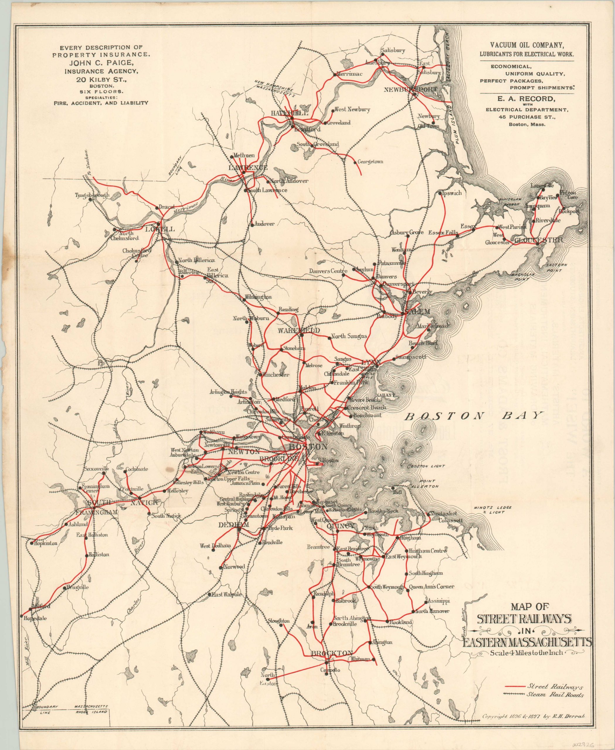
Map of Street Railways in Eastern Massachusetts
The robust network of street railways available around Boston in the late 19th century.
Out of stock
Description
Travelers to Boston in the late 19th century had the option of visiting numerous towns and small villages in the region, thanks to the robust network of uniform gauge interurban railways that served eastern Massachusetts. According to a contemporary railroad journal referencing this map, it took eleven hours to travel from Hopedale (lower left) to Salisbury (upper right) along the electrified rail lines, at a cost of six shillings and six pence (about $50 in today’s dollars). Steam railroads are also noted.
Two advertisements are included at the top of the page. One is for John Paige, an insurance agent in Boston, and the second is for Vacuum Oil Company. A little irony there, since oil companies such as Vacuum (eventually taken over by Standard) directly contributed to the downfall of America’s interurban railway system.
Published in 1897 by R.H. Derrah as part of his Street railway guide for Eastern Massachusetts.
Map Details
Publication Date: 1897
Author: R.H. Derrah
Sheet Width (in): 13.70
Sheet Height (in): 16.90
Condition: B+
Condition Description: Creasing and light wear along former fold lines. Narrowed left margin shows a bit of discoloration near the top of the sheet, and there is a second bit of staining east of Newton. Good to very good overall.
Out of stock