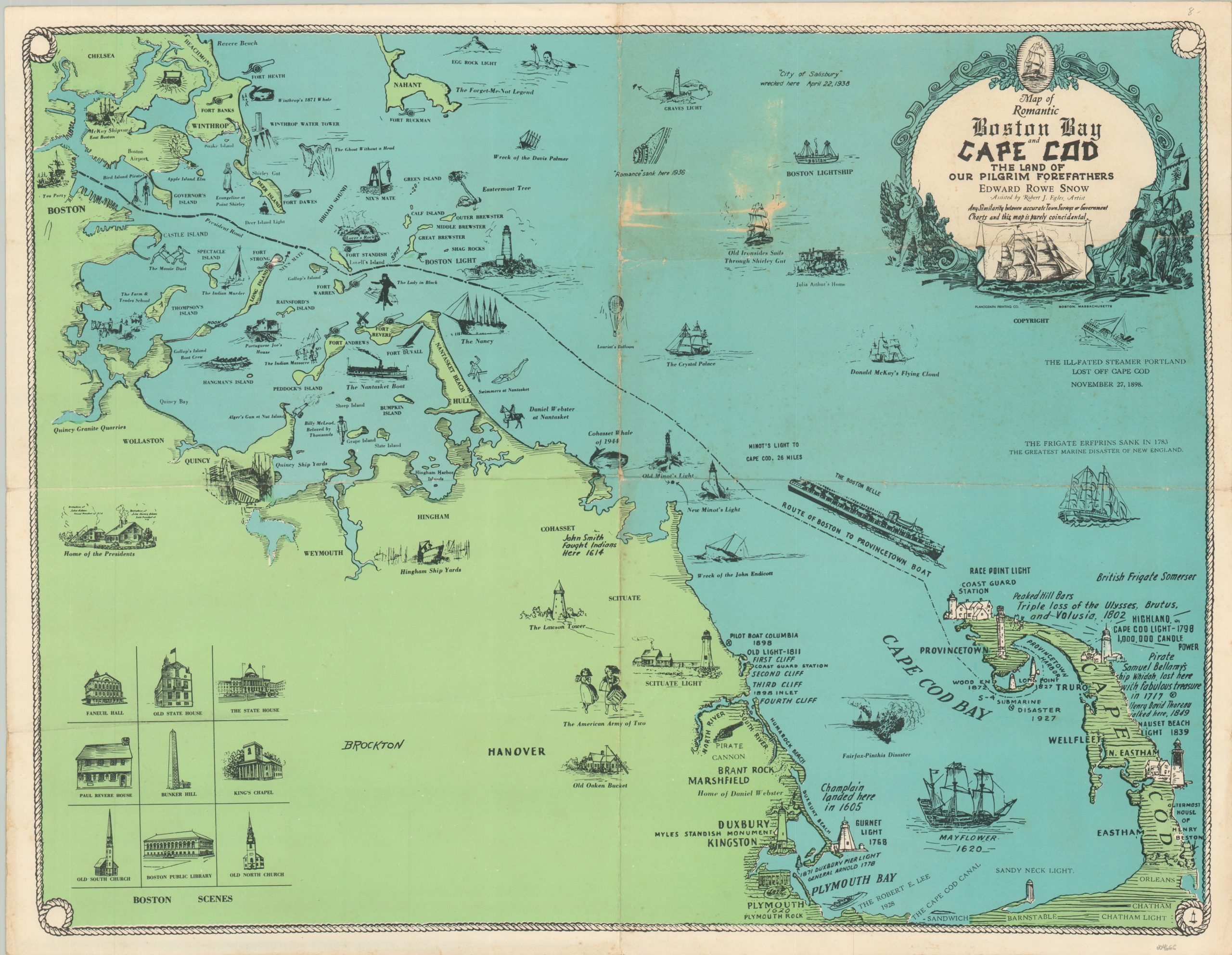
Map of Romantic Boston Bay and Cape Cod
$110.00
Connecting Cape Cod to Boston via a neat pictorial map.
1 in stock
Description
This fun map of the Massachusetts coastline between Boston Harbor and Cape Cod highlights the route of the Boston Belle ferry between the two points. Dozens of captioned and dated vignettes highlight historic sites, notable events, local vessels, and much more. One entry that helps to date the map to the postwar years is the ‘Cohasset Whale of 1944’. This refers to a dead whale that washed ashore near the town. According to its official report from that year;
“The whale, which was estimated as weighing in the vicinity of twenty-five tons, was finally disposed of by a combination of dynamiting and cutting of the carcass. The Town was fortunate indeed in having men who were willing to brave the rigors of the weather of last January to assist in disposing of what might well have become a nuisance of considerable magnitude.”
The cost for ‘demolition’ and whale removal was approximately $220 (about $4,500 today). The map was compiled by Edward Rowe Snow, with assistance by artist Robert J. Egles. Printed in Boston by the Planograph Printing Company.
Map Details
Publication Date: c. 1946
Author: Edward Rowe Snow
Sheet Width (in): 21.9
Sheet Height (in): 16.9
Condition: B
Condition Description: Heavily creased and worn along old fold lines. Several areas of whitening have affected the upper right quadrant, adjacent to the title cartouche. Some minor wear and wrinkling in the margins. Almost good condition overall.
$110.00
1 in stock

