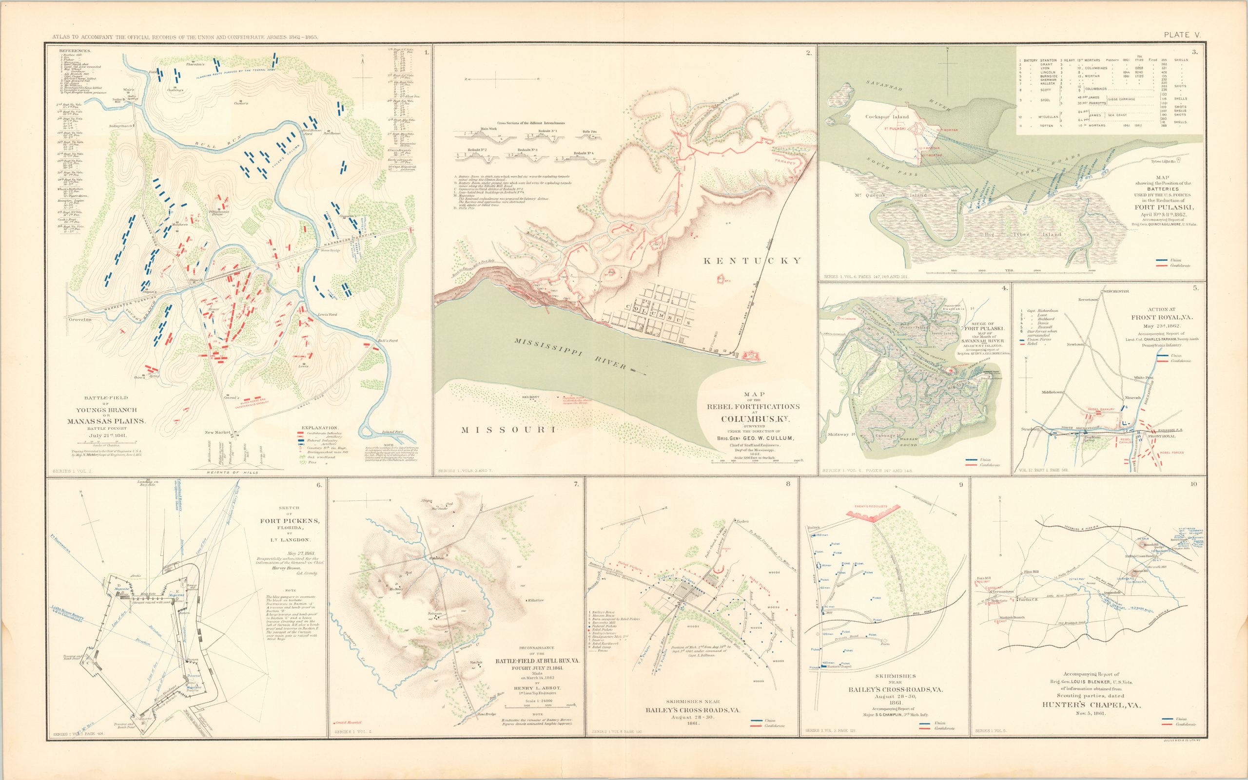
Battle-Field of Young’s Branch or Manassas Plains; Map of Rebel Fortifications at Columbus, Ky.; Sketch of Fort Pickens, Florida; Skirmishes Near Bailey’s Cross-Roads, Virginia
$75.00
Plate Number V from the War of the Rebellion Atlas – several engagements across the Southeast.
1 in stock
Description
This double-page lithographed sheet was originally published in 1895 by the United States War Department as part of the Atlas to Accompany the Official Records of the Union and Confederate Armies. The massive two-volume work, known also as the War of the Rebellion Atlas, consists of 178 plates and over 1,000 graphic elements; mostly maps, but also panoramas, technical drawings, and full-color illustrations. Collectively, the contents offer a comprehensive resource that visualizes the vast majority of engagements, large and small, of the American Civil War. A fully scanned copy is available online in the digital collections of Baylor University Library.
Map Details
Publication Date: 1895
Author: United States War Department
Sheet Width (in): 29
Sheet Height (in): 18
Condition: B+
Condition Description: Faint water staining in the lower corners, confined to the margins. Light wear and a few spots of toning, consistent with age. Good condition overall.
$75.00
1 in stock