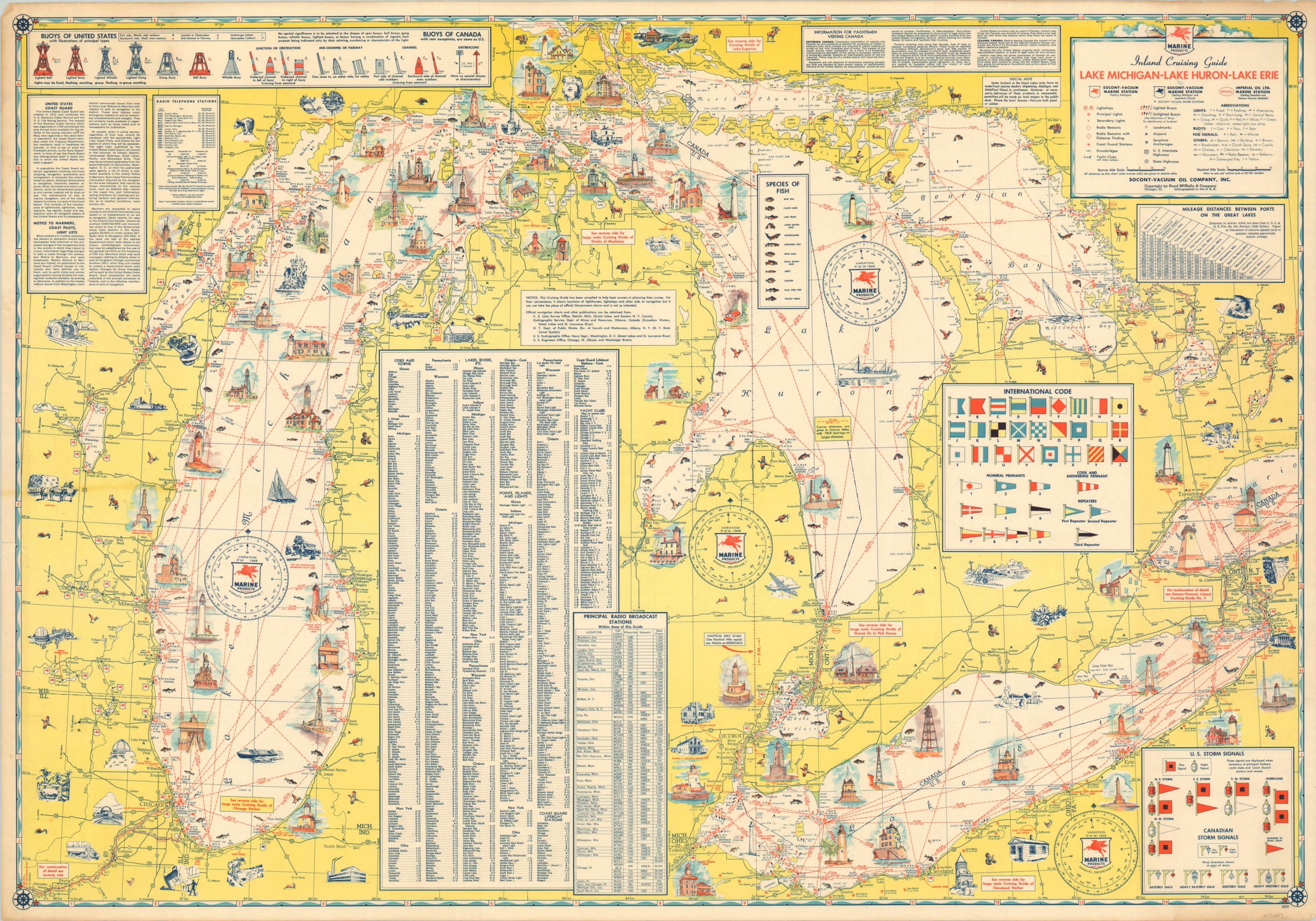
Inland Cruising Guide Lake Michigan – Lake Huron – Lake Erie
$110.00
A road map for boats!
1 in stock
Description
This awesome cruising guide of the Great Lakes transfers many common elements of road maps onto a water-based navigation chart. Distances between points, charming illustrations of notable landmarks, and examples of common ‘signage’ (pennants, buoys, and storm signals) can be seen throughout.
A detailed legend, numerous text boxes, distance tables, and an index of place names provide further helpful information for the sailor or yachtsman. Fishermen would also find the map of use, as it identifies the location of twelve species of fish available for the catch.
Published in Chicago by Rand McNally in 1958, on behalf of the Socony-Vacuum Oil Company, Inc. Possibly a proof or misprint, as the sheet is blank on the verso, despite several text boxes referencing the presence of cruising maps of specific harbors within the image.
Map Details
Publication Date: 1958
Author: Rand McNally
Sheet Width (in): 33.00
Sheet Height (in): 22.90
Condition: B+
Condition Description: Moderate soiling visible in the margins and some edge wear and extraneous crinkling from where the map was previously rolled. A few small edge tears have been repaired on the verso. Remains in very good condition overall.
$110.00
1 in stock

