General Chart of the Great Lakes
Large survey of the Great Lake system from the early 1960s.
Out of stock
Description
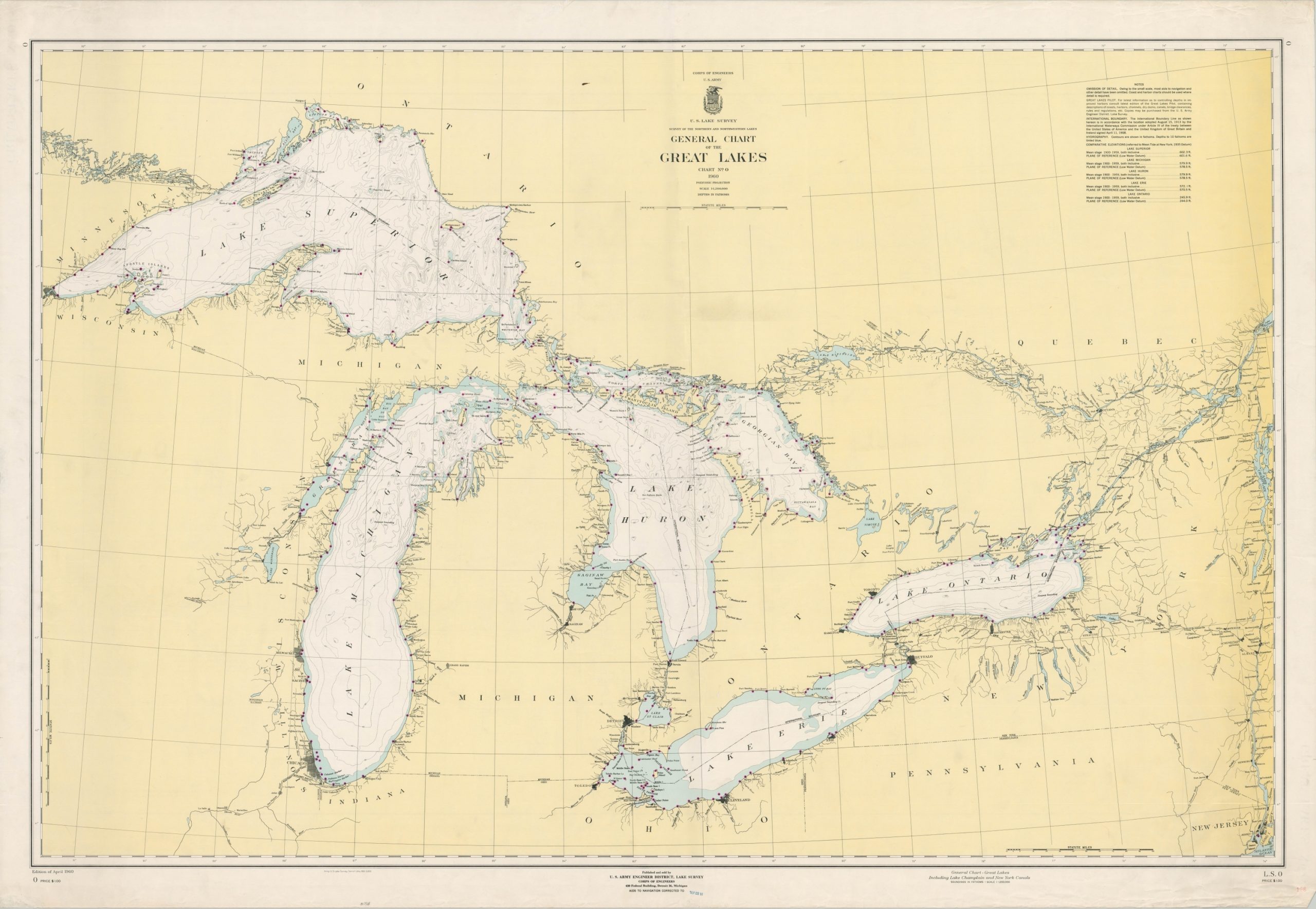
This impressive chart of the Great Lakes was originally published in Detroit by the U.S. Army Corps of Engineers in April of 1960. However, this edition has navigational updates corrected to September of 1961 according to the rubber stamp in the lower center.
The polyconic projection captures the entire breadth of Lakes Superior, Michigan, Huron, Erie, and Ontario, as well as connections to the Atlantic Ocean through the Erie Canal, Lake Champlain, and the Hudson River. The St. Lawrence River is also included up to Lake Saint-Pierre (St. Peter on the American map). Beacons and buoys are marked with purple dots along the coast and amid maritime hazards like shoals and reefs. Contour lines provide a rough outline of the lake bed, with corresponding depths provided in fathoms. Rivers and lakes accessible from the Great Lakes are generally labeled, but otherwise, interior information is scarce apart from urban areas and state borders.
Map Details
Publication Date: 1961
Author: U.S. Army Corps of Engineers
Sheet Width (in): 52.25
Sheet Height (in): 36
Condition: A-
Condition Description: Minor wear visible along the outer edges, confined to the margins, including small tears, wrinkling, and some faint discoloration. One vertical crease down the center of the sheet and faint scattered soiling visible in the image. Very good overall.
Out of stock