Dominia Anglorum in America Septentrionali
$550.00
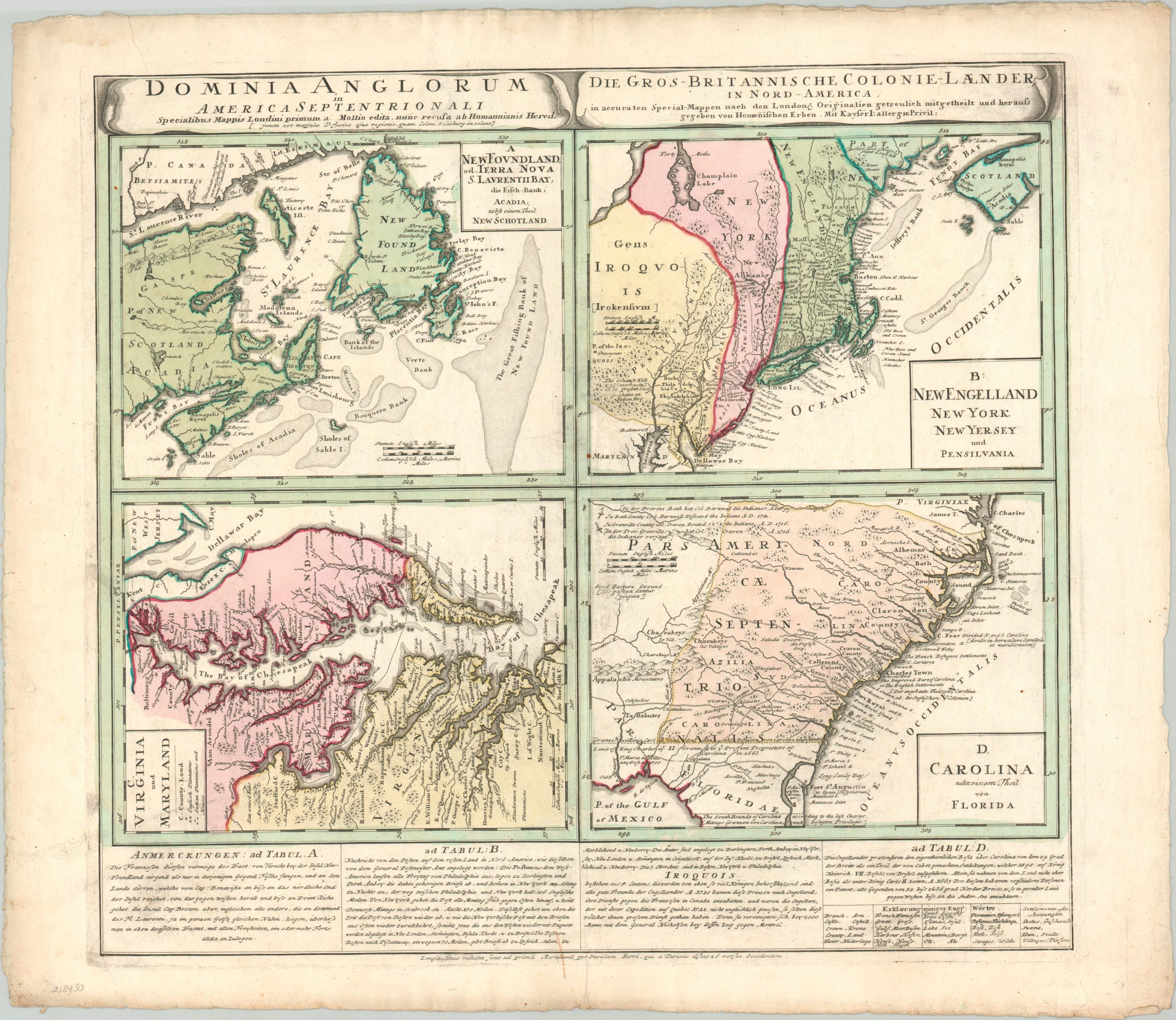
English colonies in North America from the mid-18th century.
1 in stock
Description
This engaging compilation of four separate maps of British colonies in North America was published in Nuremberg by the Homann Heirs around 1740. Each panel depicts an image based on a map that was originally published in 1729 as part of Herman Moll’s Atlas Minor.
The upper left shows territory in Newfoundland and around the Bay of St. Lawrence, with portions of the ‘lost’ colony of New Scotland. The Grand Banks are prominently noted as well. The map immediately to the right shows claims in New York and New England, with large areas in Pennsylvania noted as belonging to the Iroquois. The lower left presents the colonies of Virginia and Maryland, while the opposite can be seen the Carolinas and portions of Spanish Florida.
Each image depicts a fascinating mix of contemporary details like political borders, geographic features, indigenous settlements, transportation information, and more. Text along the bottom of the sheet provides further details on each map, as well as the Iroquois Confederacy.
Map Details
Publication Date: c. 1740
Author: Homann Heirs
Sheet Width (in): 25.60
Sheet Height (in): 21.75
Condition: B+
Condition Description: Several areas of spotting and discoloration within the image, including darkening from the plate strike, a few spots of soiling, and light wear along the centerfold. Remains in good to very good condition overall, with original hand color and printed on thick, watermarked paper.
$550.00
1 in stock