Detroit United Lines and Interurban Connections
$325.00
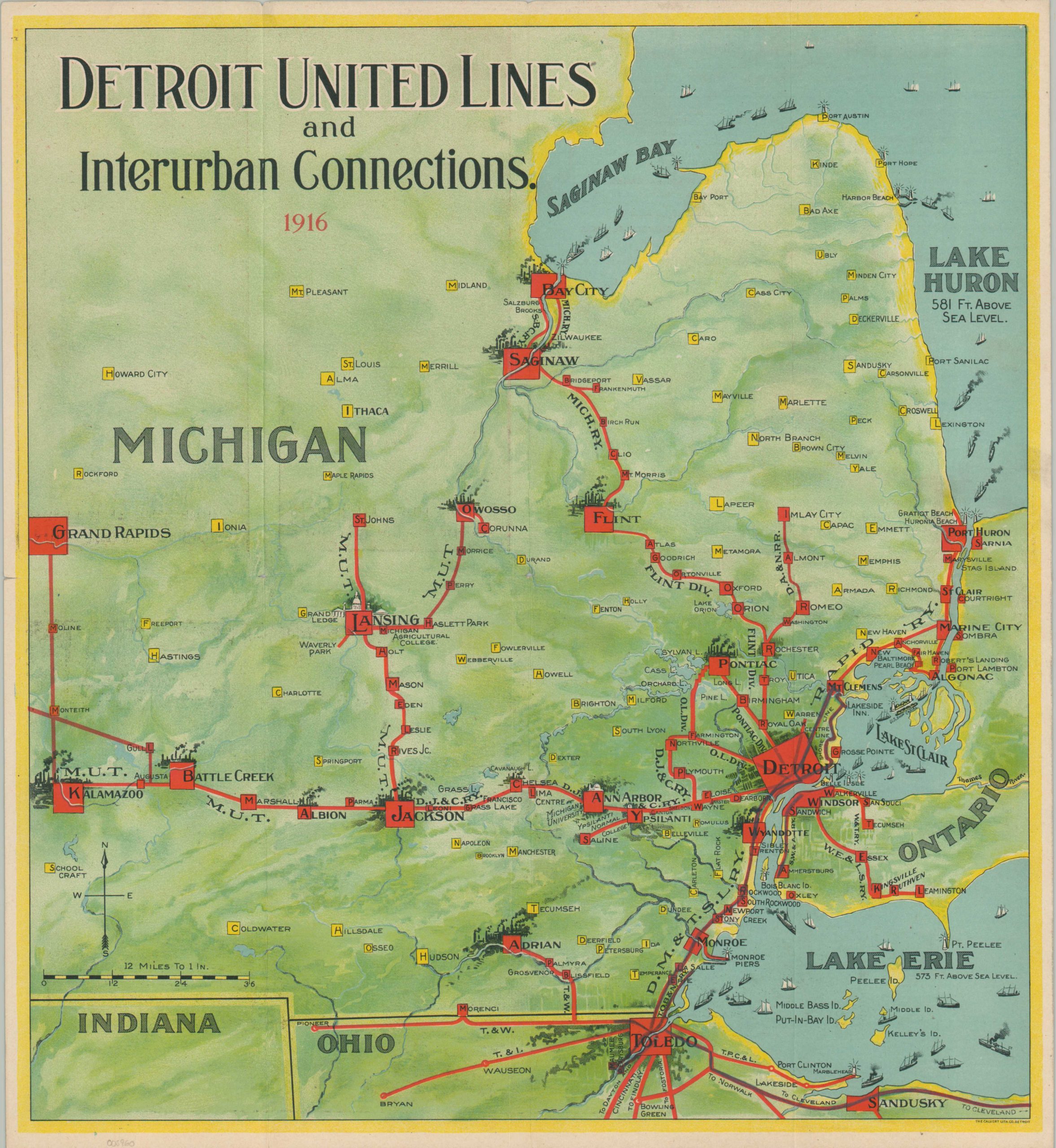
Michigan’s largest interurban railway near its height.
1 in stock
Description
The lines of the Detroit United Railway can be seen stretching from Kalamazoo to Port Huron and Bay City to Toledo on this map, published in 1916. Through its primary routes and connecting lines the company operated the largest interurban network in the state, though financial mismanagement and political pressure would cause it to become largely abandoned or sold off by about a decade later.
Labeled lines are shown in bright red emanating from Detroit and reach numerous cities across southeastern Michigan and northern Ohio. Major urban areas are represented with an industrial skyline unappealing to the modern senses, though Lansing and Ann Arbor are differentiated by their respective universities.
An interesting typographic strategy is employed to name stops along each line, as well as other towns and features. Ships of all shapes and sizes are shown across the Great Lakes, while a soft color palette adds to the overall pleasing aesthetic. Tranquil photographs ‘from a million beauty spots along the interurban lines’ and general information about the lines can be found on the verso.
Published in Detroit by the Calvert Lithograph Company on behalf of Detroit United Lines in 1916. Scarce, with only one example for this year found in OCLC at the University of Michigan.
Source: OCLC# 855210175
Map Details
Publication Date: 1916
Author: Calvert Lithograph Company
Sheet Width (in): 15.25
Sheet Height (in): 16.6
Condition: A
Condition Description: 8 panel folding brochure with a vibrant color-lithograph centerfold map. Some small spots of separation at fold intersections and very faint soiling visible in one or two places. Light wear along the outer edges of the sheet, consistent with age and use. Very good overall.
$325.00
1 in stock