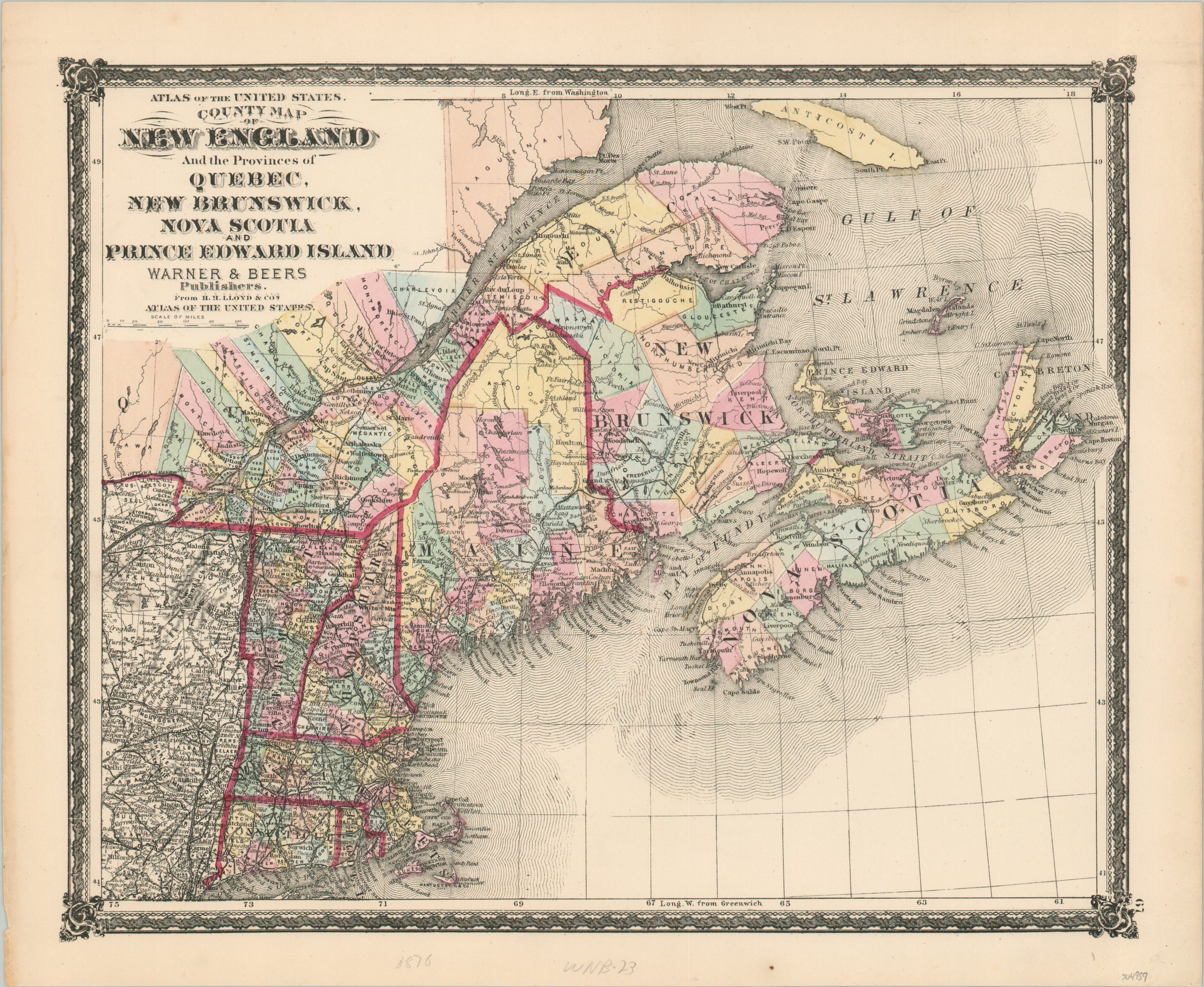
County Map of New England and the Provinces of Quebec, New Brunswick, Nova Scotia, and Prince Edward Island
$65.00
The border between New England and British Canada in the mid-1870s.
1 in stock
Description
This lovely map of New England and Canada’s Maritime Provinces was published in Chicago by Warner & Beers in 1876, originally as part of H.H. Lloyd’s Atlas of the United States. A finely engraved image shows the states of Connecticut, Massachusetts, New Hampshire, Vermont, and Maine, as well as the adjacent British provinces of Quebec, New Brunswick, Nova Scotia, and Prince Edward Island.
Original color, applied by hand at the time of printing, distinguishes local political boundaries and national borders. The transportation network is prominently featured, highlighting the numerous navigable rivers (notably, the St. Lawrence) and railroads in operation throughout the region.
Topography is depicted in hachure, emphasizing the Adirondacks of New York and the White Mountains of New Hampshire. A fascinating variety of toponyms identify settlements, geographic features, and other locations of interest.
Map Details
Publication Date: 1876
Author: H.H. Lloyd
Sheet Width (in): 18
Sheet Height (in): 14.75
Condition: A-
Condition Description: Light soiling visible in the margins and a few small spots here and there in the image, consistent with age and use. Very good overall, with attractive original color.
$65.00
1 in stock