Automobile Map of New England Accompanying Interstate Automobile Tourist’s Guide
$295.00
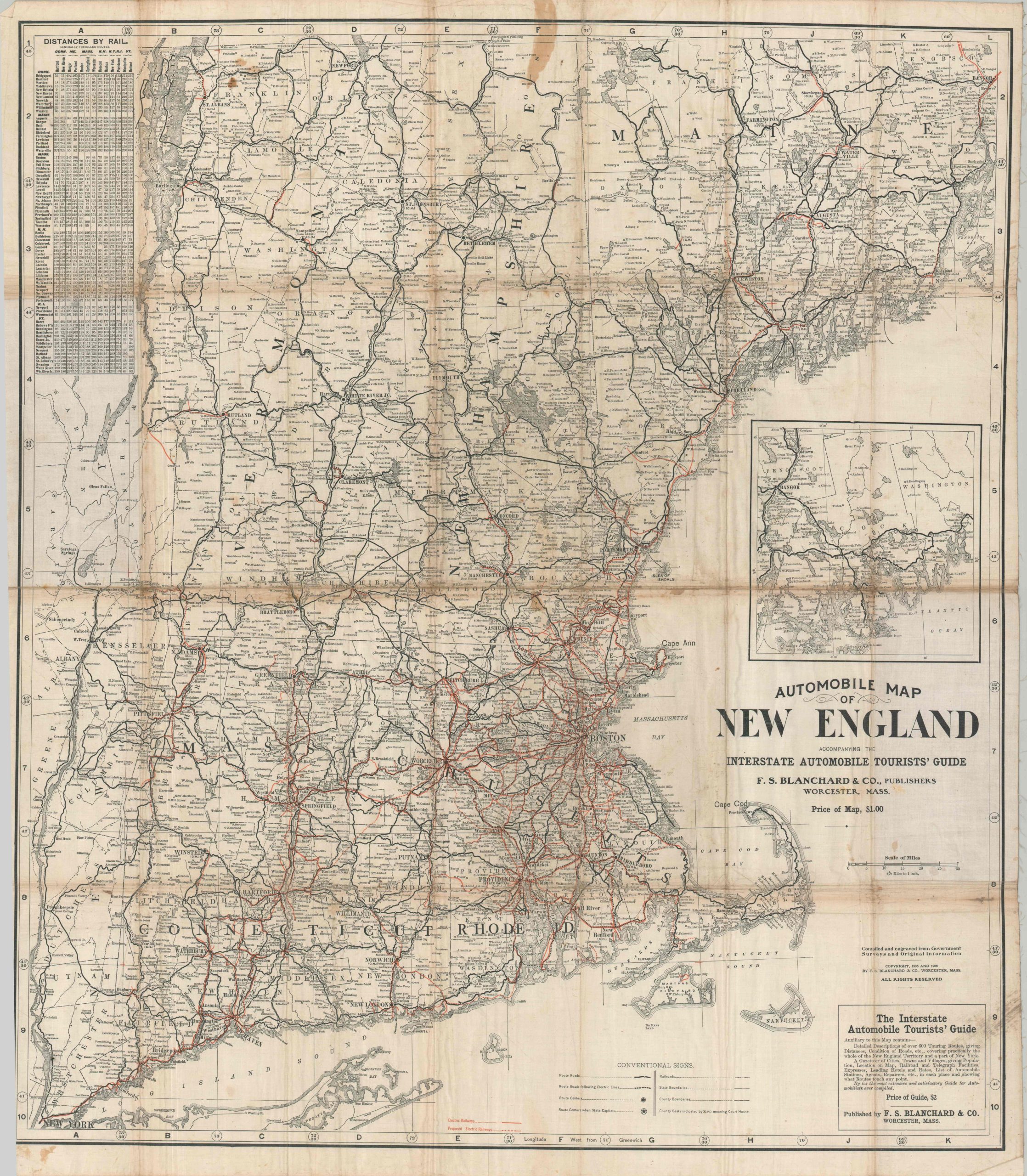
An early ‘dual-purpose’ transportation map of New England.
1 in stock
Description
This rare and exceptionally early “Automobile Map of New England” was published in 1906 by F.S. Blanchard & Co. of Worcester, Massachusetts. Compiled from government surveys and original field data, the map represents a seminal moment in American transportation history: the brief and precarious overlap between the electric interurban era and the birth of automobile tourism. In spite of the title, the initial emphasis of the image is on the network of interurbans. Operating electric railways are noted in solid red, whereas proposed lines are shown as dashes. A convenient mileage table in the upper left allows the user to easily determine distances between points (by rail). However, the network remains relatively limited and confined, primarily, to the areas around major metropolitan areas.
For true traveling freedom, the automobile was rapidly becoming the preferred choice for tourists (or those who could afford it, at least). Route Roads are indicated with solid black lines, while those running adjacent to electric railways are dashed. These early highways, mostly all dirt, strike out defiantly into the New England wilderness. Adventurous motorists, with the right equipment and favorable weather, could penetrate the dense evergreen forests of Maine, scaling the formidable notches of the White Mountains, and navigate the rugged foothills of Vermont’s Green Mountains.
Map Details
Publication Date: 1906
Author: F.S. Blanchard & Co.
Sheet Width (in): 32.00
Sheet Height (in): 36.75
Condition: B
Condition Description: Large-single sided map printed on linen, as issued, and affixed to original stiff purple paper wraps. Large damp stain in the upper center, surface soiling in the lower right, and some moderate to heavy discoloration and wear along old folds. About good condition overall.
$295.00
1 in stock