A Picture Map of Cape Ann and the North Shore
A seafaring spectacle of pirates, witches, Brahmins, and sailors.
Out of stock
Description
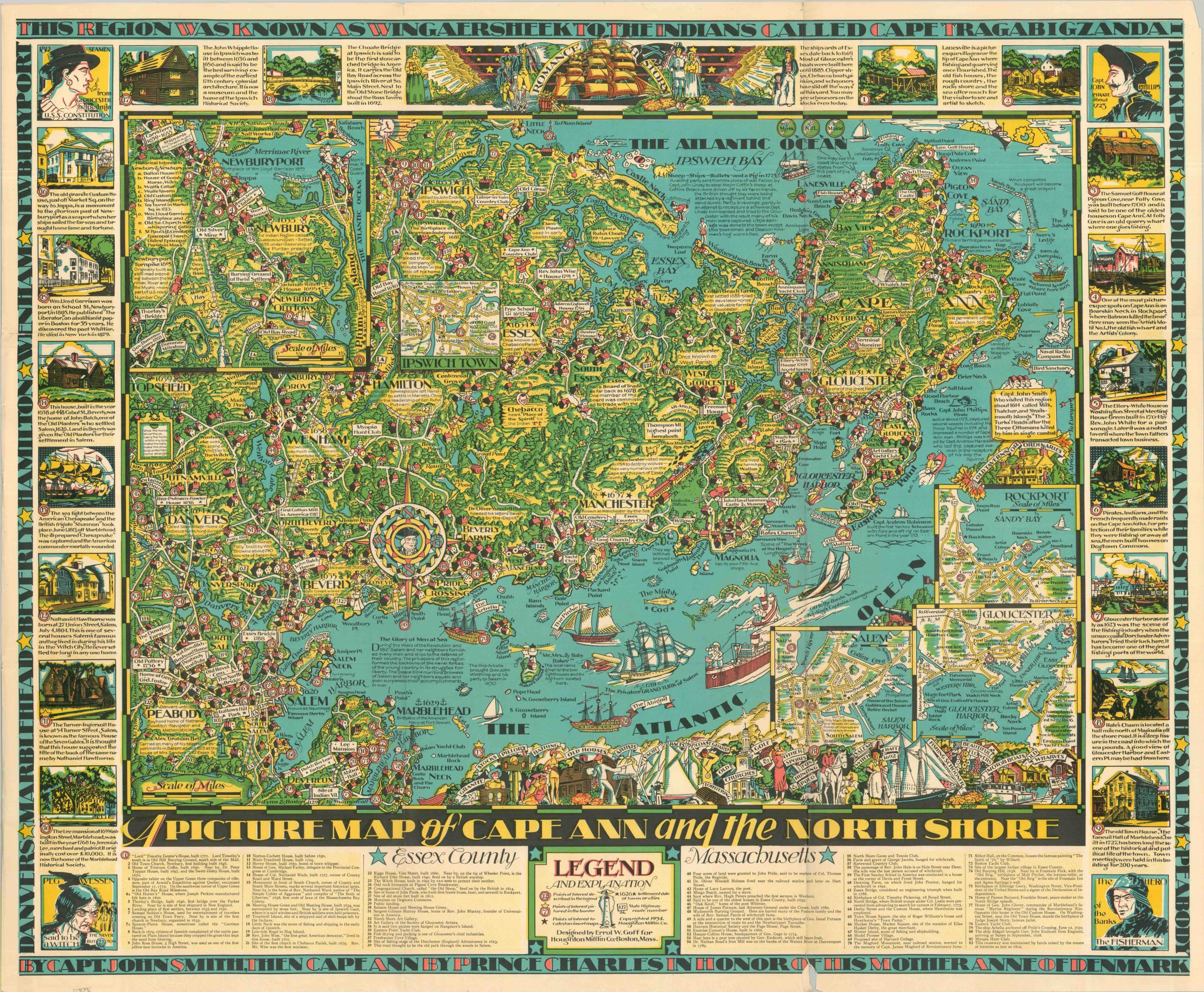
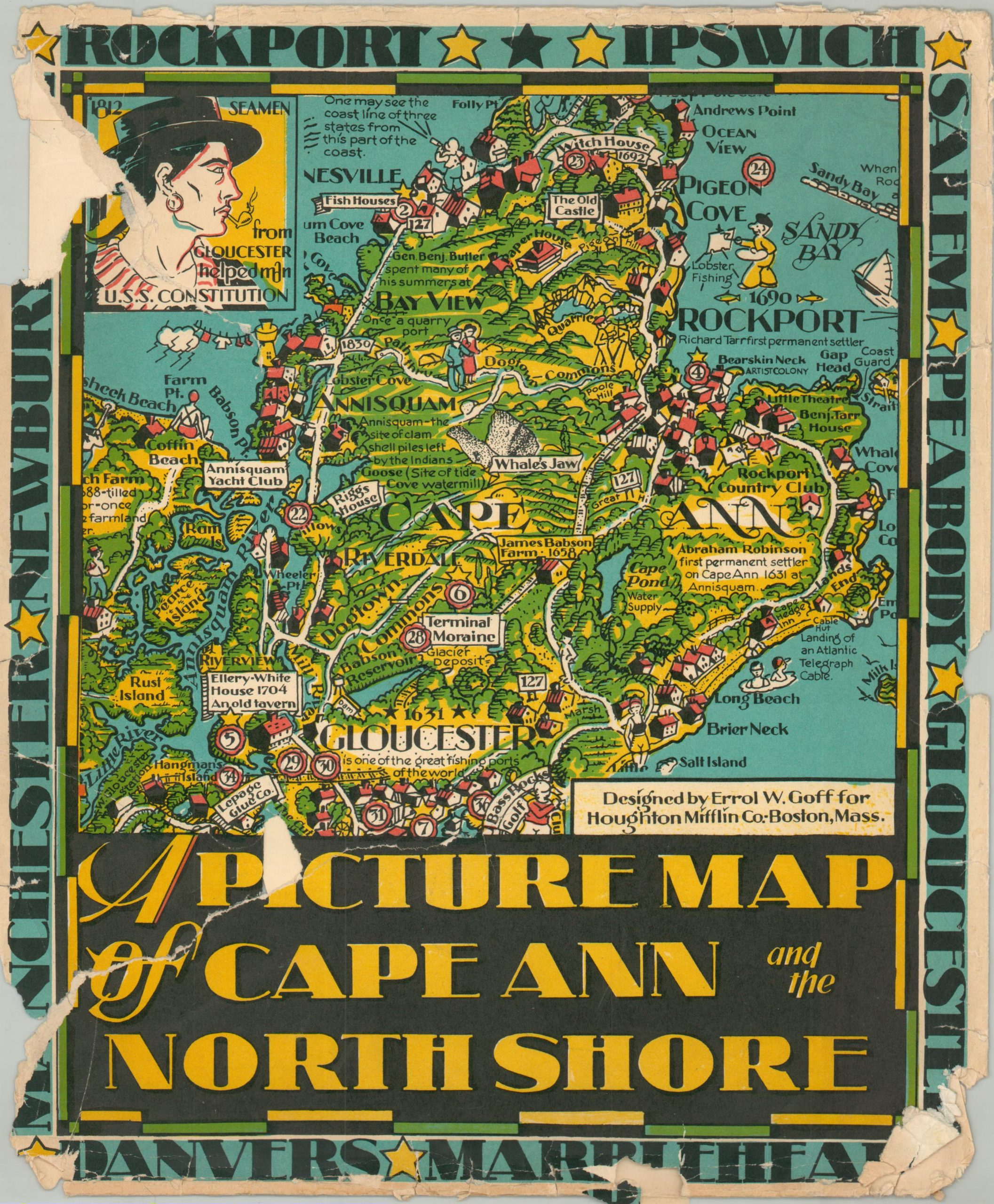
Designed by the Massachusetts artist Errol W. Goff and published by Houghton Mifflin in 1934, this vibrant pictorial map is a masterpiece of mid-century cartographic storytelling. The work captures the “essence” of the North Shore, stretching from the rocky shores of Marblehead and Salem up to the historic marshes of Ipswich and Newburyport.
Every inch of the landscape is “pictorially jam-crammed” with whimsical cartoon figures, nautical vessels from various eras, and detailed annotations that bring the region’s maritime and colonial history to life. The central map is framed by eighteen elaborate vignettes that provide a visual timeline of the area’s most momentous events, from the early explorations of Captain John Smith to the legendary tales of the Gloucester witch, Peg Wesson.
At the corners, Goff includes four striking portraits that personify the spirit of the coast: a 19th-century sailor, the pirate Captain John Phillips, a local witch, and a modern oilskin-clad fisherman. A bold, decorative border carries a historical inscription detailing the various names of the region, while the bottom panel features a comprehensive legend indexing eighty-two specific points of interest.
Map Details
Publication Date: 1934
Author: Errol W. Goff
Sheet Width (in): 35.00
Sheet Height (in): 28.75
Condition: B+
Condition Description: Vibrant chromolithographed map with original envelope (tattered), moderately worn along original folds. Several small splits along folds have been repaired on the verso, along with an irregular tear in the center where the sheet pulled away (no image loss). Good to very good condition overall.
Out of stock