A New Map of Upper & Lower Canada.
The first edition of Cary’s detailed map of Canada and the Great Lakes.
Out of stock
Description
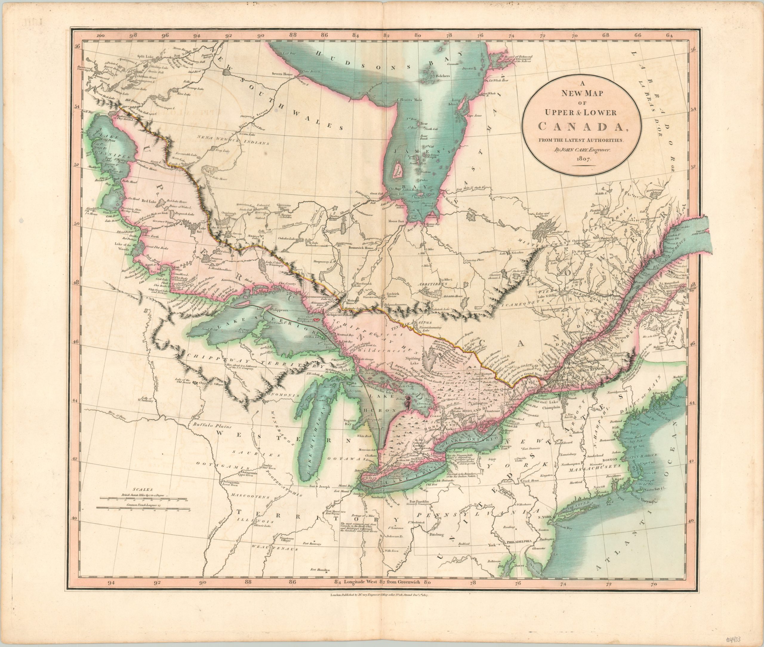
This finely executed map highlights the British possessions in their overseas colony of Canada, and covers the area from Lake Winnipeg to Hudson’s Bay and the Atlantic Ocean. The Province of Quebec was split into Upper & Lower Canada by the Constitutional Act 1791, largely along Catholic and Protestant lines. The image also includes the entirety of the Great Lakes – overall largely accurate save for a straightened, elongated Lake Michigan and the phantom Isle Philippeaux in Lake Superior.
Across the border in the United States, one can see the boundaries of the Northwest Territory (organized in 1787) and beyond – including lands further to the west newly acquired via the Louisiana Purchase (1803). The map’s interior presents a number of annotations and references of particular contemporary interest, such as commonly traversed rivers, immense forests, boundary lines, and measurements of Niagara Falls. Forts, Native American tribes and villages, and the region’s numerous lakes and rivers are also all individually labeled, presenting a comprehensive overview of British North America at the beginning of the 19th century.
The map was published in London in 1807 by John Cary.
Map Details
Publication Date: 1807
Author: John Cary
Sheet Width (in): 23.9
Sheet Height (in): 19.9
Condition: A-
Condition Description: Minor offsetting visible within the image, mainly in the upper left from the title block. Slight discoloration visible along the vertical centerfold. Very good overall, with original color.
Out of stock