
Railroad Base Point Mileage Map
A very scarce railroad map of the American Southwest from the late 1920s.
Out of stock
Description
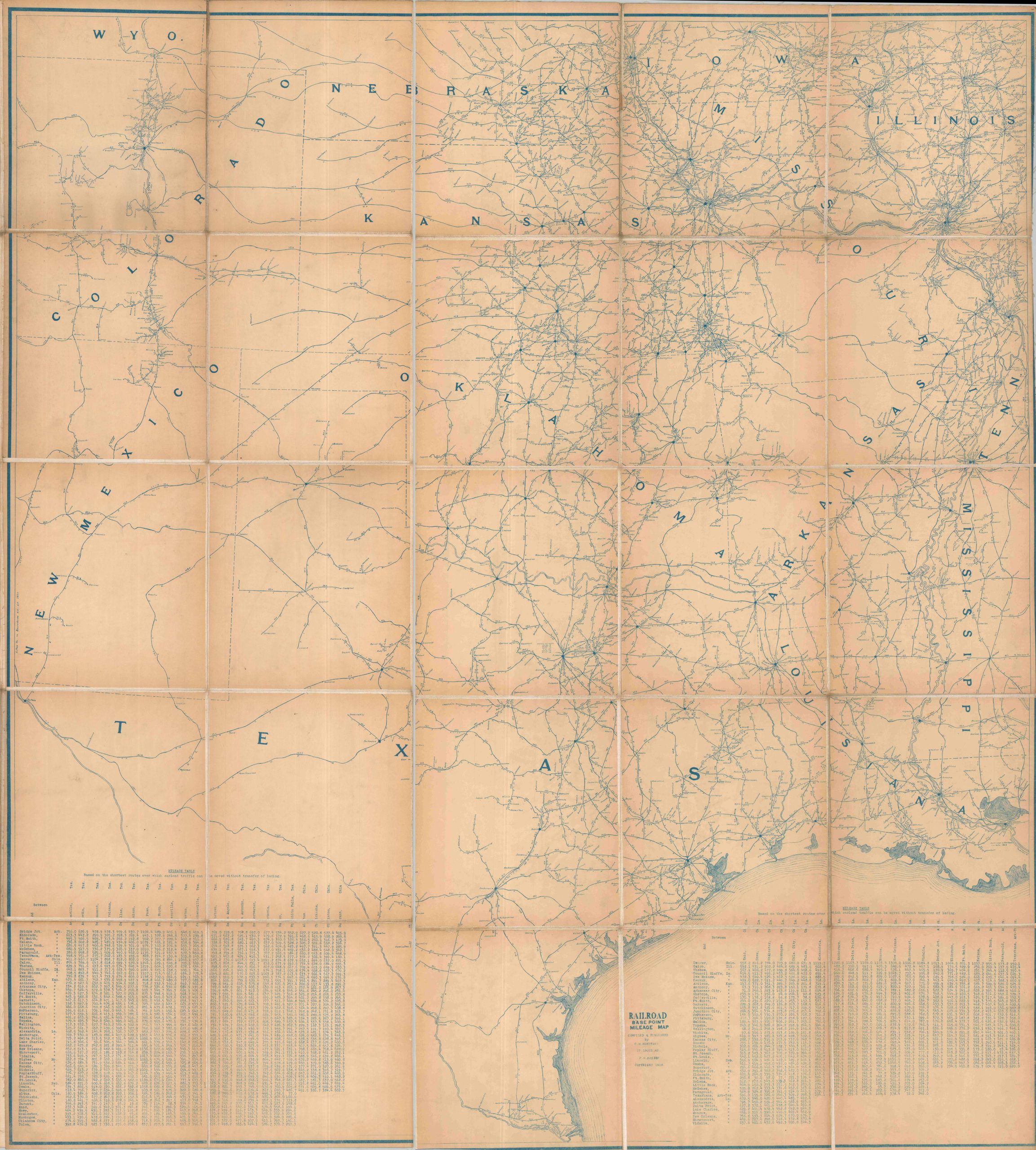
This diagrammatic map shows the railroad lines across the Southwestern United States from the Mississippi River to the Rocky Mountains/Rio Grande. It was copyrighted in 1928 and compiled and published by C.M. Montfort of St. Louis.
The image presents extensive detail about local railroad operators and distances between different points across the region. Two mileage tables in the lower corners provide further relevant data, presumably to emphasize the long distances between freight stations.
Text on the front cover (affixed to the back) indicates the map was created for use in the influential Texas court case known as I. C. C. Docket 13535 or the Consolidated Southwestern Cases. The suit appears to stem from contested rights between Texas railroad operators and the Interstate Commerce Commission on the jurisdiction of freight rates. Based on a contemporary Congressional report, Southern exporters were concerned that the equitable application of rates on a point-to-point basis would hurt the export of local commodities to lucrative (but distant) Eastern markets.
The map is quite scarce and I’ve been unable to located any other market examples or listings in WorldCat, though it’s likely that at least one copy exists in the court records held at the University of Texas Library.
Sources: University of Texas; U.S. Congress; CaseMine
Map Details
Publication Date: 1928
Author: C.M. Montfort
Sheet Width (in): 51
Sheet Height (in): 55.5
Condition: B+
Condition Description: Large map dissected into 25 segments and affixed to linen with black leather covers. Stickered title on the front indicate it was created for a court case. Moderately toned throughout and scattered creasing and wear, consistent with age. A few spots were the linen has cleanly split along the seams. Good to very good condition overall.
Out of stock