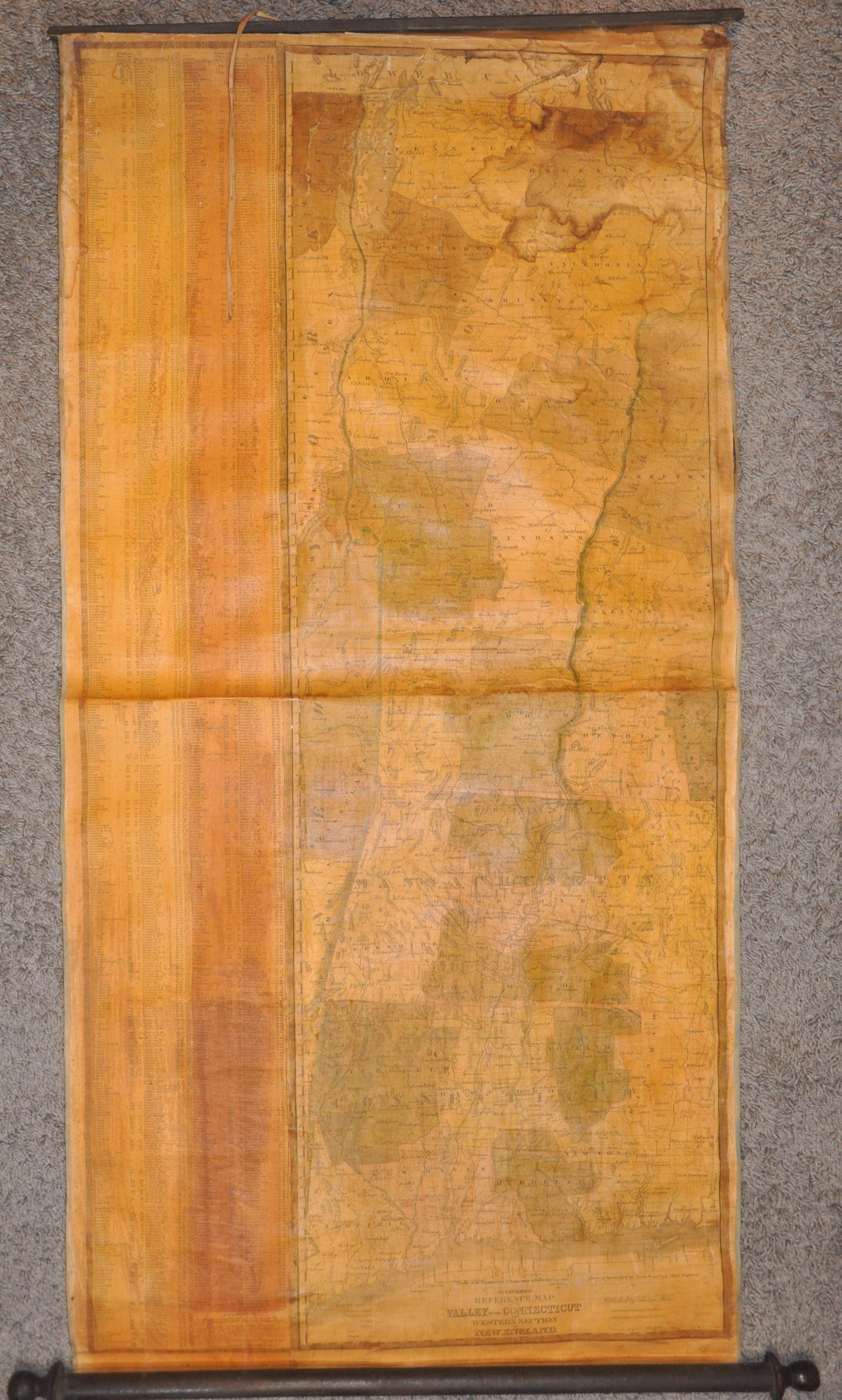
An Improved Reference Map of the Valley of the Connecticut and Western Section of New England
Rare wall map showing early developments along the Connecticut River Valley.
Out of stock


Description
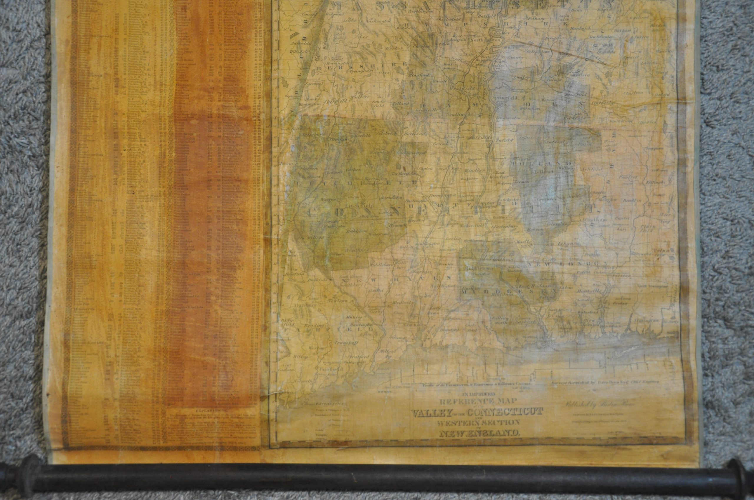
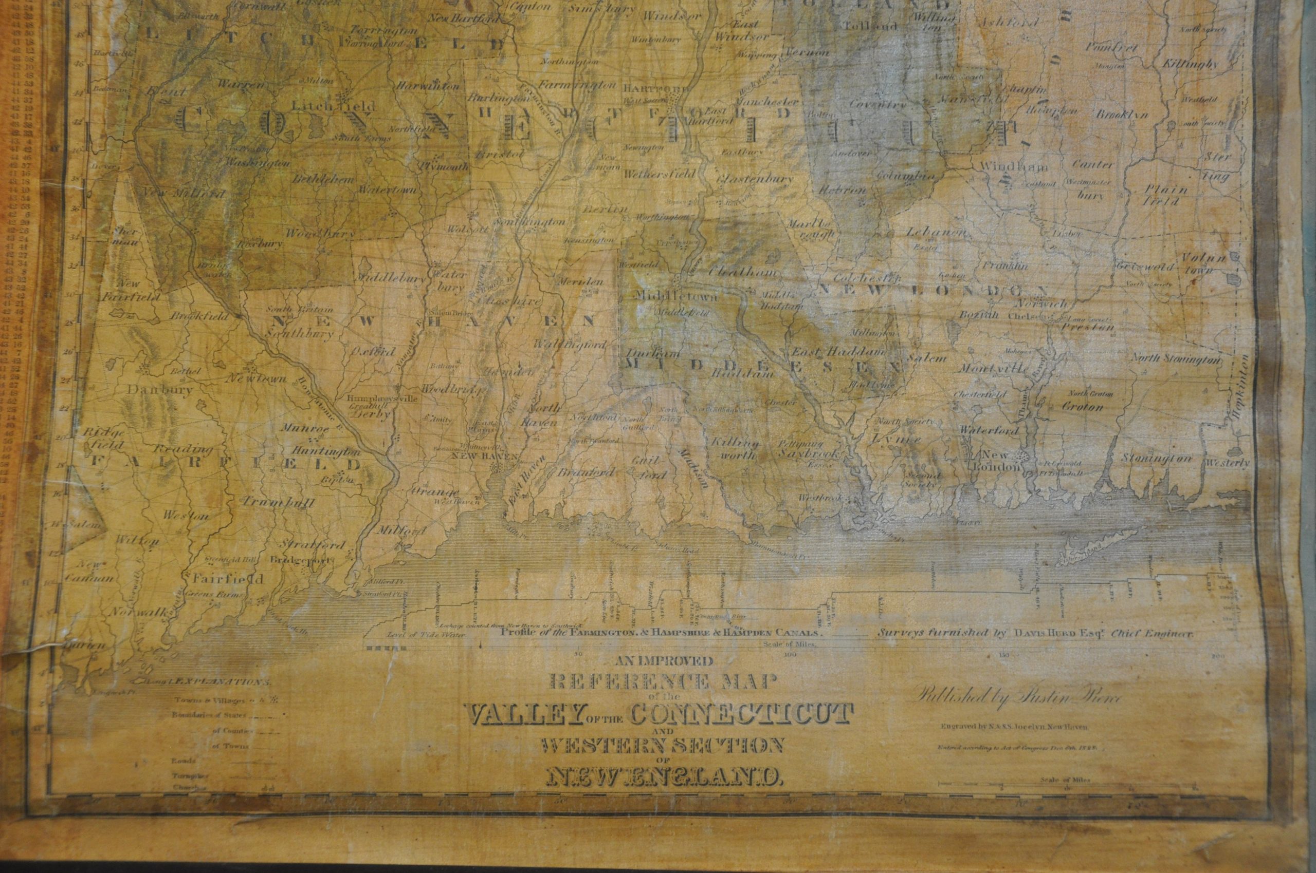
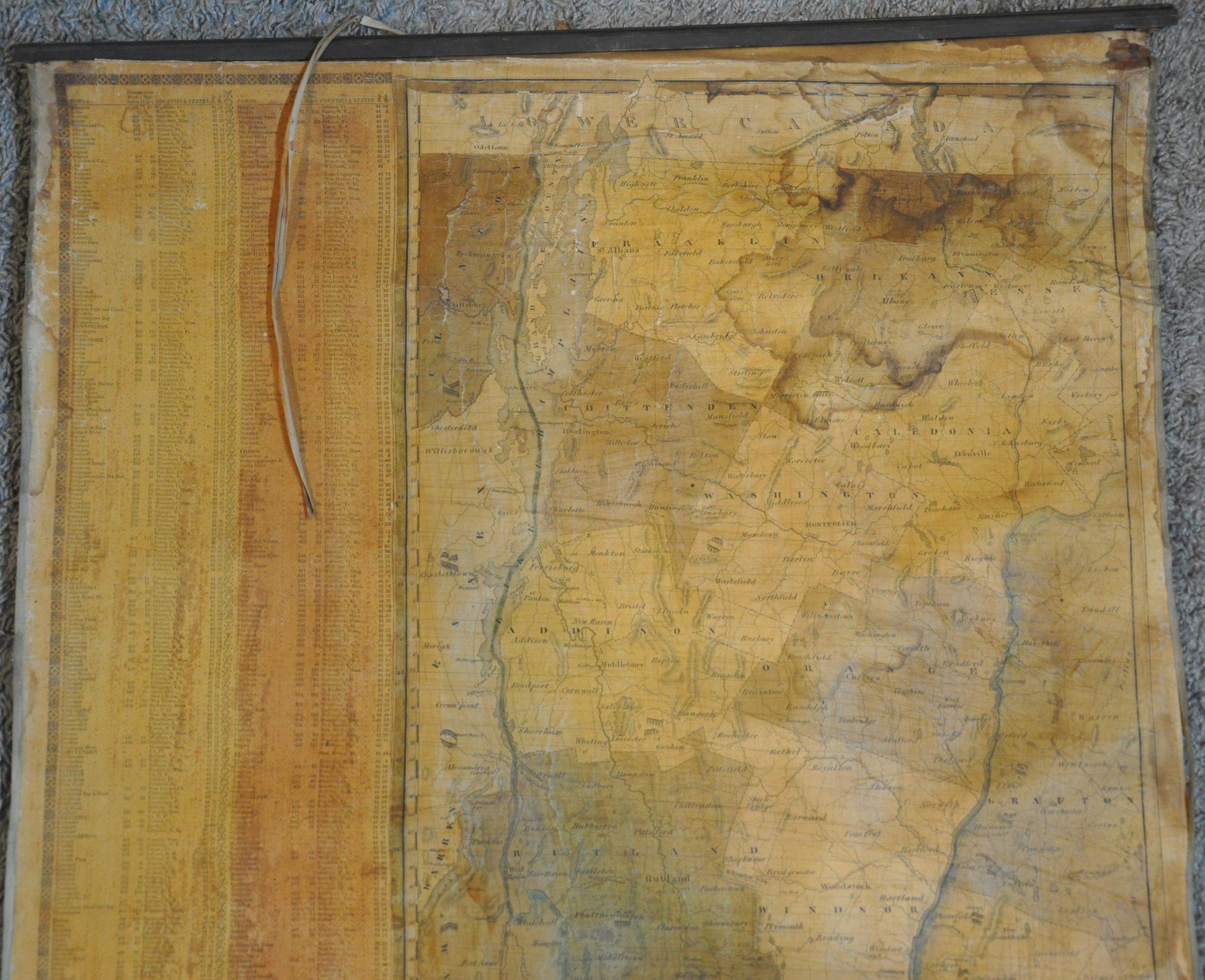
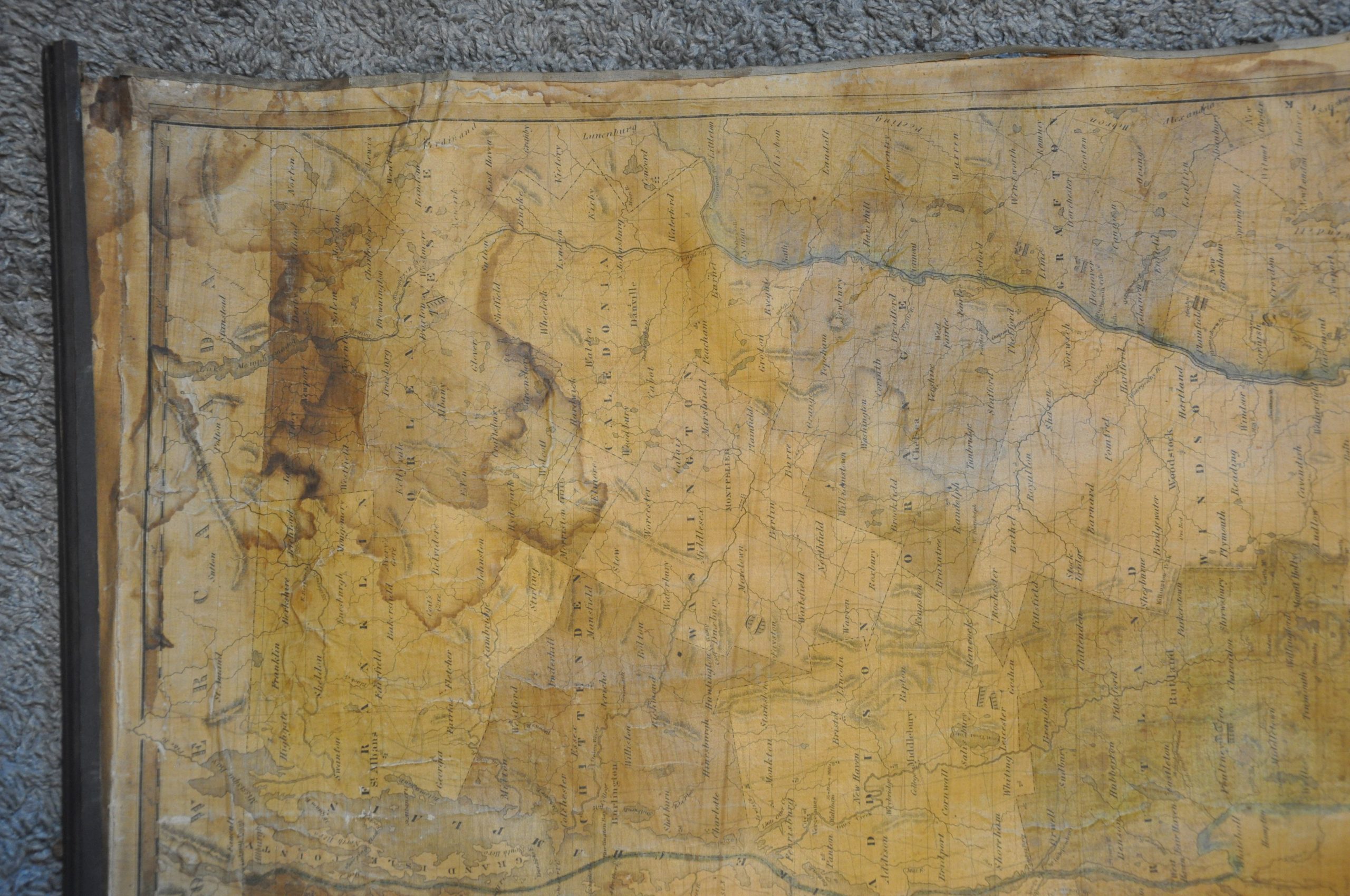
This wonderfully detailed wall map traces the course of the Connecticut River through New England, between the Canadian border to Long Island Sound. Cutting through five states, the resulting valley was a fertile agricultural area that attracted heavy settlement, especially as America’s Industrial Revolution drastically improved production and efficiency. The carefully engraved image reflects several decades of such growth, with numerous towns and villages labeled across the hand-colored counties. Churches, schools, notable geographic features, and other locations of interest are also identified. A robust transportation network of roads and turnpikes connects the primary settlements, with a comprehensive table on the left side denoting many towns’ distance from Washington, D.C.
Despite the availability of surface roads, water transportation remained a far cheaper option for most bulk goods and commodities. This encouraged local businessmen from New Haven to encourage the construction of canals that linked navigable waterways across the Connecticut River Valley. One example was the Hampshire and Hampden Canal, a profile of which can be seen at the bottom of the page. The same year as publication, its ongoing construction allowed for the passage between New Haven and Farmington. The entirety of the planned route is shown, extending all the way to Lake Memphremagog and, eventually, the St. Lawrence River.
The map was engraved by N. and S.S. Jocelyn of New Haven. Published in 1828 by Justin Pierce. Rare, with only 3 entries noted in OCLC at the Connecticut Museum of Culture and History, Dartmouth University, and Brown University. A further copy has been identified within the National Archives.
Sources: Dartmouth University; WorldCat;
Map Details
Publication Date: 1828
Author: N. & S.S. Jocelyn
Sheet Width (in): 24.5
Sheet Height (in): 48.75
Condition: B
Condition Description: Unrestored wall map mounted on original linen and affixed to old (probably original) black wooden rollers. Varnished and old color has discolored the two sheets (conjoined along a horizontal seam). Heavy damp staining visible in the upper right corner, extending down the left side until about halfway. Some moderate wear along the outer edges, including some separation from the rollers at the top. A little brittle from the varnish drying out. Despite the various defects, the image remains almost entirely intact on relatively strong linen. About good condition overall.
Out of stock