
Die von Guatemala, die Landegen von Tehuantepec, Nicaragua, and Panama….
$145.00
Detailed map of Central America published in the first physical atlas of the world.
1 in stock
Description
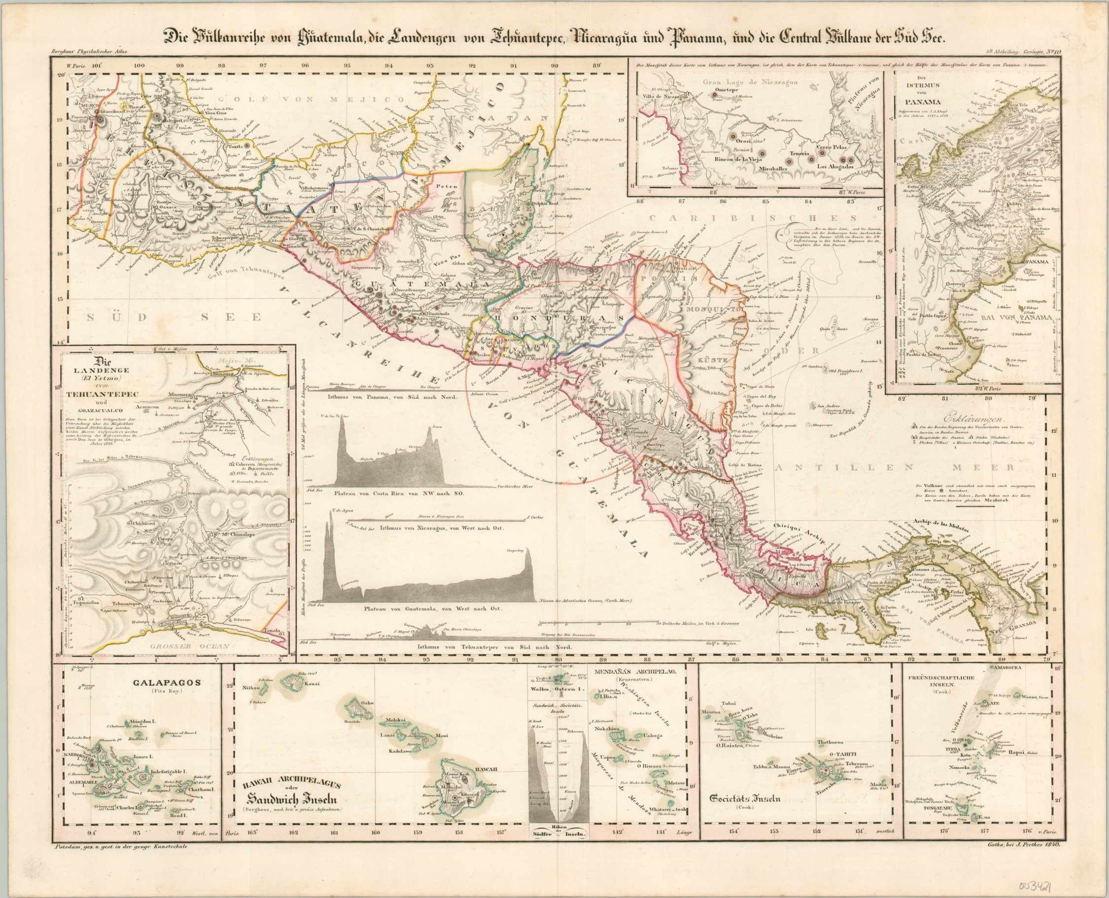
This finely engraved map of Central America shows an interesting political configuration less than two decades after most of the nations declared independence from the Spanish crown. The Mosquito Coast remains a nominally sovereign state under the influence of the British, San Salvador is an odd enclave, and Panama is part of Colombia. But the emphasis is not on the official state borders, but rather on the physical composition of the Earth.
The locations of known volcanos are dotted throughout the image, with a large circle highlighting the impact of the 1835 eruption of Cosigüina. Inset maps show the geography of the isthmuses at Panama, Tehuantepec, and Nicaragua – all then viable candidates for trans-Oceanic transportation efforts. Accompanying diagrams show the elevation change along each possible route. Additional inset maps show the archipelagos of the Galapagos, Hawaiian, Society, and Friendly Islands.
The map was designed by Heinrich Berghaus in 1840 and published in Gotha by Justus Perthes. It was issued as part of Berghaus’ Physikalischer Atlas, considered by Rumsey to be the first physical atlas of the world.
Source: Rumsey 2515.000
Map Details
Publication Date: 1840
Author: Henrich Berghaus
Sheet Width (in): 17.80
Sheet Height (in): 14.40
Condition: A-
Condition Description: A bit of faint toning and scattered soiling visible in the margins and light offsetting within the image. Otherwise in very good condition, with original outline color.
$145.00
1 in stock