Welcome to Banff, Alberta
$80.00
Travel along the Trans-Canada Highway through the newly completed Rogers Pass.
1 in stock

Description
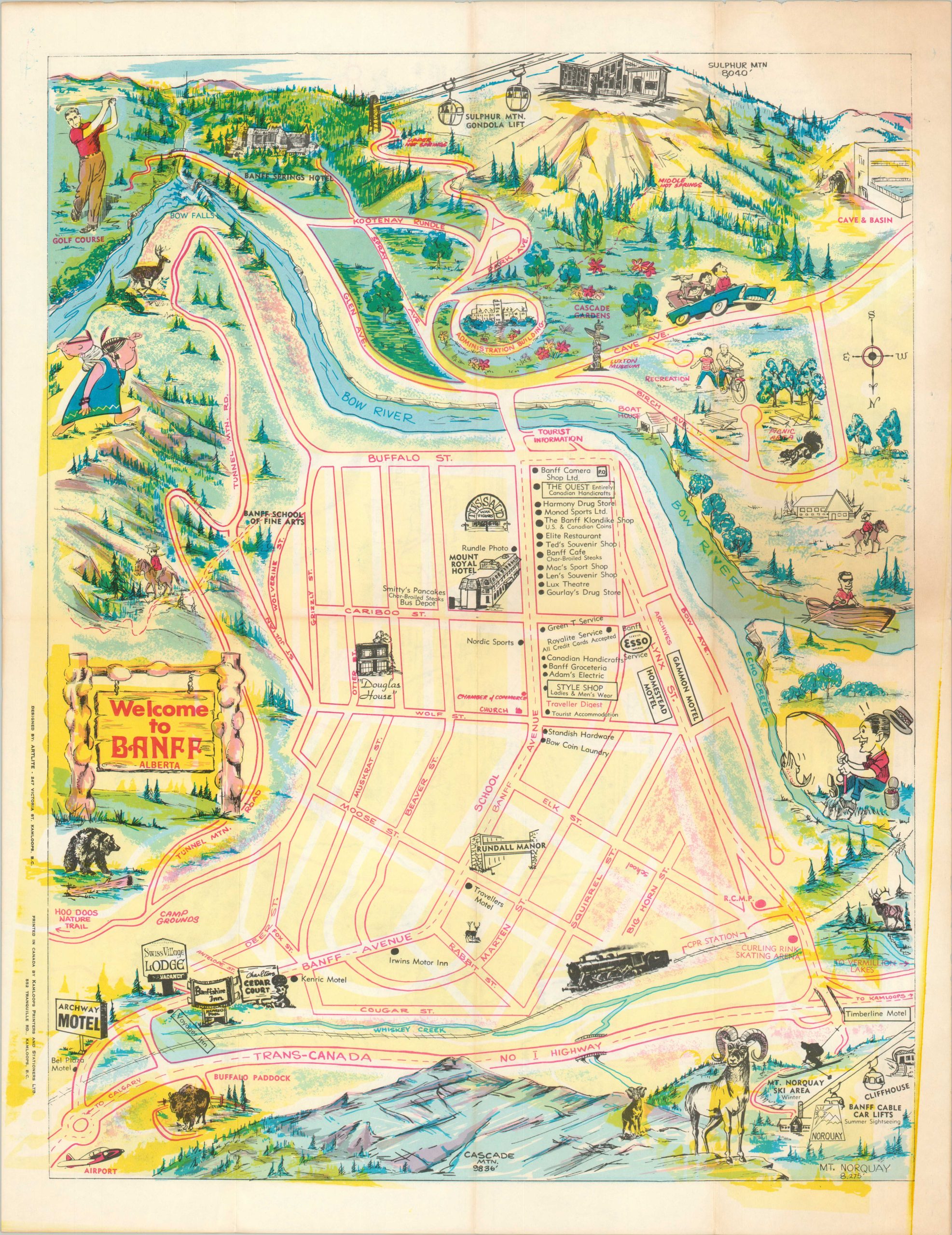
This colorful map of Banff, Alberta provides an interesting overview of the resort town in the Canadian Rockies. The image, oriented with south at the top, presents a simple street plan of downtown, with numerous businesses and accommodations labeled.
Surrounding the map are a collection of illustrated vignettes that showcase the varied geography and numerous recreational opportunities available. The verso presents an abstract road map of the Trans-Canada Highway between Banff and Kamloops. The completion of the route through Rogers Pass was accomplished shortly before publication, opening the area to mass motor tourism for the first time.
The map was a local production, designed around 1963 by ArtLite and published by Kamloops Printers and Stationers, Ltd.
Map Details
Publication Date: c. 1963
Author: ArtLite
Sheet Width (in): 17
Sheet Height (in): 22
Condition: A-
Condition Description: Creased and lightly soiled along originally issued fold lines, with some soft wear and tiny tears along the outer edges of the sheet. The front panel is toned, but it does not affect the image. Good to very good condition overall.
$80.00
1 in stock