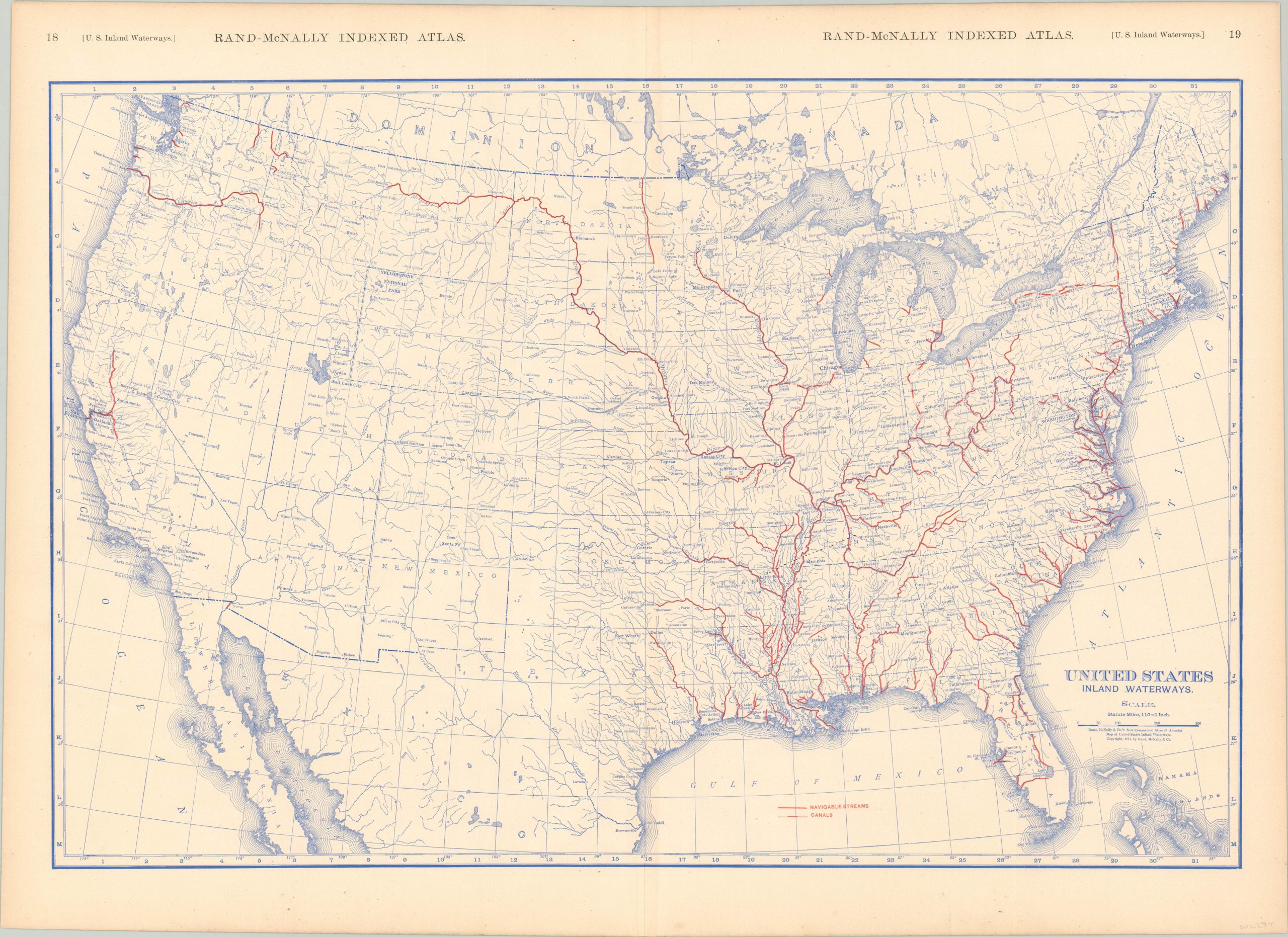
United States Inland Waterways
$60.00
Map of U.S. navigable waterways highlighting the importance of the Mississippi watershed.
1 in stock
Description
This starkly detailed map of the United States emphasizes the robust hydrological system across the country. Notably, the navigable waterways and canals are highlighted in red. Western states show a dearth of such avenues of commerce and transportation; outside of the Sacramento, Columbia, and Missouri Rivers.
The mighty Mississippi and it’s numerous tributaries dominate the majority of the system, which today extends across over 25,000 miles of navigable waters. An interesting reflection on the patterns of settlement across the U.S., as many major urban centers are located on one (or more) rivers or canals. Published in Chicago by Rand McNally in 1911.
Map Details
Publication Date: 1911
Author: Rand McNally
Sheet Width (in): 28.50
Sheet Height (in): 20.50
Condition: A
Condition Description: Faint toning around the outer edges of the sheet, but in near fine condition overall.
$60.00
1 in stock

