Tropical Cyclones of the North Atlantic Ocean Tracks and Frequencies of Hurricanes and Tropical Storms, 1871-1963
$75.00
Mapping nearly a century of cyclones across the North Atlantic.
1 in stock


Description
“All activities in the regions subject to periodic tropical cyclones – business, commerce, industry, agriculture – can benefit from more complete information concerning their occurrence.” – Preface.
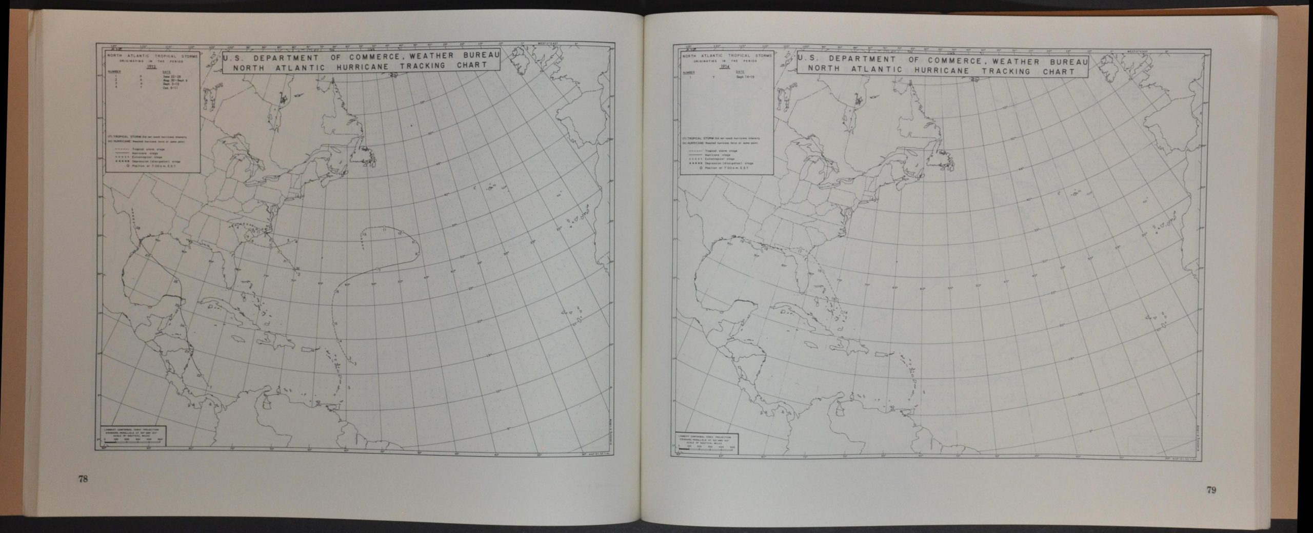
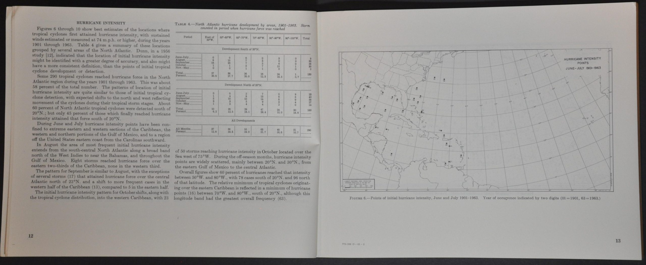
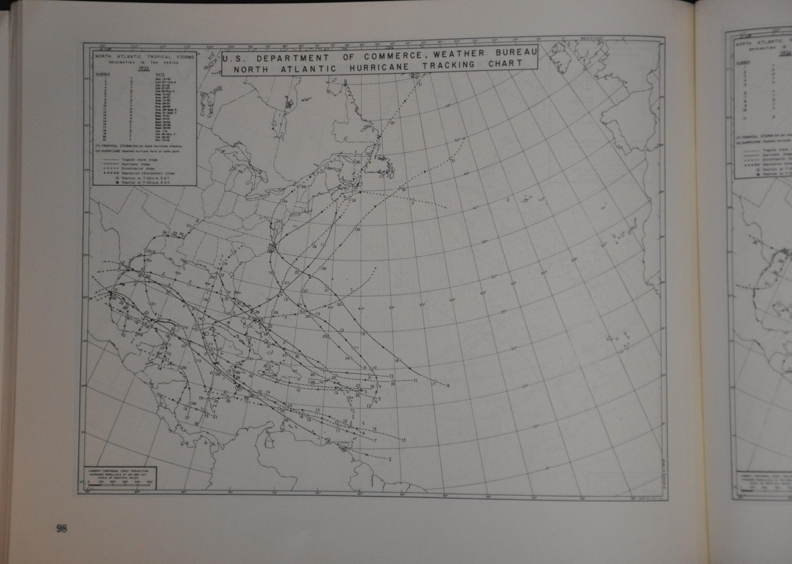
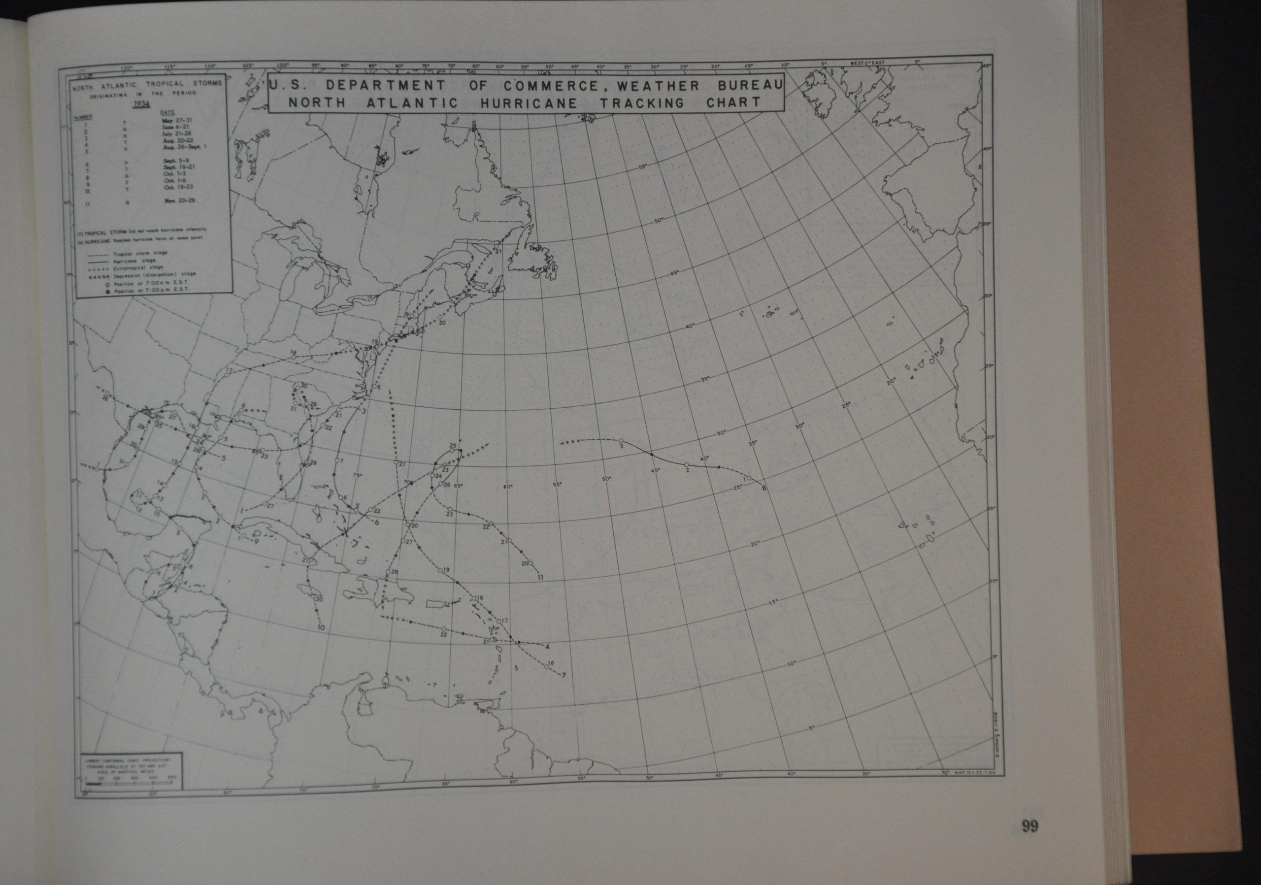
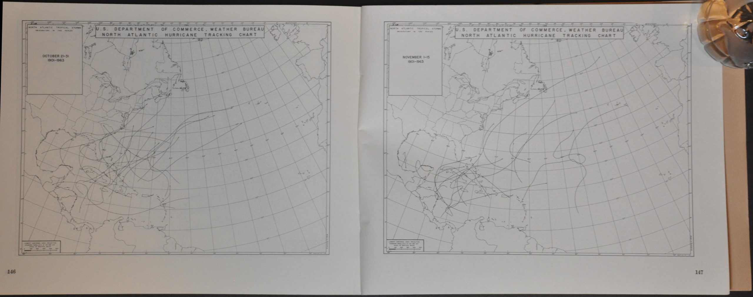
This analytical atlas of tropical storms was compiled under the careful eye of George W. Cry in the Laboratory of Climatology of the United States Weather Bureau. An introduction outlines the terms in use, sources, and other relevant technical and background information. This is followed by a series of annual maps of the North Atlantic and Caribbean that track the course of various storms across the region for the years 1871-1963. The sheet for 1933 is particularly notable, with a record of 21 storms that would not be surpassed until 2005. 1914 was the least active season, with only one tracked hurricane!
Map Details
Publication Date: 1965
Author: George W. Cry
Sheet Width (in): 10.25
Sheet Height (in): 7.9
Condition: A
Condition Description: 148 pp. booklet with stapled binding and original brown paper wraps. A bit of light wear, consistent with age and use, but in near fine condition overall.
$75.00
1 in stock