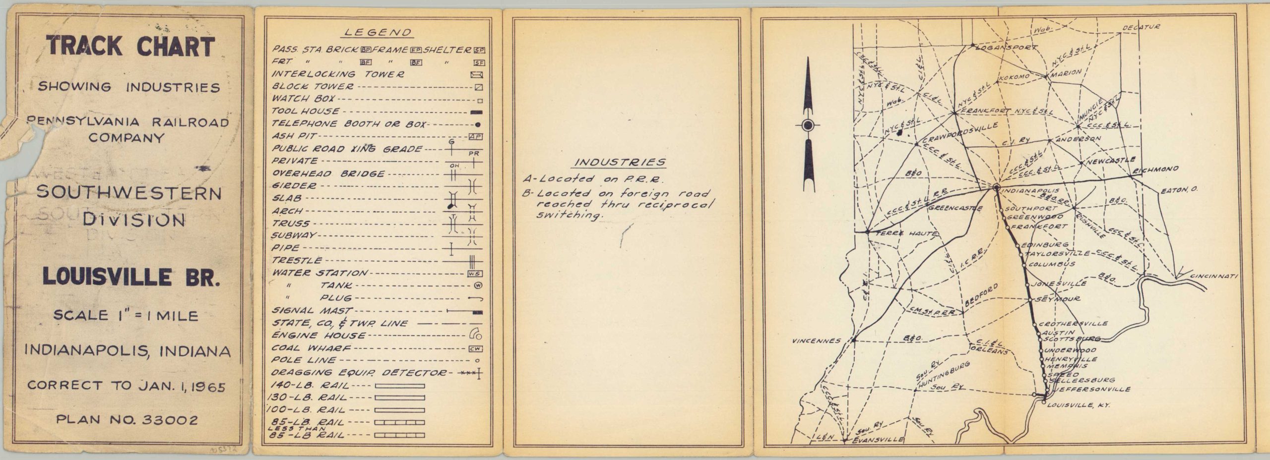
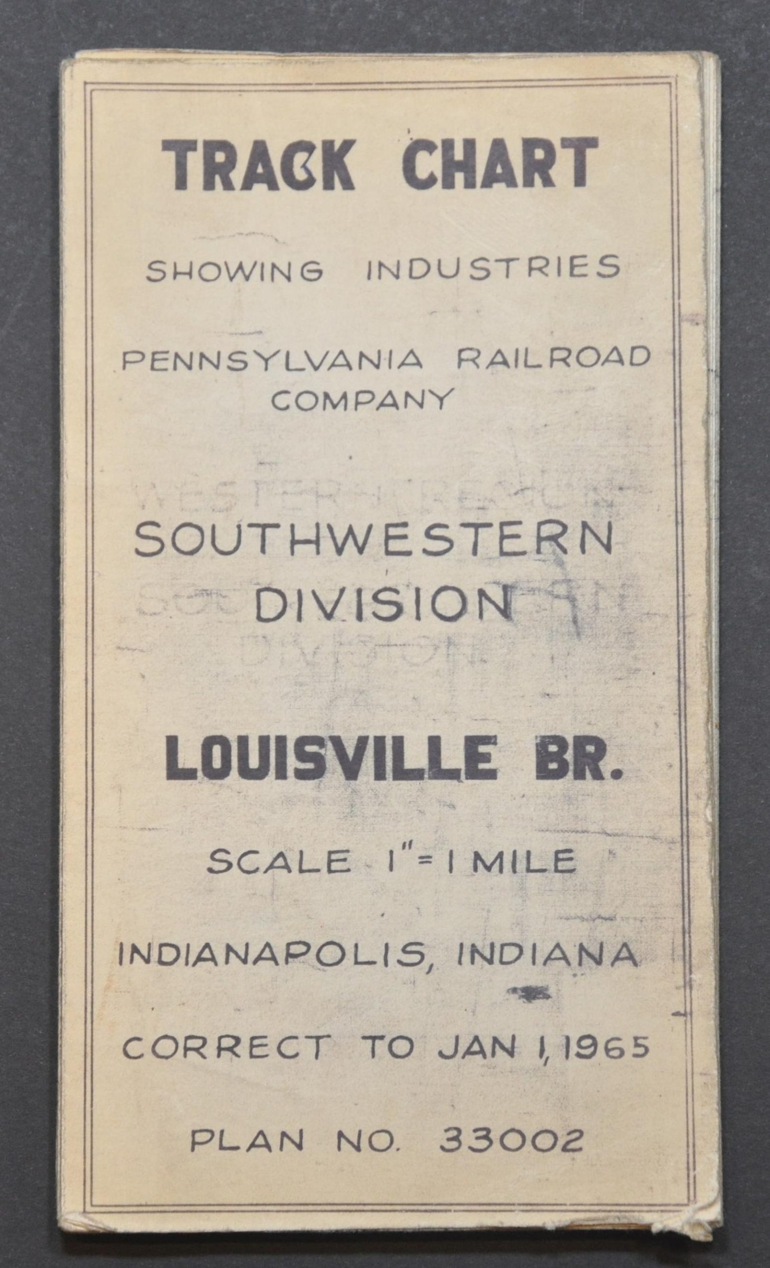
Track Chart Showing Industries Pennsylvania Railroad Company Southwestern Division Louisville Branch
$175.00
Uncommon track chart showing the route of the ‘Pennsy’ between Indianapolis and Louisville.
1 in stock


Description
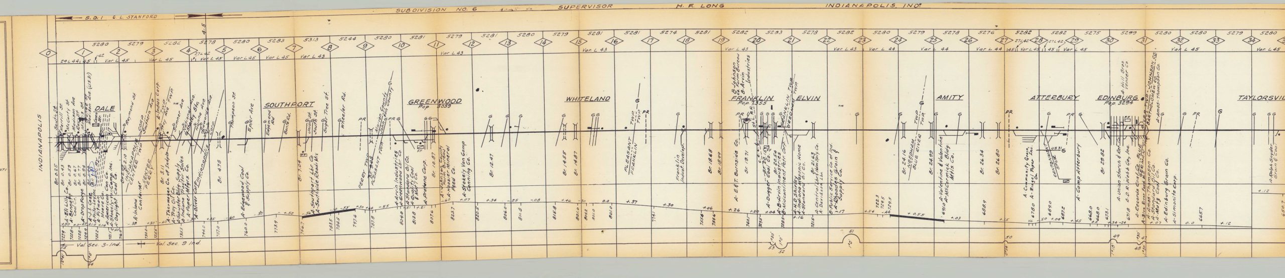
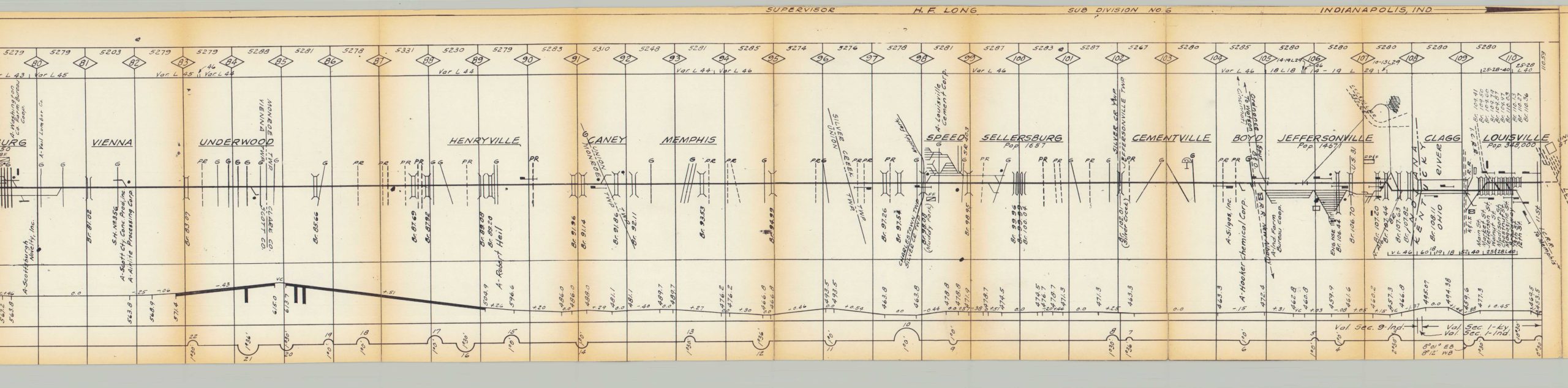
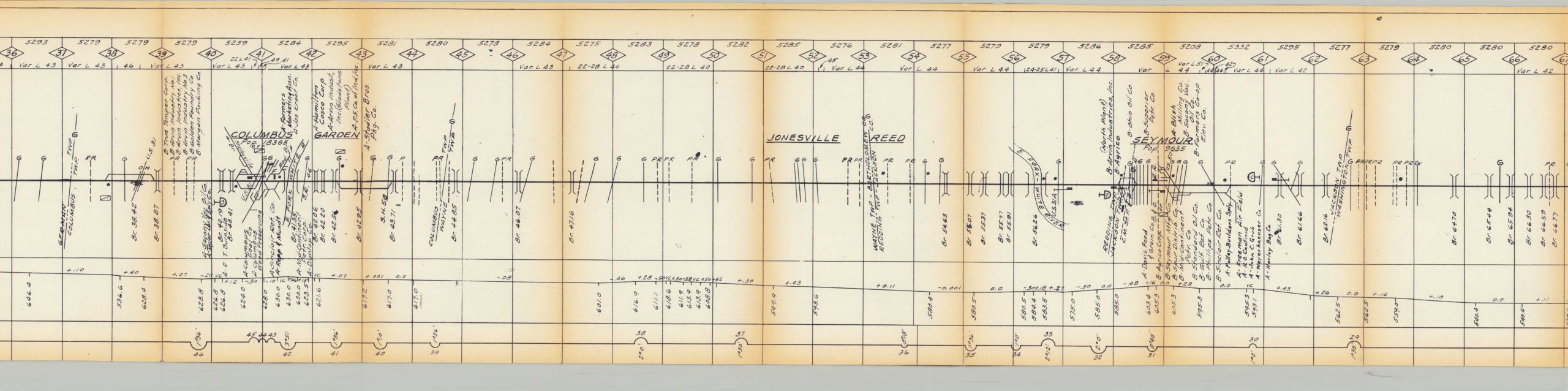
This large-scale track chart was published in 1965 by the Pennsylvania Railroad, while the iconic company was in dire financial straits and just a few years before the merger into the ill-fated Penn Central. It shows the primary railroad facilities along the Indianapolis-Louisville branch of the Southwestern Division, including the towns of Southport, Columbus, Seymour, and Jeffersonville.
A detailed diagram issued at a scale of 1″ to 1 mile labels towers, watch boxes, telephone booths, ash pits, water stations, engine houses, and coal wharves; as well as necessary infrastructure like bridges, girders, and pipes. Major businesses that operate via spurs along the line are named individually. An elevation diagram runs along the bottom of the folding sheet and includes a handful of manuscript updates in pencil. Also includes a helpful index map and legend.
Map Details
Publication Date: 1965
Author: Pennsylvania Railroad
Sheet Width (in): 194
Sheet Height (in): 7.25
Condition: B+
Condition Description: Extremely long strip map folded into original paper wraps. Moderate wear and soiling throughout, including small edge tears, ink offsetting, and scattered staining. Good to very good condition overall.
$175.00
1 in stock