Tour Map Lexington, Kentucky
$75.00
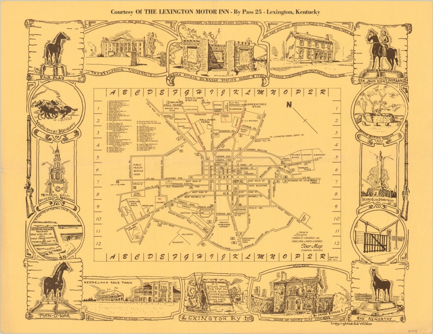
Mid-century map of Lexington, KY issued by the local Chamber of Commerce.
1 in stock
Description
This simple, yet charming, map of Lexington, Kentucky combines a legible street plan with illustrations of some of the city’s most famous sites. Fifty locations of interest are numbered within the map, which also shows street names, neighborhoods (note the numerous tobacco warehouse districts), and important buildings. Vignettes of statues, historic points of interest, and local attractions comprise the border and were provided by James E. Neace.
The map was created by Ed Wilder and published around 1950 by the Lexington Chamber of Commerce.
Map Details
Publication Date: c. 1950
Author: Ed Wilder
Sheet Width (in): 21.90
Sheet Height (in): 16.70
Condition: A-
Condition Description: Creasing along vertical and horizontal fold lines, wear along the outer edges, and red pencil marks within the image (see upper center of map).
$75.00
1 in stock