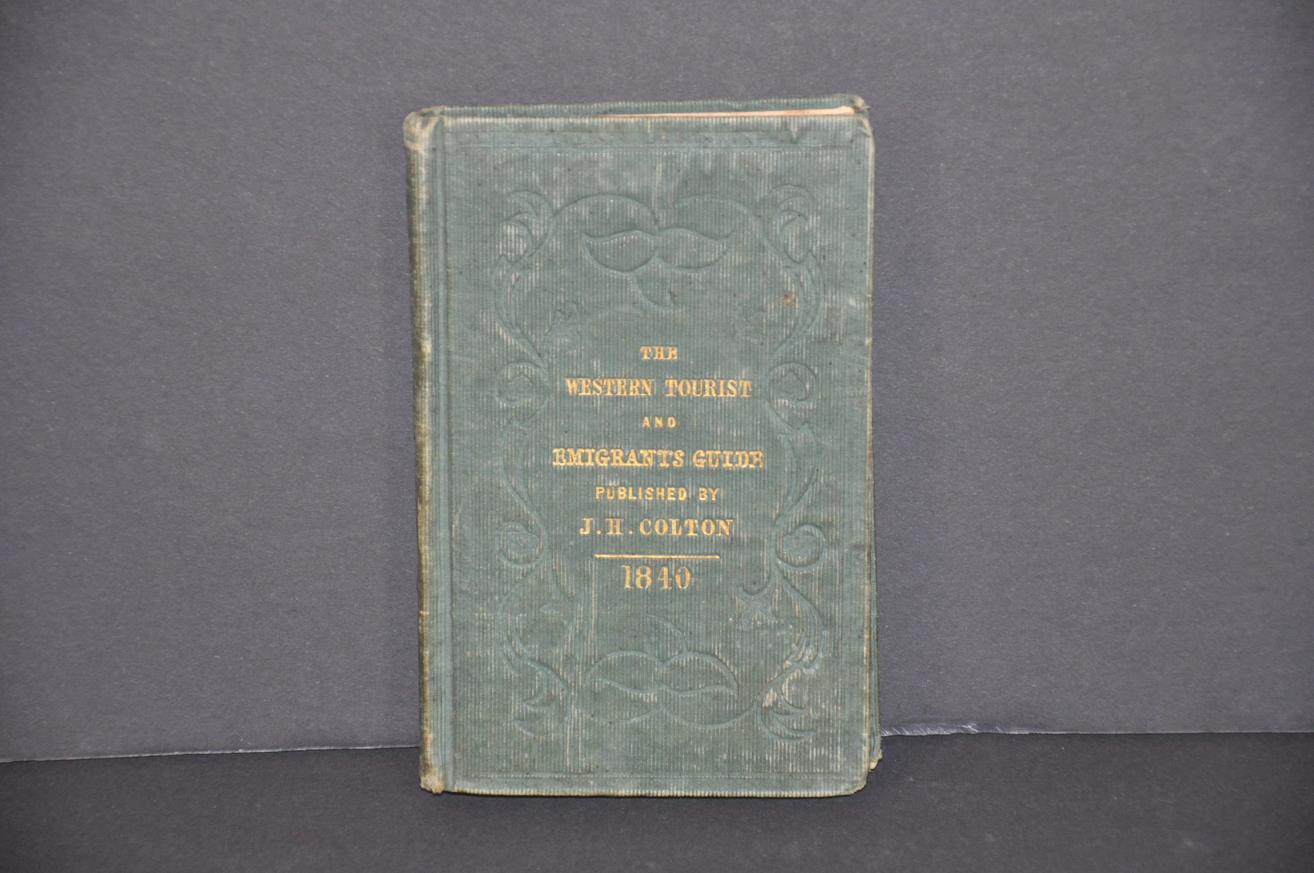
The Western Tourist and Emigrant’s Guide
An immigration guide to the Midwest from 1840.
Out of stock


Description
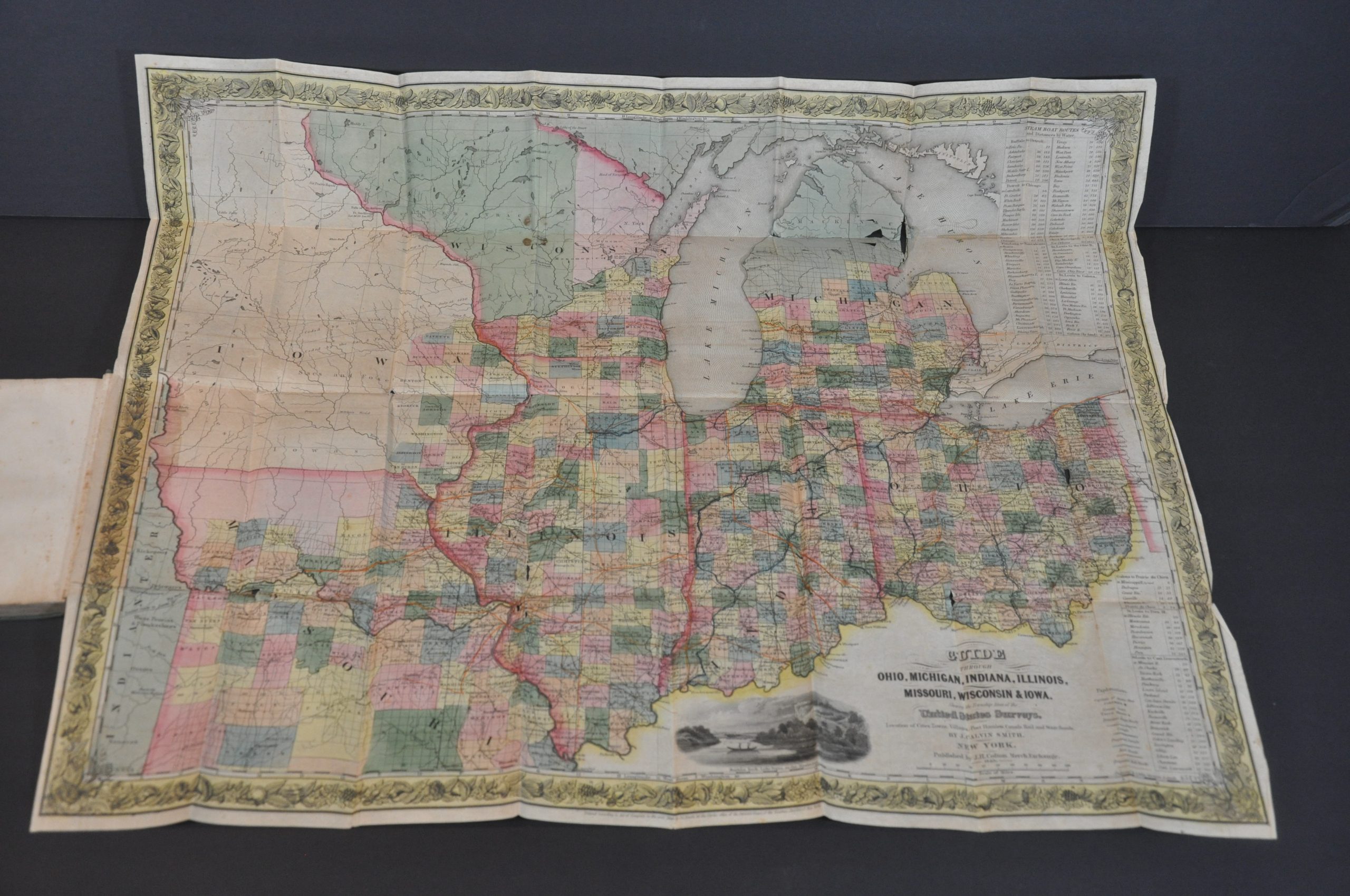
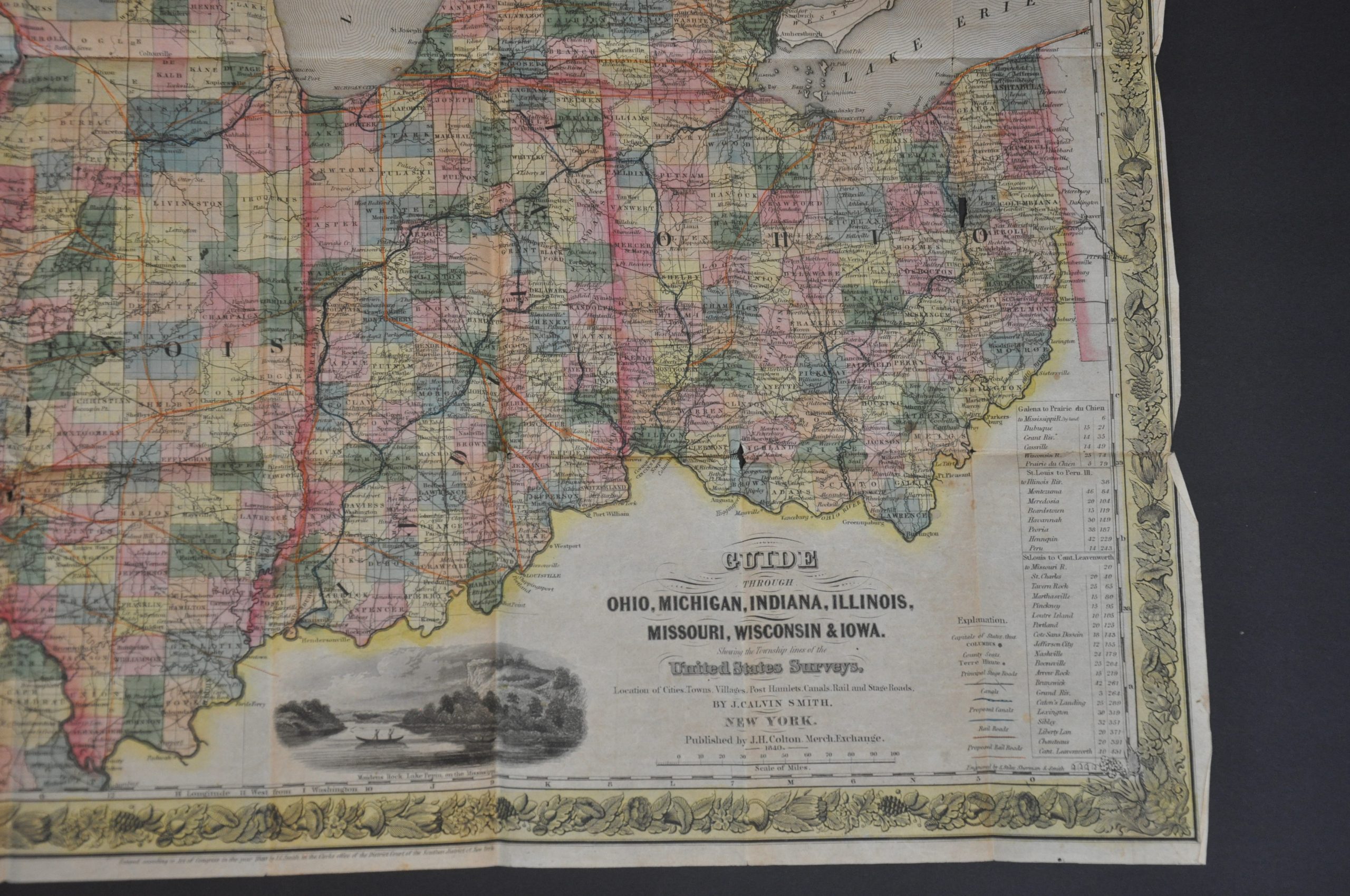
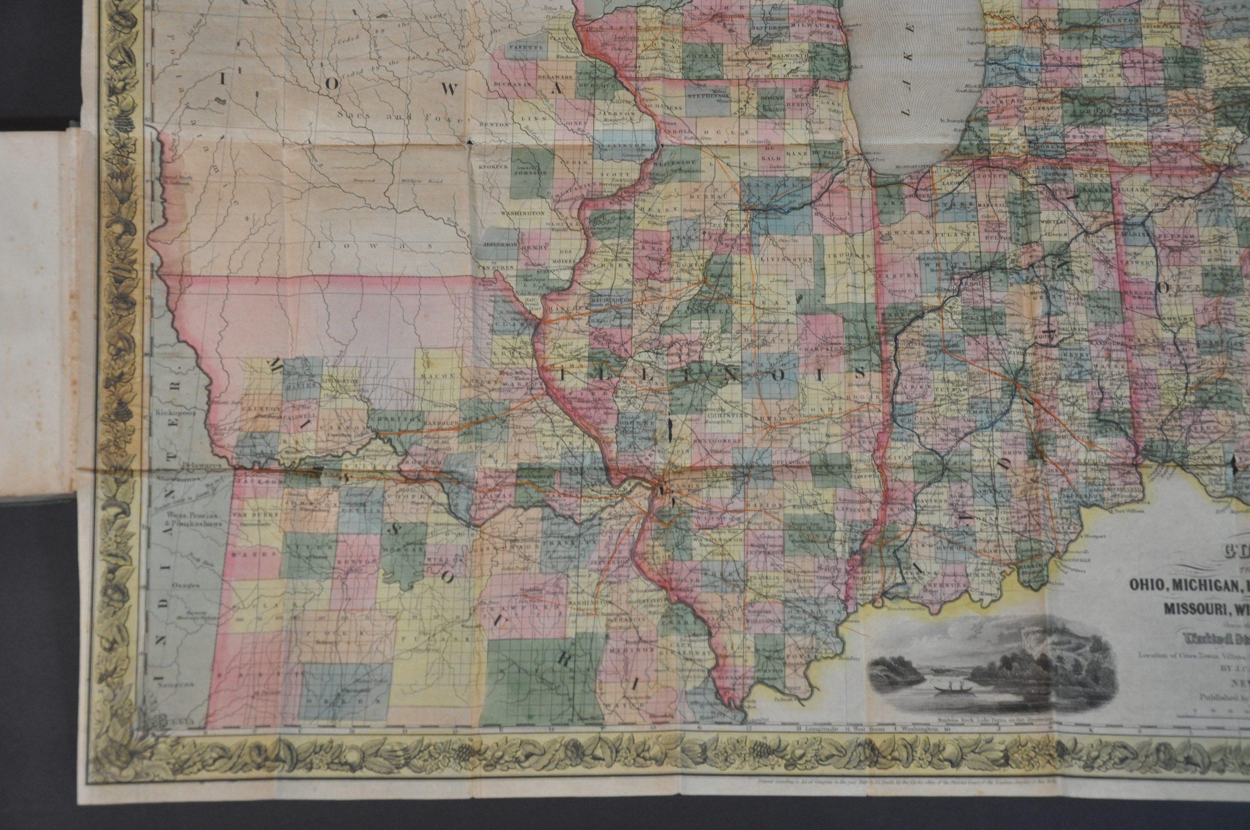
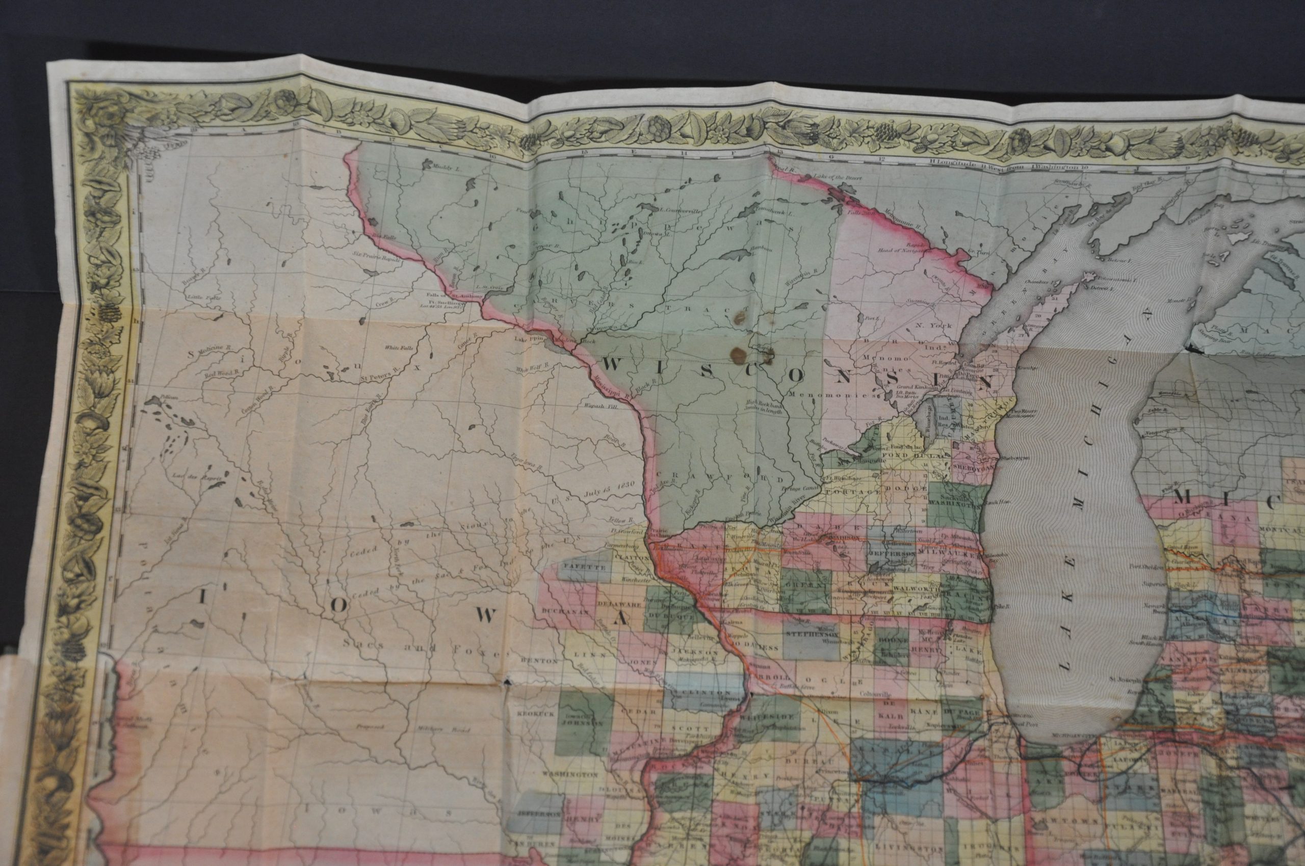
“The great region of the North and West comprehended in the States of Ohio, Michigan, Indiana, Illinois and Missouri, and the Territories of Wisconsin and Iowa, is daily becoming more and more important and interesting. Its vast resources are in a state of rapid development; industry and enterprise, aided by enlightened legislation, are calling forth its energies, and the prophetic declaration that “westward the start of empire takes its way,’ is advancing to its fulfillment.”
These impressive words open the preface of this guidebook to the aforementioned states, published in New York by J.H. Colton & Co. in 1840. The following pages are filled with tables of statistics, descriptive text, and settlement indexes praising the various amenities across the region ultimately known as the Upper Midwest.
The contents provide a fascinating snapshot of the contemporary attitudes regarding economic opportunity in the former Northwest Territory, encompassing a diverse array of industries including agriculture, mining, transportation, and real estate.
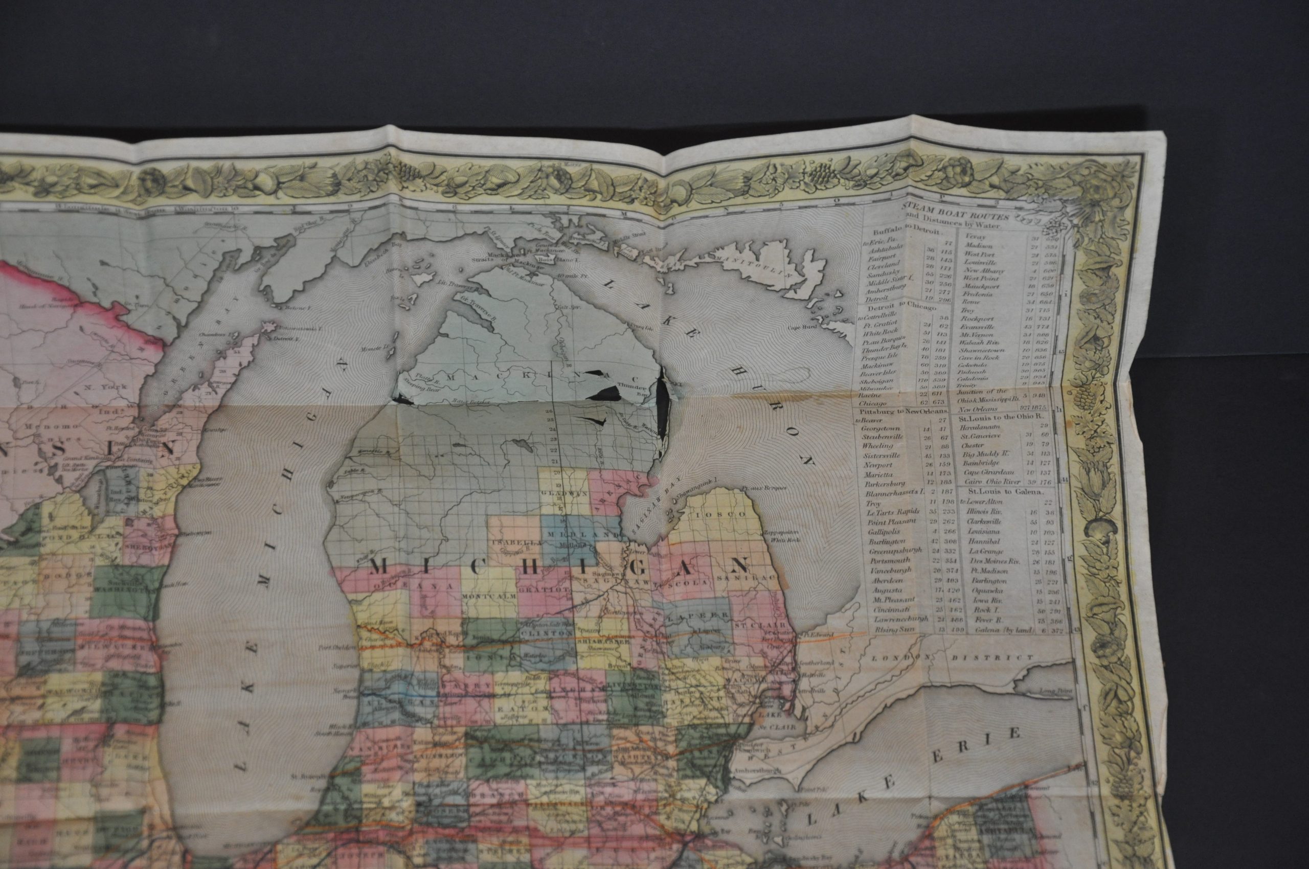
The guidebook is accompanied by a large fold-out map of the region, hand colored by county. Native American tribes are show abutting the progress of surveyed townships, reflecting the larger struggle over the land between indigenous people and white settlers.
Emphasis is given to local transportation routes, with canals and railroads individually highlighted in blue and orange, respectively. Distance tables show the length of various steam boat routes and a view of Maiden’s Rock on Lake Pepin can be seen in the lower center.
Map Details
Publication Date: 1840
Author: J.H. Colton & Co.
Sheet Width (in): See Description
Sheet Height (in): See Description
Condition: B+
Condition Description: 180 pp. guidebook bound in original green embossed gilt cloth covers. Pages measure approximately 3.75" x 6" and are generally in quite good condition. Light to moderate scattered spotting and toning, consistent with age. Includes a fold-out map, Guide Through Ohio, Michigan, Indiana, Illinois, Missouri, Wisconsin & Iowa, that measures approximately 24.5" x 20.5" and in fair to good condition. Original coloring has oxidized slightly, causing the paper to brittle and resulting in a few tears and minor paper loss. Several spots of discoloration in the upper reaches of Wisconsin, and moderate toning and wear visible in the margins.
Out of stock