The Santa Fe Trail
Illustrated celebration of the Santa Fe Trail.
Out of stock
Description
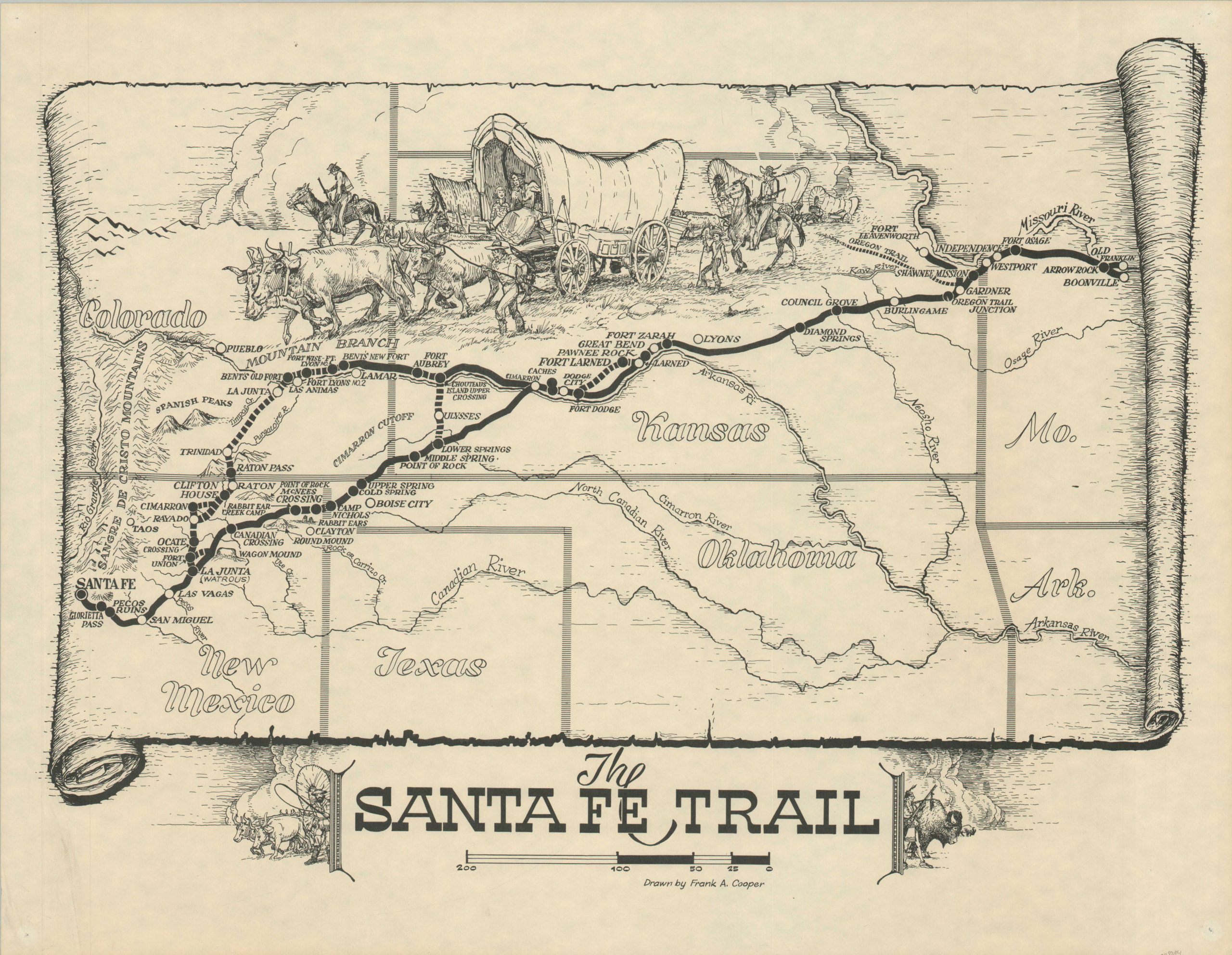
Less well known than its Oregon counterpart, the Santa Fe Trail was an important 19th-century route for cultural and economic exchange between Missouri and New Mexico. Established officially in 1821 by William Becknell, the nearly 900-mile path linking Santa Fe and Franklin facilitated the movement of people and goods from the United States into newly independent Mexico.
The relevance of the Santa Fe Trail declined rapidly with the introduction of the railroad, but its overland hazards and the hardy pioneers who braved them are commemorated here, over a century later. The fine pictorial map, illustrated by Frank Arlo Cooper, depicts the route boldly, noting the two main branches after Cimarron and the relevant cut-off.
Map Details
Publication Date: c. 1960
Author: Frank A. Cooper
Sheet Width (in): 21.75
Sheet Height (in): 16.75
Condition: A-
Condition Description: Wear along the outer edges of the sheet, including some wrinkling, pinholes in the corners, and faint discoloration. Good to very good overall. Blank on verso.
Out of stock